


![Request for Information – Potential [Placeholder for Prize]](https://assets.science.nasa.gov/dynamicimage/assets/science/psd/solar/2023/09/s/solarsystem_0.jpg?w=1024)


Internet of Animals (IoA)
The Internet of Animals project tracks animal movement from space to support studies of biodiversity and advance Earth system remote sensing and modeling.
TYPE
Remote Sensing
DUration
2020–Present
POC
Morgan Gilmour
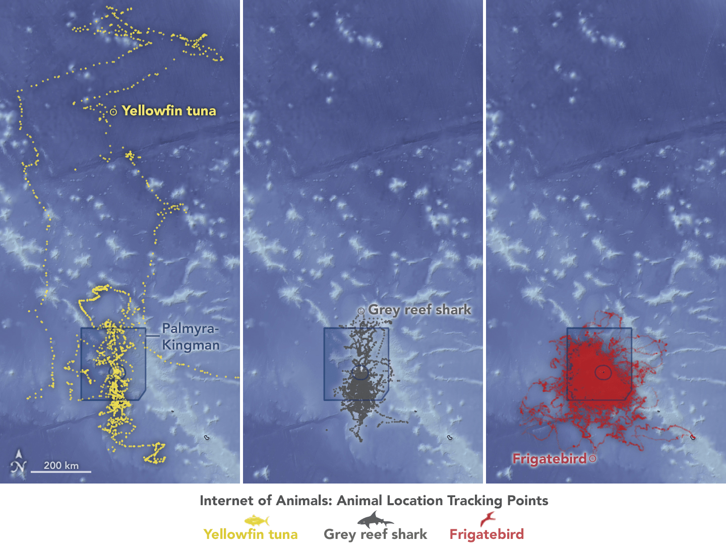
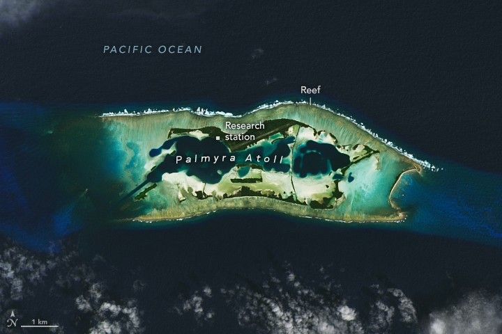
Internet of Animals Data Visualization: Tuna, Sharks, and Frigatebirds
Tagged Yellowfin Tuna, Grey Reef Sharks, and Great Frigatebirds move in and out of a marine protected area (blue square), which surrounds Palmyra Atoll in the tropical heart of the Pacific. These species are three of many that rely on the atoll and its surrounding reefs for food and for nesting.
Credits: NASA/Lauren Dauphin
Overview
The Internet of Animals (IoA) project combines animal telemetry data with Earth observations to better support biodiversity studies and applied ecological management, architects a next-generation space-based animal tracking system, and develops technology to collect ambient environmental information for satellite calibration and validation.
What is Internet of Animals (IoA)?
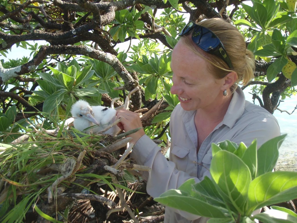
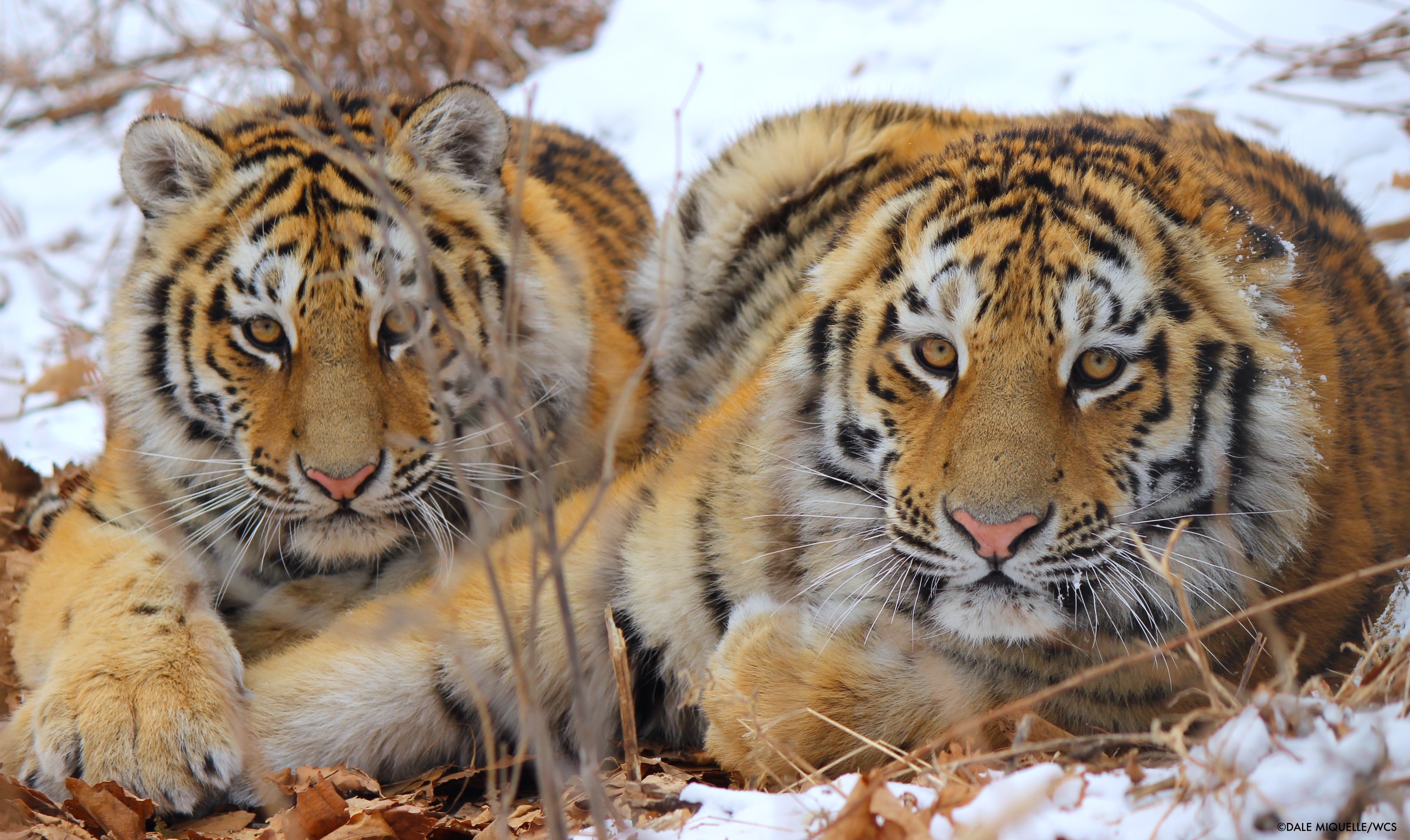
The Internet of Animals project aims to understand needs of the animal tracking community, design NASA architectures for next-generation spaceborne animal telemetry technologies, and advance Earth system remote sensing and modeling via new modalities via animal-borne sensing. The IOA team at Ames Research Center is studying how biologgers on frigatebirds can reveal the dynamics of the planetary boundary layer (PBL) with data that are difficult to obtain solely from satellite-based measurements. The dynamics of the PBL mediate interaction between the atmosphere and the surface of the Earth and influence climate, weather, and air quality. Understanding the dynamics of the PBL is a scientific objective of NASA and the target of future satellite missions.
Internet of Animals Science
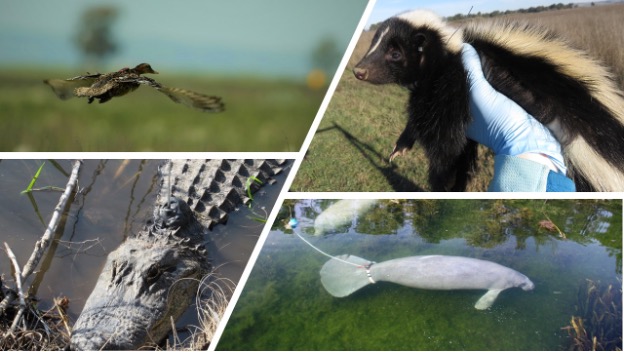
Understanding where, when, and how animals interact with and move through and between habitats is essential to crafting successful management plans to conserve Earth’s wildlife, preserve vital ecosystem services, and safeguard human well-being and livelihoods. Animal tracking enables us to understand behaviors and estimate dynamic habitat requirements, which can improve ecological management and conservation, like assessing whether animals stay within protected areas, or how diseases like avian flu move through regions. By combining animal tracking with remote sensing Earth Observations like temperature and changes in vegetation, we can estimate how animal movement might change with changing climates and better inform biodiversity research.
Current animal tracking technology has advanced dramatically in recent decades but is still limited in its spatiotemporal resolution and ability to track small animals. Improved technology enables researchers to process large amounts of data (including both on-board and general data processing). Space-based technology provides an opportunity to decrease the weight and cost of tracking devices, which could allow tracking of more species at higher resolution with more auxiliary data (accelerometry, heart rate, temperature). The Internet of Animals project aims to understand the needs of the animal tracking community to design a space-based system that efficiently meets these needs.
Animal telemetry itself can serve as an earth observation, either through animal-borne sensors (e.g., temperature or salinity sensors) or by using known movement-environment relationships to infer local environmental conditions. Animal tracking and remote sensing data are also increasingly available at high spatial and temporal resolutions, which provides opportunities for more detailed and mechanistic understanding of earth systems. The IOA project aims to link remotely sensed data on Earth’s environment with animal telemetry to answer theoretical and applied questions in biodiversity science, ecological management, and earth sciences.
What can IoA teach us about wildlife conservation?
Advances in low-power, low-latency global tag-satellite communications catalyze innovation beyond wildlife tracking alone, including emergency beacons for search and rescue, precision free-range livestock farming, supply chain tracking, drone fleet tracking and personal safety devices. For wildlife applications, these advances enable informed protected areas planning, secure migratory corridors, early detection of ecological disruptions such as species invasion and declines, monitoring of disease vectors like avian influenza, and proactive management of human-wildlife conflicts.
Applications extend to agriculture, livestock management, forestry, and outdoor recreation activities – providing agencies and land managers with critical data to balance conservation with ecosystem services like air and water purification, sustainable land use practices and public health considerations.

