

What We Do
NASA’s Earth Science Division is organized around four programmatic areas: flight, research, applied sciences, and technology. Together these areas include programs and projects that are responsible for conducting and sponsoring research to advance scientific understanding of Earth as a system, collecting and disseminating new observations, developing new technologies and computational models, and building the capacity to develop innovative applications of Earth science observations and research results.
Featured Programs & Projects
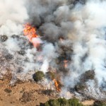
FireSense
FireSense is a NASA-wide effort to bring together data, technology, research, flights, aeronautics, innovation, applications to create the next generation of tools and science-informed capabilities for wildfire adapted communities and to enable society to live sustainably with wildland fires.


Disaster Response Coordination System (DRCS)
Ames is a participating center in NASA’s Disaster Response Coordination System (DRCS). The Earth Sciences Division maintains dedicated coordinators to actively monitor for disaster threats, network with emergency management agencies, and connect Ames’ Earth Observation experts with emergency responders during disaster response situations.


Missions
Asia-AQ
Airborne and Satellite Investigation of Asian Air Quality (Asia-AQ) is conducting airborne sampling across four locations in collaboration with local partners, to improve understanding of the factors controlling local air quality across Asia through multi-perspective observations and modeling.
ABoVE
ABoVE is a field campaign being conducted in Alaska and Western Canada, broadly focused on gaining a better understanding of the vulnerability and resilience of Arctic and boreal ecosystems to environmental change in western North America, as well as providing the scientific basis for informed decision-making to guide societal responses at local to international levels.


SWOT
As PI of the TROPIC-SWOT project and member of the SWOT Science Team, biospheric researchers quantify ocean surface currents and understand their physics using the new high-resolution sea level observations from SWOT in the tropical and equatorial oceans. It is anticipated that this fundamental research will lead to improved fine scale predictions of ocean drift in the tropics, e.g. of debris, spilled oil, or distressed boats, as well as improved seasonal and longer term predictions of weather, climate, and the water cycle (e.g., floods, droughts, etc.) via better modeling of El Niño/Southern Oscillation dynamics that depend sensitively on upper ocean physics in the equatorial Pacific.
Internships
FireSage
FireSage is a summer internship opportunity designed to equip students with expertise in fire ecology and remote sensing technologies. This 10-week internship program offers a paid opportunity to work on-site at NASA Ames Earth Science Division and SJSU’s Wildfire Interdisciplinary Research Center (WIRC) Geofly Lab and FireEcology Lab.
SARP
The Student Airborne Research Program (SARP) is an eight-week summer internship program for rising-senior undergraduates. With access to one or more NASA Airborne Science Program flying science laboratories, students acquire hands-on research experience in all aspects of a scientific campaign.<br><a href="https://science.nasa.gov/earth-science/early-career-opportunities/student-airborne-research-program/"></a>