![Request for Information – Potential [Placeholder for Prize]](https://assets.science.nasa.gov/dynamicimage/assets/science/psd/solar/2023/09/s/solarsystem_0.jpg?w=1024)


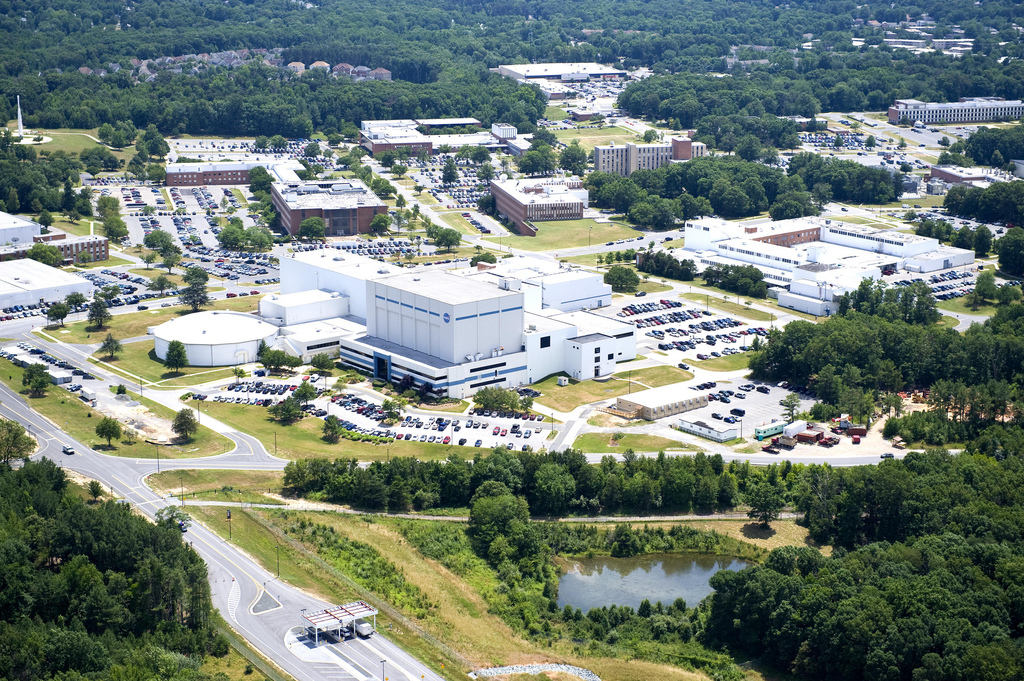
Goddard NEPA Projects
Wallops Island Shoreline Restoration and Resiliency Programs
Program Contacts:
Shari Miller (757) 864-5662
Irene Romero (301) 286-8644
Current Analysis
NASA is currently preparing a new Environmental Assessment (EA), tiered from its previous analyses. During the scoping period from January 19 to February 16, 2026, NASA solicited input from all interested parties. This input informed the preparation of the current Draft EA. The Draft EA evaluates the potential environmental impacts associated with the following actions:
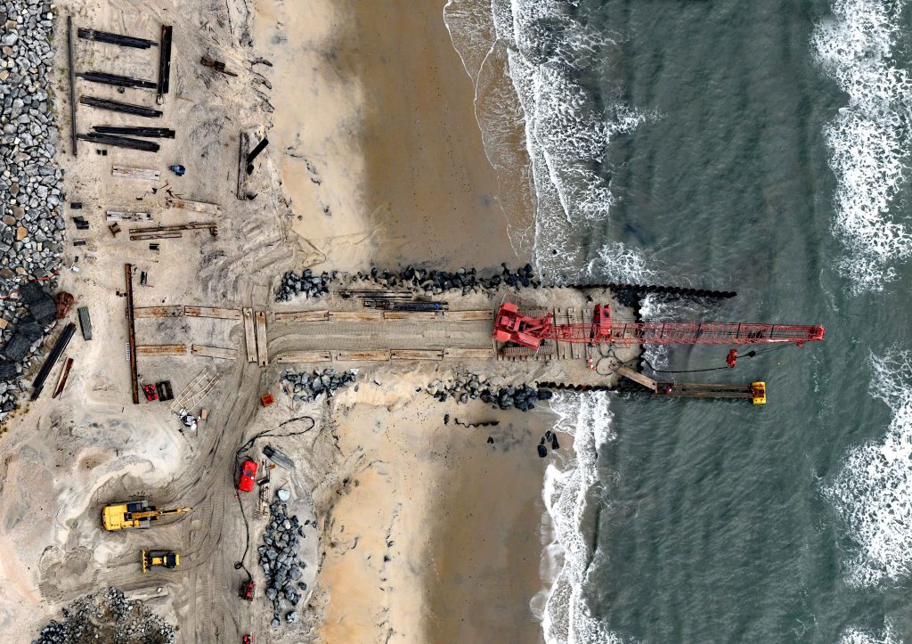
- Dredging of offshore sand from Unnamed Shoal A and placement of dredged sand on Wallops Island beach;
- Construction of a series of parallel, offshore breakwaters; and/or
- Repairing and/or extending the existing seawall.
NASA and its Cooperating Agencies , published a Notice of Availability (NOA) in the Chincoteague Beacon, Eastern Shore Post, and The Daily Times to announce the 30-day public comment period of the Draft EA and the availability of a presentation of the Shoreline Protection project and the NEPA EA process. The public comment period closed on February 17, 2026.
Fact sheets explaining the project and NASA’s NEPA process are available online.
The Draft EA is available for review at the following locations:
Chincoteague Island Library, Chincoteague Island, VA
Eastern Shore Public Library, Parksley, VA
Wallops Flight Facility Visitor Center, VA Rt. 175 near Chincoteague Island, VA
To request a hard copy of the Shoreline Protection Program EA, please contact: gsfc-dl-nepa@mail.nasa.gov or see Public Involvement for additional information.
Background
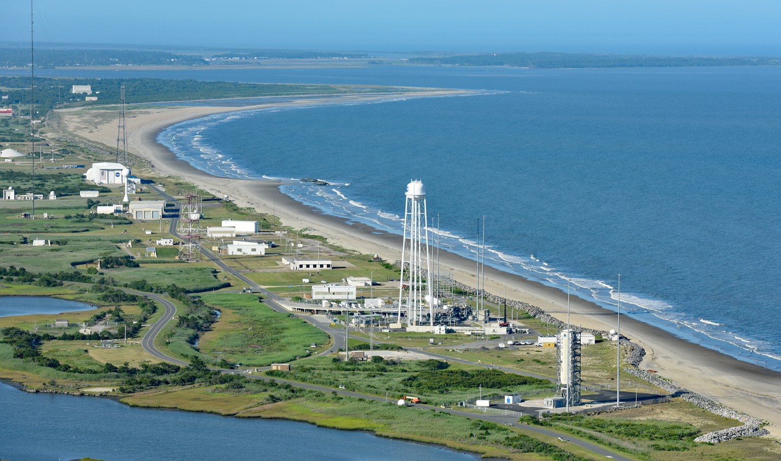
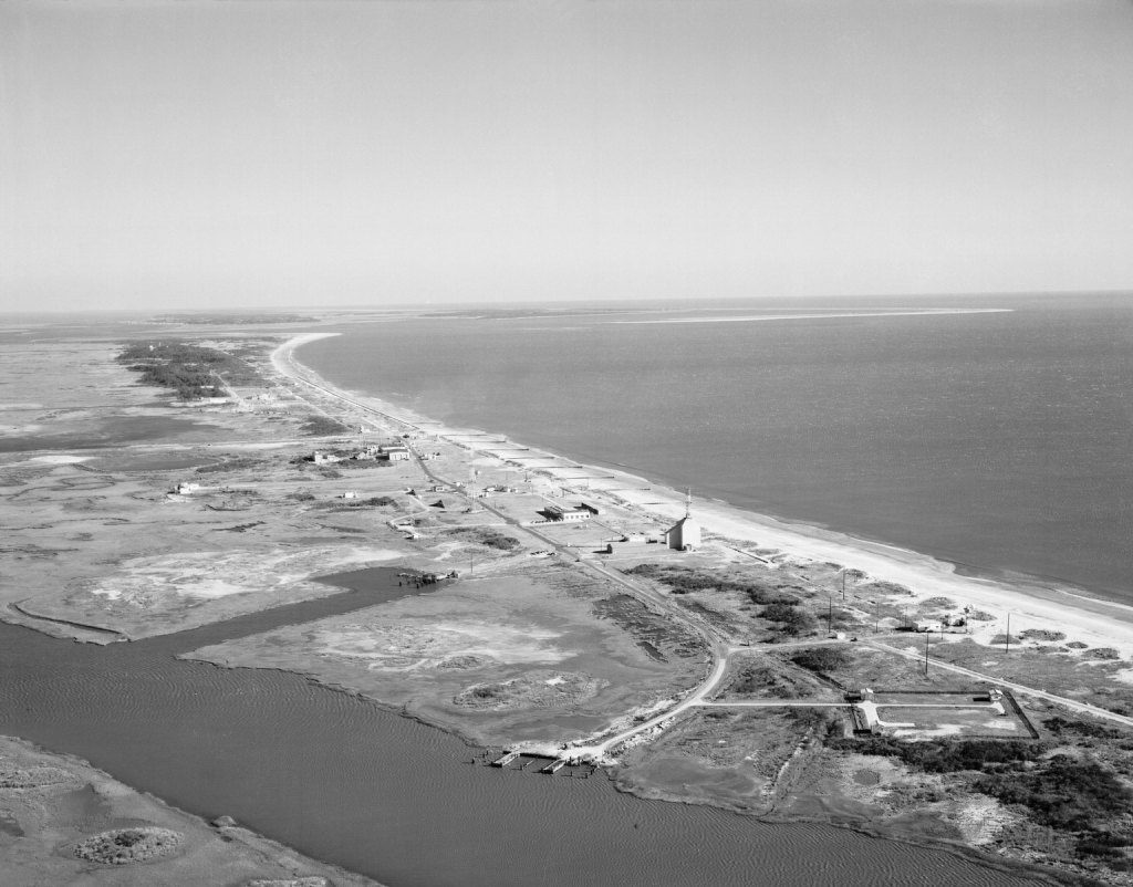
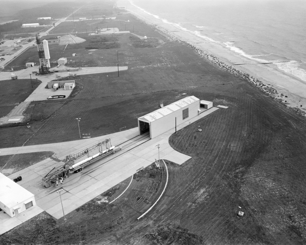
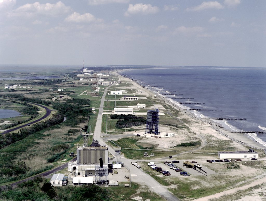
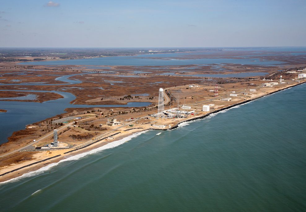
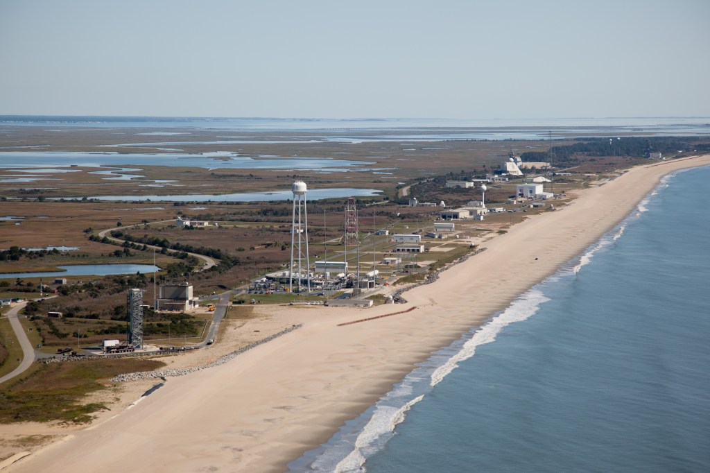
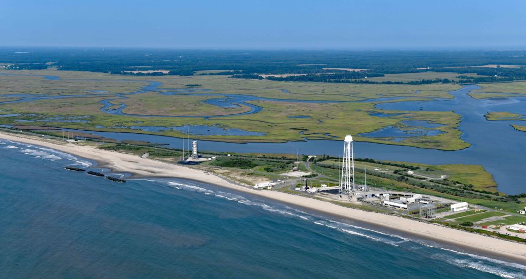
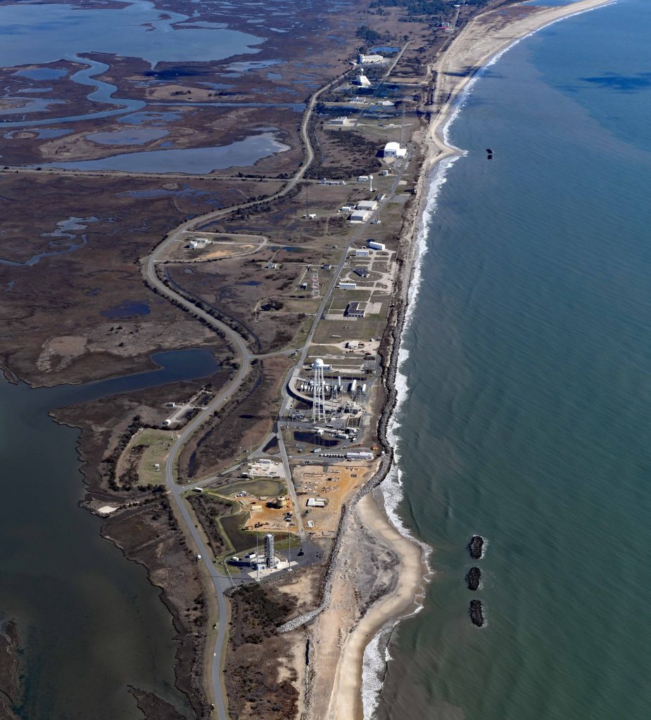
The purpose of the National Aeronautics and Space Administration (NASA) Wallops Island Shoreline Protection Program, is to reduce the potential for damage to, or loss of, NASA, U.S. Navy, and Virginia Spaceport Authority’s Mid-Atlantic Regional Spaceport (MARS) assets on Wallops Island from impacts associated with storm events and sea level rise.
In February 2010, NASA finalized the Programmatic Environmental Impact Statement for the Shoreline Restoration and Infrastructure Protection Program (SRIPP PEIS), available in the Documents section below.
In the SRIPP PEIS, NASA evaluated the potential environmental effects from a 50-year design life program with an initial construction phase followed by subsequent renourishment cycles that would be determined through monitoring and adaptive management. Various alternatives were considered, including: extending the existing seawall; recurring nourishment (every 3 to 7 years) of the beach on Wallops Island, Virginia; constructing a parallel nearshore breakwater; and constructing a southern-end perpendicular groin. The preferred action at that time consisted of extending the seawall approximately 4,600 feet and nourishing the beach with approximately 3.2 million cubic yards of sand dredged from Unnamed Shoal A.
Following the first round of beach nourishment in 2012, Superstorm Sandy struck the U.S. East Coast. While the newly expanded Wallops Island beach successfully protected NASA, Navy, and MARS assets, it suffered significant damage. In June 2013, NASA released the “Wallops Island Post-Hurricane Sandy Shoreline Repair Final Environmental Assessment” (Post-Sandy EA), available in the Documents section below. The Post-Sandy EA built upon (or tiered from) the SRIPP PEIS and evaluated potential environmental impacts associated with restoration of the shoreline beach berm and dune system, established to protect NASA’s Wallops Island launch range infrastructure, that has been eroded through storm wind and wave damage.
In 2018, NASA requested that the U.S. Army Corps of Engineers, Norfolk District Hydraulics and Hydrology Section evaluate the effectiveness of constructing a breakwater or series of breakwaters along the Wallops Island shoreline to reduce the rate of sediment transport since previous renourishments provided only temporary protection. In June 2019, NASA released the “Wallops Flight Facility Shoreline Enhancement and Restoration Project Final Environmental Assessment” (SERP EA) available in the Documents section below. The project placed approximately 1.1 million cubic yards of sand sourced from the north Wallops Island beach and constructed a total of five breakwaters placed approximately 200 feet offshore and parallel to the shoreline.
Cooperating Agencies
As the U.S. Bureau of Ocean Energy Management and the U.S. Army Corps of Engineers may be involved in permitting certain aspects of the SERP, both are serving as cooperating agencies and, as such, have assisted NASA in preparing the EA and in participating in all regulatory consultations during the NEPA process.

Documents


Wallops Island Shoreline Resiliency Studies
The U.S. Fish and Wildlife Service (USFWS) and the Virginia Department of Wildlife Resources (VDWR) proposed both physical and ecological impact assessments to enable NASA to respond to storm induced and sea level rise impacts on Wallops Island. The study objectives are (a) mitigating adverse impacts on barrier island sediment supplies and migratory bird habitats and (b) enhancing island and habitat resiliency.
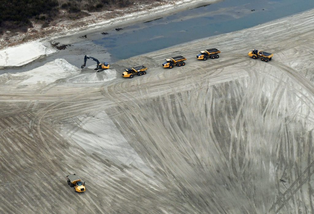
Physical studies include: collecting transect data and conducting modelling to understand and mitigate the impacts on critical infrastructure and the barrier island ecosystem resulting from continued Wallops Island shoreline stabilization. Specifically, the modelling seeks to determine the length of time it will take for the sand in the 2020-2021 harvest area on Wallops Island to recover, evaluate the impacts of the breakwaters on sediment transport, assess overall project impacts on shorebird nesting habitat, and assist NASA with future stabilization efforts by predicting associated physical impacts.
Ecological studies include monitoring prey base recovery in the 2020-2021 sand harvest and sand placement areas; measuring the impacts of breakwaters on benthic prey densities on the adjacent shoreline; and conducting modelling to determine the abundance and distribution of prey relative to habitat availability, quality, and shoreline stabilization efforts. Ecological monitoring also focuses on migrant shorebirds populations, including the state and federally threatened rufa red knot (Calidris canutus rufa) and piping plover (Charadrius melodus).
Publications from the Shoreline Resiliency Studies
- Hein, C., Boggess, A., Cahoon, K., Ciarletta, D., Davis, E., Fenster, M., Georgiou, I., Harris, M., Hein, E., Kivimaki, K. McCormick, M., and Shawler, J. (2026). “Field Trip Guide: Holocene Barrier Dynamics and Management on the Eastern Shore of Virginia.” Virginia Geological Field Conference 2025, March 20-22, 2026.
- Bemelmans, C.B., Stalk, C.A., Ciarletta, D.J., and Miselis, J.L. (2025). Coastal multibeam bathymetry and backscatter data collected in June 2024 from Wallops and Assawoman Islands, Virginia: U.S. Geological Survey data release, https://doi.org/10.5066/P14SGUMT.
- Forde, A.S., Stalk, C.A., Ciarletta, D.J., and Miselis, J.L. (2025). Chirp sub-bottom profile geophysical data collected in 2024 from Wallops Island and Assawoman Island, Virginia: U.S. Geological Survey data release, https://doi.org/10.5066/P1NZ6CC2.
- Kivimaki, K.E., Hein, E.A., and Hein, C.J., (2025). Dataset: Shorelines of Wallops and Assawoman Islands, Virginia, 2016-2025: William & Mary, data release, https://doi.org/10.25773/5ys8-cs64.
- Lyons, E.O., Bernier, J.C., Nick, S.K., Ciarletta, D.J., and Miselis, J.L. (2025). Coastal single-beam bathymetry and beach elevation data collected in 2024 from Wallops and Assawoman Islands, Virginia: U.S. Geological Survey data release, https://doi.org/10.5066/P1HFYGE6.
Public Involvement
For any questions regarding the Wallops Island Shoreline Restoration and Resiliency programs, please contact:
Shari Miller
NASA Wallops Flight Facility
Shari.A.Miller@nasa.gov
Phone (757) 864-5662