


NASA and NOAA satellites are tracking a large winter storm that is expected to bring heavy snowfall to the U.S. Mid-Atlantic region on Jan. 22 and 23. Data from NASA-NOAA's Suomi NPP and NOAA's GOES-East satellite were used to create images and an animation of the movement of the powerful storm.
Image Credit: NASA Goddard Rapid Response
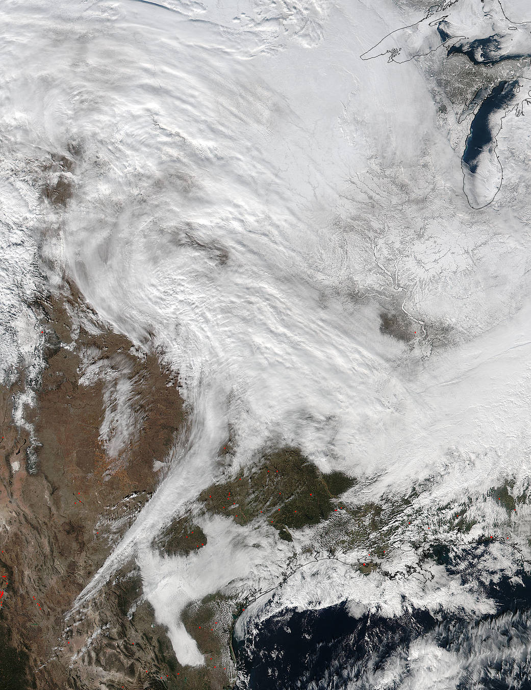
NASA and NOAA satellites are tracking a large winter storm that is expected to bring heavy snowfall to the U.S. Mid-Atlantic region on Jan. 22 and 23. The low pressure area from the Eastern Pacific Ocean moved into the western U.S. and tracked across the four corners region into Texas where NASA-NOAA’s Suomi NPP satellite observed the clouds associated with the storm. The Visible Infrared Imaging Radiometer Suite (VIIRS) instrument aboard Suomi NPP satellite captured this image on January 20, 2016 at 19:30 UTC (2:30 p.m. EST), when the storm was over the central U.S. In the image, snow cover is visible in the Rockies and southern Great Lakes states.