


![Request for Information – Potential [Placeholder for Prize]](https://assets.science.nasa.gov/dynamicimage/assets/science/psd/solar/2023/09/s/solarsystem_0.jpg?w=1024)


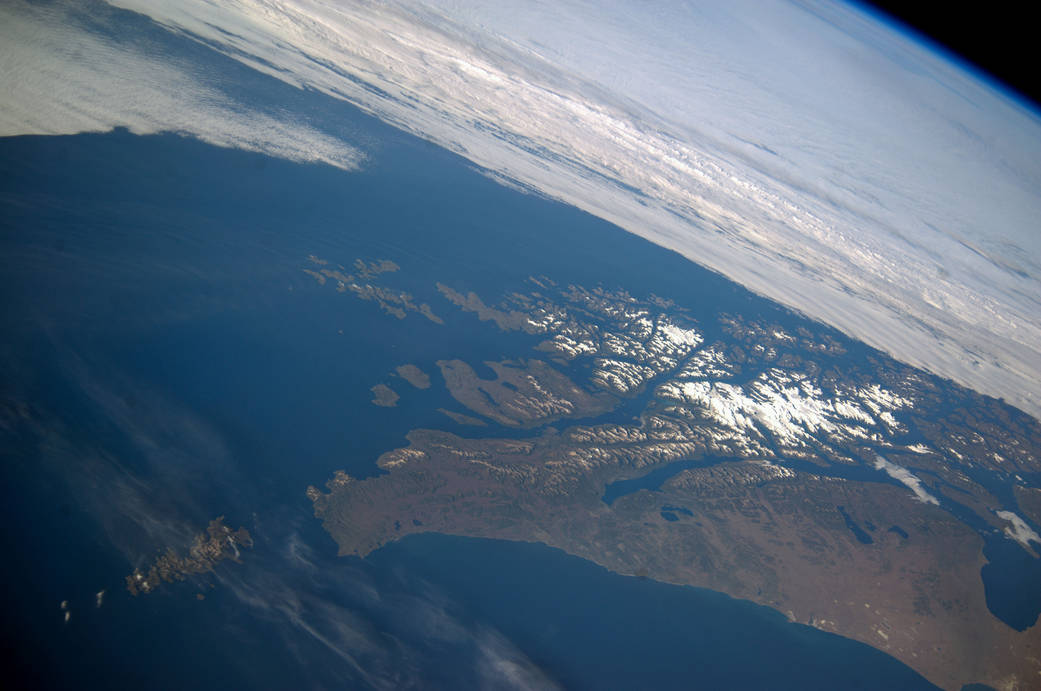
ISS038-E-047389 (14 Feb. 2014) — This panoramic image, which shows parts of Chile and Argentina, and which was exposed with an 80mm lens from the International Space Station (ISS), captures Tierra del Fuego and Cape Horn. Represented here is the southernmost tip of South America (left), with the Atlantic Ocean in the foreground and the Pacific Ocean across the top of the image. Crews on the orbital outpost seldom see Cape Horn in such clear weather. Shortly after this image was taken, the cloud mass approaching from the Pacific Ocean completely obscured the landscape from the station’s view. In this stormy part of the world, ships avoid the heavy seas around exposed Cape Horn and use the protected Strait of Magellan (lower right) on the inshore end of Tierra del Fuego. A small white ice field on the highest parts of Tierra del Fuego (center right) includes Mount Darwin, situated within Chile’s Agostini National Park. The ice field can be imagined as greatly expanded during the geologically recent ice ages, covering an area greater than the land area shown in this view. The heavily indented shape of the fiord coastline and the lake depressions (center and lower right) were carved by the downhill movement of these vanished glaciers, according to NASA scientists.