.png?w=1024)


Significant announcements:
19 December 2019.
- IMPACTS (Investigation of Microphysics and Precipitation for Atlantic Coast-Threatening Snowstorms) – Payload integration for the first field campaign for this EVS-3 investigation managed by ESPO is ongoing on the NASA P-3B aircraft and integration on the NASA ER-2 aircraft began on 2 Dec 2019. The ER-2 is performing proficiency and test flights this week. The science flights are scheduled for 15 January to 29 February 2020 out of Savannah, GA. The chief objective of IMPACTS is to improve predictive capability for East Coast snowstorms. Link: https://espo.nasa.gov/impacts
- S-MODE (Sub-Mesoscale Ocean Dynamics Experiment) – – The Investigation Confirmation Review for this EVS-3 investigation managed by ESPO was successfully completed in Washington, DC on 2 December 2019. S-MODE examines the finer-scale variability in ocean-atmosphere exchange over the Pacific Ocean off the coast of Northern California important for weather and climate. Link: https://espo.nasa.gov/s-mode
- Hal Maring visited ARC’s Earth Science Division’s SunSat group on 6 December 2020 – Dr. Maring is NASA Program Manager for Radiation Sciences and Atmospheric Composition (AC) – Focus Area Lead.
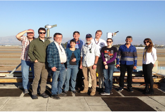
- • ESPO hosted the Earth science Project management International Collaborative (EPIC) meeting at ARC on 4-6 December 2019 – Led by ESPO at Ames, about 25 attendees from 5 countries (U.S., France, UK, Germany, Korea), and US participants from NASA (Ames, JPL, Armstrong, HQ), DOE, NCAR, NEON, PNNL, LANL, NSF shared lessons-learned on airborne, shipborne, and other field projects management, including international, technology, management, and human aspects. Link: https://espo.nasa.gov/epic_2019/content/EPIC_2019
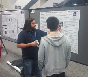
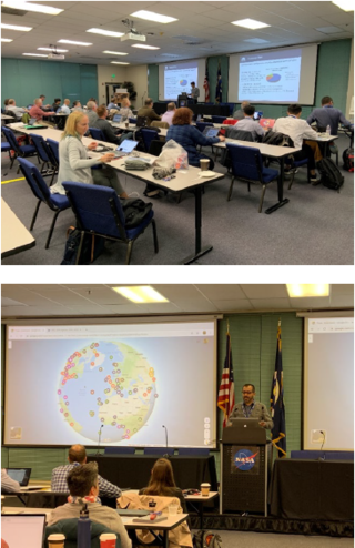
- 2019 Fall Meeting of the American Geophysical Union (AGU) – Ames Research Center Earth Science Division participated with over half of the division present and 30 oral and poster presentations, including invited contributions. Spackman and Schwandner attended the NASA Science Communications workshop on 8 December. Active participation and community engagement in townhalls.
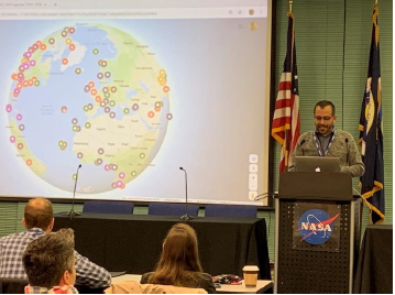
- GeoNEX at AGU, and new website online – Our AGU GeoNEX oral and poster sessions last week went well. The GeoNEX website has been thoroughly revised and there is now a live link to the publicly available GeoNEX data from the NAS Data Portal. The URL for GeoNEX is http://nasa.gov/geonex
- Ved Chirayath was invited to participate at the Ocean Worlds workshop at ARC. 5-6 December 2019. The workshop’s objectives included (a) Identify new potential themes and areas of collaboration between Earth and Planetary science related to ocean research (ocean in other worlds), (b) Begin articulating a strategy for this effort (eventually to be captured in a white paper). Laura Lorenzoni, the Program Scientist for Ocean Biology and Biogeochemistry, hosted the cross-disciplinary meeting at ARC.
-
US-Italy Science and Technology Joint Commission meeting, 12 December 2019. Consulate General of Italy, San Francisco – ARC Earth Science Deputy Division Chief Florian Schwandner participated upon invitation by the Italian delegation (Dr. F. Buongiorno). Delegates from Italy and several US federal agencies (DOE, USGS, NOAA, NASA incl ARC, HQ, JPL) participated; the Italian consul and the science attaché of the consulate facilitated. This is a biannual meeting since creation of the working group in 2013. The meeting’s objectives are to identify topics for strategic opportunities to enhance science and technology cooperation with a strong emphasis on Earth science remote sensing with a focus on early warning, resilience, and mitigation of natural disasters. Outcomes were advances in awareness and relationships built between ARC Earth Science and Italian as well as domestic entities.
-
100th American Meteorological Society (AMS) Annual Meeting 12–16 January 2020 Boston. Link: https://annual.ametsoc.org/index.cfm/2020/
-
Project Milestones:
Earth Science Decadal Survey designated observable studies led by ARC’s Earth Science Division
- “Surface Biology and Geology (SBG)
- The ARC Earth Science Division played a leadership role in the development of a well-received proposal delivered to HQ by the Surface Biology and Geology (SBG) team for a 5-year precursor activity to deliver SBG-like data products to the scientific community. This effort will prepare the community for unprecedented volumes of medium resolution imaging data (spectrometer and thermal) acquired from space, providing prototype data to prepare the science community, especially young scientists and modelers, for the SBG mission, and engaging the community in higher level product-related decisions (e.g., product types, formats, access and delivery, visualization, etc.). ARC will contribute the data processing pipeline infrastructure and aquatic science algorithm development. This will also keep ARC formally engaged with the SBG team between the end of the current pre- Phase A study and SBG’s launch. A decision on the proposal pends a stable budget environment.
-
The ARC Flight Dynamics team reached an important milestone with the first version of an algorithm for calculating the ground footprint of a hyperspectral sensor and percent overlap with the footprints of subsequent overpasses by satellites in constellation flight. Current orbital analysis software provides only point-revisit time, which does not provide the level of fidelity the Surface Biology and Geology (SBG) study team needs to distinguish the scientific utility of competing architectures. The ARC Flight Dynamics team will continue to mature the algorithm and plans a technical publication.
- “Surface Deformation & Change” (SDC)
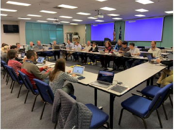
The ARC Earth Science Division hosted the Surface Deformation & Change Leadership Team Meeting, including HQ program scientists and Center representatives, on December 6th. The team reviewed prior year accomplishments and lessons learned, plans for FY20, and the path ahead for the SDC study in FY20-FY23. Anh Nguyen presented results from the ARC flight dynamics studies. Joint NASA/USGS post-doctoral fellows Liz Carter and Dan Griffith also presented their research and had the opportunity to explore several promising collaborations with SDC scientists. The USGS Innovation Center hosted a visit to the new USGS offices.
4 December 2019.
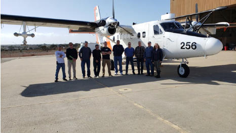
- C-HARRIER (Airborne Instrument Technology Transition project) completed test flights of the 3STAR (Sky Scanning Sun Tracking Airborne Radiometer) the week of 18 November 2019 – C-HARRIER airborne instruments support calibration and validation of coastal and inland waters data that are of interest for proposed NASA missions, including the Plankton, Aerosol, Cloud, ocean Ecosystem (PACE) mission and the Surface Biology and Geology (SBG) mission study. 3STAR is used to derive aerosol optical depth (AOD) to inform atmospheric correction of radiometer and imaging spectrometer data collected over water targets for water quality research. The test flights included both aircraft performance and 3STAR engineering test flights for certification on the Naval Postgraduate School’s (NPS) Twin Otter aircraft. 3STAR flew with the fairing installation that included two of the three C-AIR (Coastal Airborne In-situ Radiometers) used for deriving water-leaving radiance. The 3STAR was tested in five orientations to measure any resonance issues and 3STAR also performed sun-tracking during flight for an AOD profile flight plan. There were no resonance issues during flight and the test flights were a success with 3STAR tracking the sun. Next steps are to conduct science validation flights. Team members: Steve Dunagan, 3STAR engineer; Jim Eilers, mechanical engineer and airworthiness process lead; and Liane Guild, PI.
- ATom (Atmospheric Tomography) – The ATom Science Team Meeting was held in Boulder on 18-20 November 2019. The ATom team produced quality data during 96% of the flight time and has produced 29 publications to date. ATom is an Earth Venture Suborbital-2 (EVS-2) investigation, managed by ESPO and with Ames science participation, that recently concluded its 5-year period of performance and is actively producing scientific outcomes primarily in the atmospheric composition focus area.
- S-MODE (Sub-Mesoscale Ocean Dynamics Experiment) – The Investigation Confirmation Review for this EVS-3 investigation managed by ESPO was successfully completed in Washington, DC on 2 December 2019. S-MODE is an EVS-3 investigation managed by ESPO to examine the sub-mesoscale variability in ocean-atmosphere exchange over the Pacific Ocean off the coast of Northern California. Link: https://espo.nasa.gov/s-mode
- IMPACTS (Investigation of Microphysics and Precipitation for Atlantic Coast-Threatening Snowstorms) – Payload integration for the first field campaign for this EVS-3 investigation managed by ESPO is ongoing on the NASA P-3B aircraft and integration on the NASA ER-2 aircraft began on 2 Dec 2019. The deployment is scheduled for 15 January to 29 February 2020. The chief objective of this Earth Venture Suborbital (EVS-3) investigation managed by ESPO is to improve predictive capability for East Coast snowstorms. Link: https://espo.nasa.gov/impacts
- 2019 Fall Meeting of the American Geophysical Union (AGU) Participants from the Ames Earth Science Division:
9 December 2019 (Monday)
08:00-12:00 – Stephen Broccardo – Ship-based black-carbon observations over the south Atlantic and Southern Ocean
08:00-12:00 – Samuel LaBlanc – Aerosol above cloud, optical depth and direct radiative effect in the southeast Atlantic
08:00-12:00 – Roy Johnson – The seagoing sky-scanning sun tracking atmospheric research radiometer: automated sunphotometry from ships
10:32-10:44 – Vincent Ambrosia – The Group on Earth Observation (GEO) Global Wildfire Information Systems (GEO-GWIS)
11:35-11:50 – Christopher Potter – Recovery of Vegetation Cover in Burned Ecosystems of Interior Alaska Derived from a Combination of ABoVE-AVIRS and Landsat Imagery
13:40-18:00 – Elaine Matthews – Methane emission from high-latitude wetlands: Evaluating the impact of incorporating wetland types and the full suite of high-latitude methane fluxes
13:40-18:00 – Michal Segal-Rosenhaimer – Utilization of airborne observations to assess model parametrizations of critical RH profiles in the Arctic Ocean and their effect on surface radiative budget predictions
13:40-18:00 – Vanessa Genovese – New Global Datasets for Methane Modeling: Natural Wetlands, Lakes and Reservoirs
14:55-15:10 – Meytar Sorek-Hamer – Characterizing speciated particulate matter over the California Central Valley with AERONET and MISR aerosol products
15:25-15:40 – Ved Chirayath – NeMO-Net — The Neural Multi-Modal Observation & Training Network for Global Coral Reef Assessment
16:15-16:30 – Matt Fladeland – Recent Advances in High Altitude Pseudosatellites (HAPS) and Potential Roles in Future Earth Observing Systems
17:10-17:20 – Elaine Matthews – Natural wetlands and the global methane cycle: Five decades of research presents interesting and surprising challenges for the future
10 December 2019 (Tuesday)
08:00-08:15 – Ian Brosnan – NASA’s AIST Program Advances Information Technology to Support Research into Biodiversity and Ecological Forecasting
09:30-09:45 – Emma Yates – Investigating the Processes Affecting Surface Air-Quality in California’s Sierra Nevada Mountain Range
13:40-18:00 – Yohei Shinozuka – Updating satellite-based estimates of aerosol-cloud interactions with refined approximation of cloud condensation nuclei
15:25-15:40 – Florian Schwandner – Above-canopy mapping of elevated CO2 gradients from volcanic gas seeps in a Costa Rican rainforest using fixed wing-sUAS
12 December 2019 (Thursday)
08:00-12:20 – Hirofumi Hashimoto – GOES ABI high frequency data for understanding Amazon vegetation dynamics
08:00-12:20 – Shuang Li -Surface Reflectance Product from Geostationary Satellite
08:00-12:20 – Susan Kulawik – Reducing regional biases from OCO-2 observations
13:40-18:00 – Laura Iraci – Vertical profiles of greenhouse gases collected over land and water in the Western US in support of partial column validation efforts
14:28-14:35 – Kristina Pistone – When there are different types of smoke in the sky it changes how the sun light goes through the sky
13 December 2019 (Friday)
09:10-09:30 – Robert B Chatfield – Which remotely sensed quantities relate to pollutants and toxics at the surface? An overview from California, October 2018 and WE-CAN 2018
10:20-10:35 – Rei Uyeama – Influence of Deep Convection on Cirrus and Water Vapor Concentration in the Upper Troposphere and Lower Stratosphere
11:35-11:50 – Kristina Pistone – Radiative impacts of Arctic sea ice melt: using observations to inform future climate effects
13:40-18:00 – Diana Gentry – Sampling Strategy Concerns for Atmospheric Microbiology
13:40-18:00 – Matthew Johnson – Carbon Dioxide Emissions during the 2018 Kilauea Eruption Estimated using OCO02 Observations
17:15-17:30 – Jon Jenkins – Surface Biology& Geology Pathfinder Data Analysis Pipeline
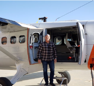
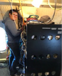
- 18 – 22 November 2019. Tests of new generation Search and Rescue beacon-locating system. NASA ARC personnel (from Earth Science and Flight Operations) successfully tested a new generation Search & Rescue Beacon-Locating System at Camp Roberts, California done in collaboration with GSFC) and Rockwell-Collins France. The tests were comprised of two parts, a UAV (Unmanned Aerial Vehicles) -mounted search & rescue beacon locator and a mobile search and rescue beacon simulator. The UAV was the SIERRA B which was flown entirely within the Camp Roberts restricted flight areas. The mobile beacon simulator was deployed at various locations within a 30-nautical mile radius of Camp Roberts.
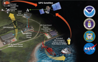
This next-generation search & rescue system under test uses the Cospas-Sarsat satellites. The Cospas-Sarsat system is a globally available search and rescue system that uses satellites to locate and rescue persons in distress who are equipped with approved, commercially available 406 emergency beacons. The beacons are available for boats, airplanes, and personal use. When activated, the beacon transmits a signal that is relayed by satellites to ground stations that process the signal to determine information about the beacon including its location. The beacon information is distributed to the appropriate rescue forces that could be located anywhere in the world. The specific purpose of the testing was to test new direction-finding equipment that has been upgraded to home in on a new generation of 406 emergency beacons that have been recently developed. At the same time, the testing is exploring the use of UAVs to utilize the upgraded direction-finding equipment to fly to the beacon where it could, theoretically, drop appropriate survival equipment to the persons in distress while rescue forces are underway. The U.S. contribution to the Cospas-Sarsat system is managed by four agencies – NASA, Coast Guard, Air Force, and NOAA – as shown in the graphic below.
GSFC leads the project to develop next generation search & rescue homing beacon technology. Rockwell designed and built the SAR (Synthetic Aperature Radar) hardware. ARC provided the aircraft and technical prowess to integrate the payload into the SIERRA-B aircraft.
-
4 -6 December 2019. Earth science Project management International Collaborative (EPIC) Meeting. Earth Science Project Office (ESPO) is hosting the meeting at NASA Ames Research Center, Moffett Field, CA. Led by ESTO at Ames, about 25 attendees from 5 countries (U.S., France, UK, Germany, Korea), and US participants from NASA (Ames, JPL, Armstrong, HQ), DOE, NCAR, NEON, PNNL, LANL, NSF share lessons-learned on airborne, shipborne, and other field projects management, including international, technology, management, and human aspects.
- 6 December 2019. Ocean Sciences Across the Solar System workshop Ved Chirayath (SGE) is invited to participate in the workshop at Ames Research Center (ARC). Objectives of the workshop: a. Identify new potential themes and areas of collaboration between Earth and Planetary science related to ocean research (ocean in other worlds) b. Begin articulating a strategy for this effort (eventually to be captured in a white paper)
p.p1 {margin: 0.0px 0.0px 0.0px 0.0px; font: 11.5px Arial}
Project Milestones
GSFC (Goddard Space Flight Center) Pandora – ARC (Ames Research Center) Meeting on 21 November 2019
- Members of the Pandora team from GSFC visited ARC to kick off a new partnership and to install an automated spectrometer to measure column amounts of ozone, nitrogen dioxide and formaldehyde in the atmosphere. This instrument will make ARC part of the Pandonia Global Network supporting satellite validation (e.g., TEMPO, Tropospheric Emissions: Monitoring Pollution) and air quality science worldwide. After years of advocacy and planning, the new installation (supported by B. Lefer) will initiate a long-term record of column measurements with: a) co-located airborne in-situ trace gas measurements from the AJAX (Alpha Jet Atmospheric eXperiment) project and b) extended intercomparisons with the resident 4STAR and 5STAR (Spectrometers for Sky-Scanning, Sun-Tracking Atmospheric Research) instruments, which are widely recognized for their high-quality direct-beam measurements of aerosol optical depth (AOD) and other properties. Extended discussions between the ARC and Pandora teams highlighted multiple science topics of interest, as well as several ways in which this partnership will advance the development of the Pandora retrievals.
- With our combination of assets, ARC will be positioned to evaluate measurements from Cimel (AERONET), Pandora, 4STAR and 5STAR instruments in an honest and open discussion of strengths of each of the different approaches relative to four different user communities: satellite validation/verification, air quality/atmospheric composition monitoring, model evaluation, and research activities.