Suggested Searches

Intelligent Robotics Group

Intelligent Robotics Group

Overview

The Intelligent Robotics Group (IRG) explores extreme environments, remote locations, and uncharted worlds. We conduct applied research in computer vision, geospatial data systems, human-robot interaction, planetary mapping and robot software.  IRG Brochure

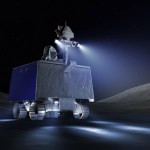
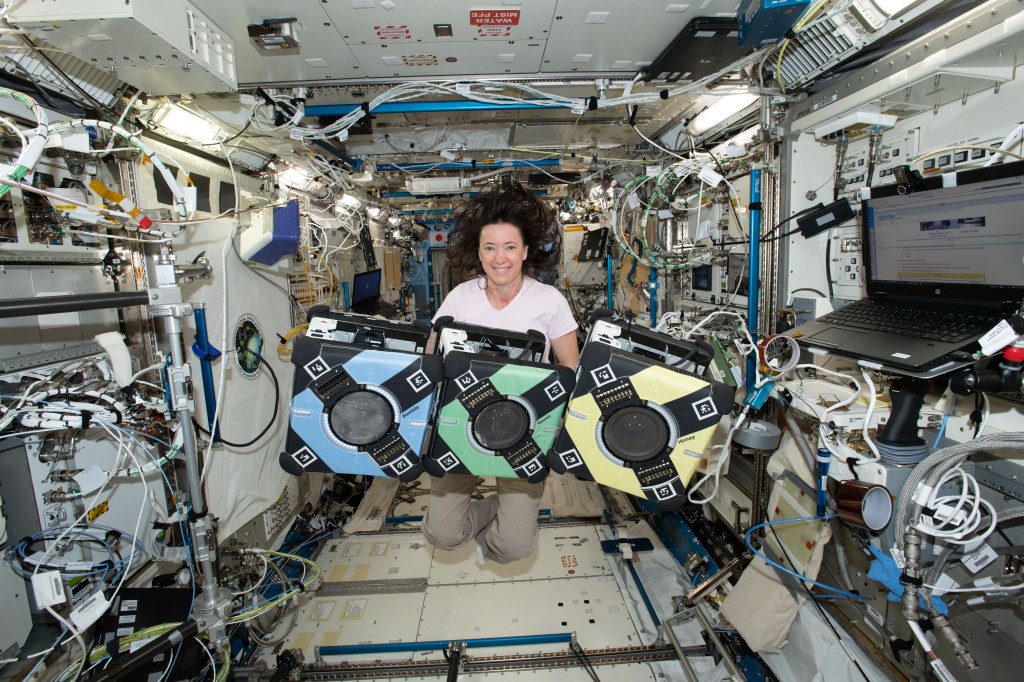
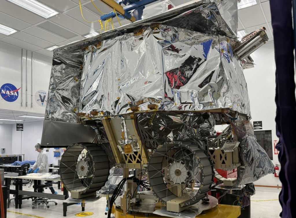
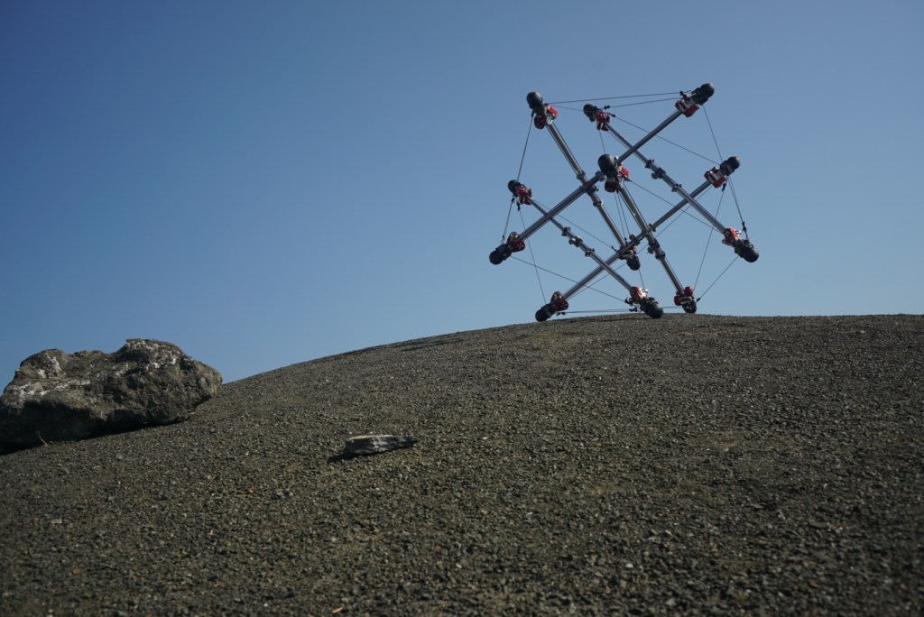
IRG has developed the Astrobee free-flying robot, the “K-REX” and “K10” series of planetary rovers (slideshow, fact sheet), and the SUPERball Bot tensegrity robot. We conduct robotic field tests each year in planetary analog sites, such as Black Point Lava Flow and Haughton Crater (data sets available).

We are committed to collaboration. Read about our Google Partnership in the Mt. View Voice and our Microsoft Partnership). If you are interested in working together, please contact us today.

See the latest news, photos, and videos on our blog (forthcoming).

IRG Media

IRG Open Source Software & Datasets

Software

Datasets

Projects

Astrobee
Launched in 2019, the Astrobee free-flying robots operate inside the International Space Station alongside astronauts. Astrobee’s primary purpose is to host innovative guest science; it can also provide mobile camera views of crew activities and perform environmental surveys.

Deep Earth Learning, Tools, and Analysis (DELTA) Toolkit
NASA Ames is partnering with the United States Geological Survey (USGS) and National Geospatial-Intelligence Agency (NGA) to develop DELTA, an open source toolkit for deep learning on satellite imagery. DELTA will empower Earth scientists to achieve state-of-the-art classification results with little-to-no knowledge of machine learning or computer programming. Initially, DELTA will be trained and evaluated for mapping floods for disaster response and recovery. Potential later uses include studying other natural disasters, changing land-use patterns, studying climate change, and more.

Digital Terrain Models and the NASA Ames Stereo Pipeline (ASP)
Digital terrain models are essential for cartography, science analysis, and mission planning and operations. IRG has developed software to automatically generate high-quality topographic and albedo models from satellite images. Our software uses multi-view geometry and photoclinometric techniques to produce 3D models with very high accuracy and resolution. ASP is an open source C++ framework for deriving, manipulating, and sythesizing terrain and shape data products. ASP has been used to create 3D terrain models for landing sites on Mars, topography on icy satellites and Kuiper Belt Objects (KBOs) in the outer solar system, as well as glaciers, mountains, and volcanoes here on Earth.

Exploration Ground Data System (xGDS)

Project Leads: Tamar Cohen and Matt Deans
IRG’s Exploration Ground Data System (xGDS) provides software tools to plan robot activities, monitor task execution, log robot telemetry, archive science data, and visualize a wide range of information.The xGDS makes use of the NASA Ensemble framework, Web interfaces and geospatial data browsers.

Extreme Perception
NASA’s future robotic exploration targets include spike-covered icy surfaces on Jupiter’s moon Europa, liquid methan lakes on Saturn’s moon Titan, and other environments that exist at the limits of imagination. IRG is developing novel sensors and a perception capability to enable robots to see in these extreme environments. Our approach blends elements of computer vision, optics, and physics-based simulation to understand planetary environments and target effective sensing modalities. We are also developing advanced decision-making and in-situ processing techniques to optimize information collected from our approaches. Technologies innovated by IRG include thermal vision-based navigation for landing on icy surfaces, cold-gas projectiles that map in ballistic flight and form monitoring networks once emplaced, and programmable microscopes that model individual grains of soil in 3D.

Integrated System for Autonomous and Adaptive Caretaking (ISAAC)
ISAAC uses both Astrobee robot free-flyers and the Robonaut 2 humanoid robot on the International Space Station to develop autonomous caretaking capabilities that will enable safe and reliable operation of future human spacecraft, such as the planned Lunar-orbiting Gateway, especially during extended periods when astronauts are not present.

Ocean Worlds Autonomy Testbed for Exploration Research and Simulation (OceanWATERS)
OceanWATERS is an open source simulator for developing onboard autonomy software for the robotic exploration of ocean worlds, such as Jupiter’s moon Europa, and Saturn’s moons Enceladus and Titan. The simulator emulates surface conditions, robotic manipulator operations, and lander systems. The simulator is modeled on the Europa Lander mission, but could be configured for other lander missions and planetary bodies.

Skylights and Caves Robotic Technologies
Skylights are gigantic sinkholes that might lead to intact caves on other planets. Exploration of these features is crucial for science, resource development, and future habitation throughout the solar system. IRG is developing robotic technologies for exploring subterranean environments — from life-detection payloads to automated mapping software — and testing them in field experimentation at terrestrial analog sites. IRG plans a technology demonstration by participating in the first commercially-led micro-rover mission to visit and circumnavigate one of the major Lunar skylights.

Tensegrity Robotics
Robots based on tensegrity structures have significant potential to reduce size, mass, and energy required for manipulation and mobility in space. Tensegrity structures are extremely lightweight, can be compactly stored for launch, are inherently compliant, and highly robust. Our work focuses on developing these highly non-linear structures to enable new science missions for extreme terrain locations.

Volatiles Investigatin Polar Exploration Rover (VIPER)
VIPER is a 2023 rover mission that will search for subsurface volatiles, such as water ice, in the polar regions of the Moon. IRG is developing the onbaord software, navigation systems, and rover robot-driving tools. We are also creating 3D Lunar terrain maps from satellite images for mission planning and providing software to support high-tempo science operations.

Team

Group Lead
Maria Bualat

Deputy Group Lead
Matthew Deans

Chief Roboticist

Terry Fong

Researchers
Oleg Alexandrov
Mark Allan
Khaled Al-Sharif
Ian Baldwin
Ross Beyer
Xavier Bouyssounouse
Jonathan Bruce
Salem Cherenet
Tamar Cohen
Brian Coltin
Philip Cooksey
Michael Dille
Lorenzo Flückiger
Tom Flynn
Michael Furlong
Julius Gyorfi
Brian Hamilton
Katie Hamilton
Rusty Hunt
Kaden Jeppesen
Roshan Kalghatgi
Joseph Kitchin
Dave Lees
Lanssie Ma
Matt Machlis
Ethan Massey
John McCaffery
Scott McMichael
Marina Moreira
Ted Morse
Estrellina Pacis
In-Won Park
Joseph Pea
Chris Provencher
Arno Rogg
Ernie Smith
Trey Smith
Ryan Soussan
Antoine Tardy
Hans Thomas
Vinh To
Hans Utz
Massimo Vespignani
Terry Welsh
DW Wheeler
Uland Wong