


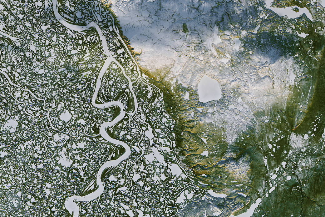
This view, acquired on Nov. 7, 2016, by the Operational Land Imager (OLI) on Landsat 8, shows a portion of Canada’s Mackenzie River Delta and the town of Inuvik, home to more than 3,000 people. A frozen highway — 194 kilometers (120 miles) long — runs between the remote outposts of Inuvik and Tuktoyaktuk along the river’s East Channel. White, snow-and-ice covered waterways stand out amid green, pine-covered land. The low angle of the sunlight bathes the higher elevations in golden light.
The Mackenzie River system is Canada’s largest watershed, and the tenth largest water basin in the world. The river runs 4,200 kilometers (2,600 miles) from the Columbia Icefield in the Canadian Rockies to the Arctic Ocean.
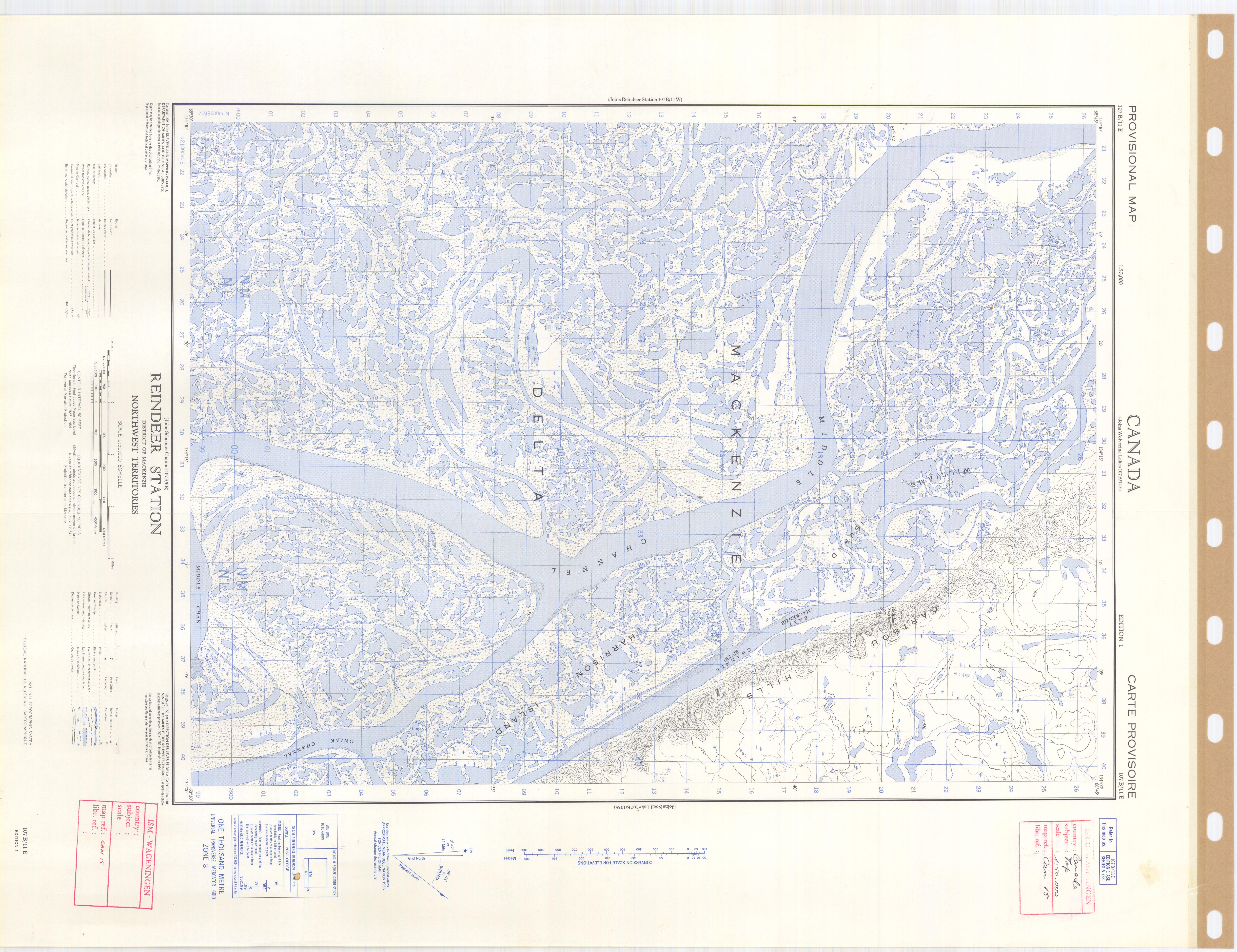
Every so often, flooding from the Mackenzie River replenishes the surrounding lakes. A 1950s-era map of the area indicates that its landforms have not changed much since then. However, parts of the watershed sit atop permafrost, which makes the area vulnerable to climate change.
The pond- and lake-covered lands around the river are home to caribou, waterfowl, and a number of fish species. Several thousand reindeer travel through this area each year on the way to their calving grounds.
Annotated image and references: NASA Earth Observatory
Image Credit: NASA Earth Observatory images by Joshua Stevens, using Landsat data from the U.S. Geological Survey
Caption: Pola Lem