


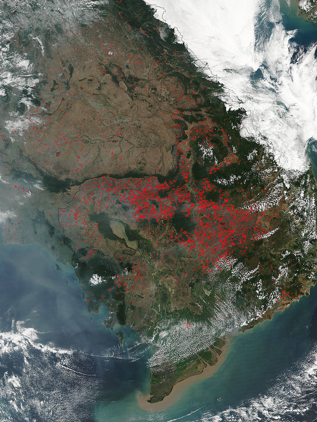
NASA’s Suomi NPP satellite collected this natural-color image using the VIIRS (Visible Infrared Imaging Radiometer Suite) instrument on February 04, 2018. The VIIRS instrument which collected this image is a 22-band radiometer which collects infrared and visible light data to observe weather, climate, oceans, nightlight, wildfires, movement of ice, and changes in vegetation and landforms. Suomi NPP is the first Earth-observing satellite to measure both global climate changes and key weather variables. Actively burning areas are outlined in red and encompass parts of Vietnam, Thailand, Laos, and Cambodia. The location, widespread nature, and number of fires suggest that these fires were deliberately set to manage land as farmers often use fire to return nutrients to the soil and to clear the ground of unwanted plants. While fire helps enhance crops and grasses for pasture, the fires also produce smoke that degrades air quality.
Suomi NPP is managed by NASA and NOAA. NASA image courtesy Jeff Schmaltz LANCE/EOSDIS MODIS Rapid Response Team, GSFC. Caption by Lynn Jenner