


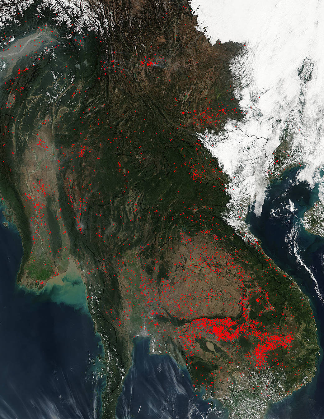
Agricultural fires set in Southeast Asia for the purpose of clearing fields peak in late winter/early spring as farmers prepare land for seasonal planting. This image seems to evoke near peak burning in the area compared with the image collected on January 19, 2017. As explained in the update of January 19, the burning across Indochina for the sake of farming unfortunately creates a seasonal pattern of emissions that plays a significant role in regional air pollution, including tropospheric ozone. Ozone can be both beneficial and harmful in the atmosphere, depending on its altitude. High up in the stratosphere, ozone protects the planet from harmful UV radiation. Closer to earth, tropospheric ozone is a harmful air pollutant. Fires in this image from the biomass burning cover most of Indochina with the highest number being in Cambodia and Laos. Ground snow cover obscures the upper right hand side of the image and clouds obscure parts of the lower right hand side.
NASA’s Suomi NPP satellite collected this natural-color image using the VIIRS (Visible Infrared Imaging Radiometer Suite) instrument on February 06, 2017. Actively burning areas, detected by MODIS’s thermal bands, are outlined in red. NASA image courtesy Jeff Schmaltz LANCE/EOSDIS MODIS Rapid Response Team, GSFC. Caption by Lynn Jenner