


Agricultural fires set in Southeast Asia for the purpose of clearing fields peak in late winter or early spring as farmers prepare land for seasonal planting.
The widespread nature of the burning across Indochina creates a seasonal pattern of emissions that play a significant role in regional air pollution, including
tropospheric ozone. (Ozone can be both beneficial and harmful in the atmosphere, depending on its altitude. High up in the stratosphere, ozone protects
the planet from harmful UV radiation. Closer to earth, tropospheric ozone is a harmful air pollutant.)
Like most parts of the world, the burning in Southeast Asia exhibits a diurnal (daily) cycle, in which burning is less widespread in the morning and
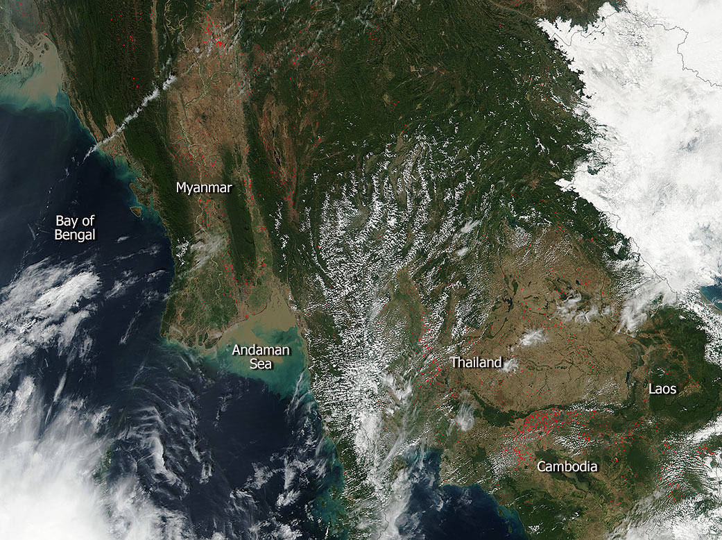
increases throughout the day as the fires grow and spread in the fields. Fires in this image from the biomass burning cover large portions of Cambodia,
Thailand, and Myanmar.
NASA’s Suomi NPP satellite collected this natural-color image using the VIIRS (Visible Infrared Imaging Radiometer Suite)
instrument on January 19, 2017. Actively burning areas, detected by MODIS’s thermal bands, are outlined in red. NASA image courtesy
Jeff Schmaltz LANCE/EOSDIS MODIS Rapid Response Team, GSFC. Caption by Lynn Jenner