


![Request for Information – Potential [Placeholder for Prize]](https://assets.science.nasa.gov/dynamicimage/assets/science/psd/solar/2023/09/s/solarsystem_0.jpg?w=1024)


A new NASA paper provides the most detailed map to date of near-surface water ice on the Red Planet.
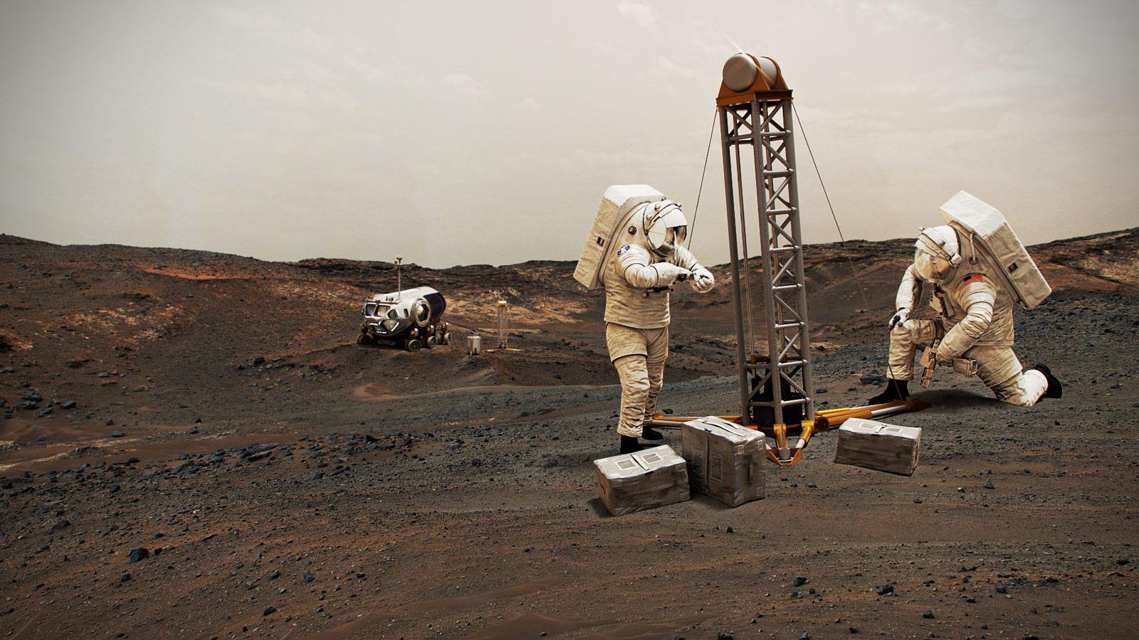
So you want to build a Mars base. Where to start? Like any human settlement, it would be best located near accessible water. Not only will water be crucial for life-support supplies, it will be used for everything from agriculture to producing the rocket propellant astronauts will need to return to Earth.
Schlepping all that water to Mars would be costly and risky. That’s why NASA has engaged scientists and engineers since 2015 to identify deposits of Martian water ice that could be within reach of astronauts on the planet’s surface. But, of course, water has huge scientific value, too: If present-day microbial life can be found on Mars, it would likely be nearby these water sources as well.
A new study appearing in Nature Astronomy includes a comprehensive map detailing where water ice is most and least likely to be found in the planet’s northern hemisphere. Combining 20 years of data from NASA’s Mars Odyssey, Mars Reconnaissance Orbiter, and the now-inactive Mars Global Surveyor, the paper is the work of a project called Subsurface Water Ice Mapping, or SWIM. The SWIM effort is led by the Planetary Science Institute in Tucson, Arizona, and managed by NASA’s Jet Propulsion Laboratory in Southern California.
“The next frontier for Mars is for human explorers to get below the surface and look for signs of microbial life,” said Richard Davis, who leads NASA’s efforts to find Martian resources in preparation for sending humans to the Red Planet. “We realize we need to make new maps of subsurface ice to improve our knowledge of where that ice is for both scientific discovery and having local resources astronauts can rely on.”
In the near future, NASA plans to hold a workshop for multidisciplinary experts to assess potential human-landing sites on Mars based on this research and other science and engineering criteria. This mapping project could also inform surveys by future orbiters NASA hopes to send to the Red Planet.
NASA recently announced that, along with three international space agencies, the signing of a statement of intent to explore a possible International Mars Ice Mapper mission concept. The statement brings the agencies together to establish a joint concept team to assess mission potential as well as partnership opportunities between NASA, the Agenzia Spaziale Italiana (the Italian Space Agency), the Canadian Space Agency, and the Japan Aerospace Exploration Agency.
Location, Location, Location
Ask Mars scientists and engineers where the most accessible subsurface ice is, and most will point to the area below Mars’ polar region in the northern hemisphere. On Earth, this region is where you find Canada and Europe; on Mars, it includes the plains of Arcadia Planitia and glacier-filled valleys in Deuteronilus Mensae.
Such regions represent a literal middle ground between where to find the most water ice (the poles) and where to find the most sunlight and warmth (the equator). The northern midlatitudes also offer favorable elevations for landing. The lower the elevation, the more opportunity a spacecraft has to slow down using friction from the Martian atmosphere during its descent to the surface. That’s especially important for heavy human-class landers, since Mars’ atmosphere is just 1% as dense as Earth’s and thus provides less resistance for incoming spacecraft.
“Ultimately, NASA tasked the SWIM project with figuring out how close to the equator you can go to find subsurface ice,” said Sydney Do, the Mars Water Mapping Project lead at JPL. “Imagine we’ve drawn a squiggly line across Mars representing that ice boundary. This data allows us to draw that line with a finer pen instead of a thick marker and to focus on parts of that line that are closest to the equator.”
But knowing whether a surface is hiding ice isn’t easy. None of the instrument datasets used in the study were designed to measure ice directly, said the Planetary Science Institute’s Gareth Morgan, the SWIM-project co-lead and the paper’s lead author. Instead, each orbiter instrument detects different physical properties – high concentrations of hydrogen, high radar-wave speed, and the rate at which temperature changes in a surface – that can suggest the presence of ice.
“Despite having 20 years of data and a fantastic range of instruments, it’s hard to combine these datasets, because they’re all so different,” Morgan said. “That’s why we assessed the consistency of an ice signal, showing areas where multiple datasets indicate ice is present. If all five datasets point to ice – bingo.”
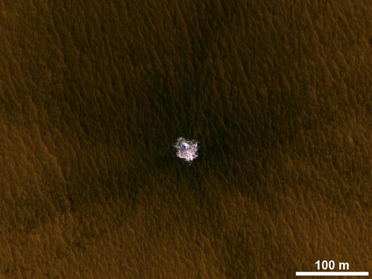
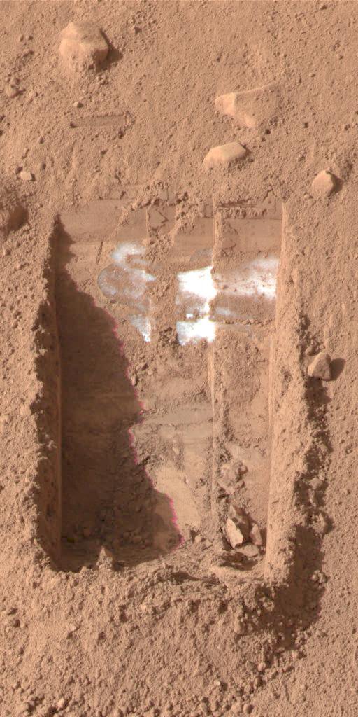
If, say, only two of them did, the team would try to suss out how consistent the signals were and what other materials could be creating them. While the different datasets weren’t always a perfect fit, they often complemented one another. For example, current radars peer deep underground but don’t see the top 30 to 50 feet (10 to 15 meters) below the surface; a neutron spectrometer aboard one orbiter measured hydrogen in the uppermost soil layer but not below. High-resolution photos revealed ice tossed onto the surface after recent meteorite impacts, providing direct evidence to complement radar and other remote-sensing indicators of water ice.
Next Steps
While Mars experts pore over these new maps of subsurface ice, NASA is already thinking about what the next steps would be. For one, blind spots in currently available data can be resolved by sending a new radar mission to Mars that could home in on the areas of greatest interest to human-mission planners: water ice in the top layers of the subsurface.
A future radar-focused mission targeting the near surface could also tell scientists more about the mix of materials found in the layer of rock, dust, and other material found on top of ice. Different materials will require specialized tools and approaches for digging, drilling, and accessing water-ice deposits, particularly in the extreme Martian environment.
Mapping efforts in the 2020’s could help make human missions to Mars possible as early as the 2030’s. But before that, there’ll be a robust debate about the location of humanity’s first outpost on Mars: a place where astronauts will have the local water-ice resources needed to sustain them while also being able to make high-value discoveries about the evolution of rocky planets, habitability, and the potential for life on worlds beyond Earth.
Andrew Good
Jet Propulsion Laboratory, Pasadena, Calif.
818-393-2433
andrew.c.good@jpl.nasa.gov
Alana Johnson / Grey Hautaluoma
NASA Headquarters, Washington
202-672-4780 / 202-358-0668
alana.r.johnson@nasa.gov / grey.hautaluoma-1@nasa.gov
2021-024