


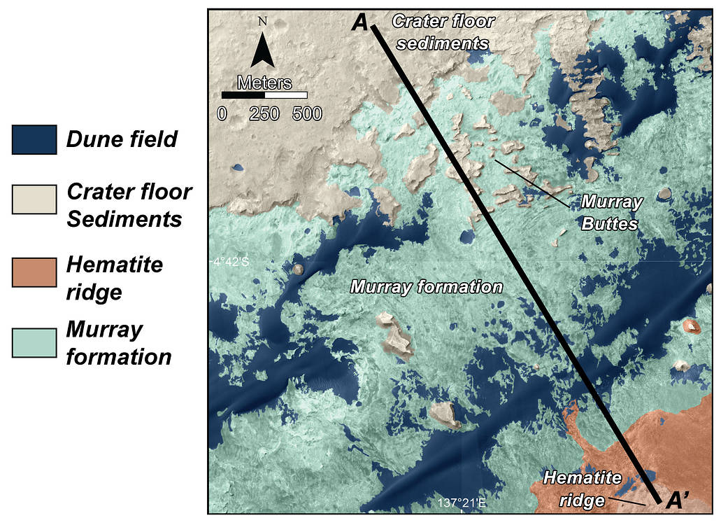
This is a map of lower Mount Sharp on Mars, showing the major geologic units identified from orbit. The rocks of the “Murray Formation,” mapped in green, likely represent the oldest layers of Mount Sharp that NASA’s Curiosity rover will explore. The Murray formation is in contact with two other major units: The sedimentary rocks of the crater floor that Curiosity has been exploring for the past two years, and the hematite ridge, a feature on Mount Sharp that shows a very distinct mineral composition from orbit. The segment A to A’ corresponds to the geologic cross-section presented in PIA18782. This image was made using the data from the High Resolution Imaging Science Experiment (HiRISE) camera, one of six instruments on NASA’s Mars Reconnaissance Orbiter.
The University of Arizona, Tucson, operates HiRISE, which was built by Ball Aerospace & Technologies Corp., Boulder, Colorado. NASA’s Jet Propulsion Laboratory, a division of the California Institute of Technology in Pasadena, manages the Mars Reconnaissance Orbiter and Mars Science Laboratory projects for NASA’s Science Mission Directorate, Washington.
Image Credit: NASA/JPL-Caltech/Univ. of Arizona