


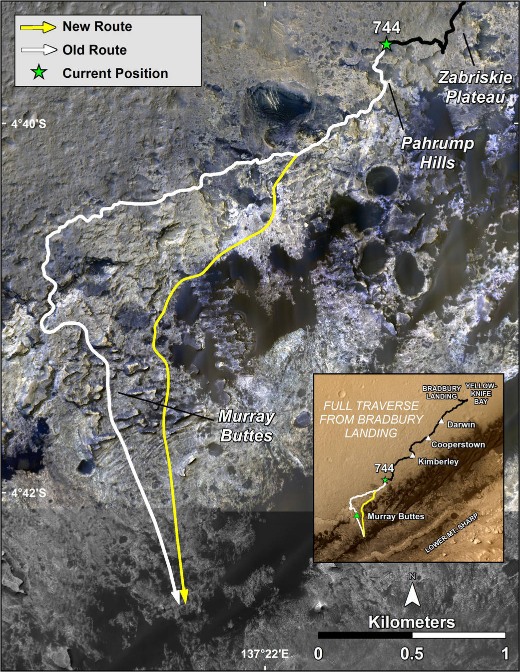
The route of NASA’s Mars Curiosity rover up the slopes of Mount Sharp on Mars is indicated in yellow in this false-color image. The rover’s current position is marked with a star. After work at “Pahrump Hills,” Curiosity will drive across the “Murray Formation” of rocks via the yellow route, which shortens the distance by almost 330 feet (100 meters) relative to an earlier route, shown in white.
This new route provides excellent access to many features in the Murray Formation. And it will eventually pass by the Murray Formation’s namesake — “Murray Buttes” — previously considered to be the entry point to Mt. Sharp.
The image is composed of color strips taken by the High Resolution Imaging Science Experiment, or HiRISE, on NASA’s Mars Reconnaissance Orbiter. It reveals that the Murray Formation is light-toned relative to rocks of Gale Crater’s plains (Aeolis Palus). This formation continues across the base of Mt. Sharp between Murray Buttes and the Pahrump Hills.
The maps were made using data from NASA’s Mars Reconnaissance Orbiter’s High Resolution Imaging Science Experiment, or HiRISE.
NASA’s Jet Propulsion Laboratory, a division of the California Institute of Technology, Pasadena, manages the Mars Science Laboratory Project for NASA’s Science Mission Directorate, Washington. JPL designed and built the project’s Curiosity rover.
HiRISE is one of six instruments on the Mars Reconnaissance Orbiter. The University of Arizona, Tucson, operates HiRISE, which was built by Ball Aerospace & Technologies Corp., Boulder, Colorado. JPL manages the Mars Reconnaissance Orbiter Project for NASA’s Science Mission Directorate, Washington.
More information about Curiosity is online at https://www.nasa.gov/msl and http://mars.jpl.nasa.gov/msl/.
NASA/JPL-Caltech/Univ. of Arizona