


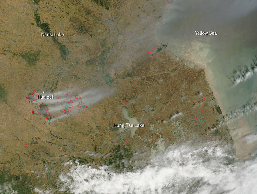
The Moderate Resolution Imaging Spectroradiometer (MODIS) on NASA’s Terra satellite captured this true-color image of agricultural fires on June 13, 2015. Smoke and actively burning fires (shown with red outlines) are visible in the true-color image.
This area falls within the North China Plain, a fertile and densely-populated region home to approximately 35 percent of the country’s agricultural yields. The staple crops here are wheat and maize, and the two crops are generally grown in rotation. Winter wheat is sown in mid-October and harvested it at the end of May. In June, farmers burn the remaining plant residue to fertilize the soil for the maize crop. Three quarters of all fires in the North China Plain occur in June. There is another peak in fire activity which occurs in October after the maize harvest.
Since the 1990s, the number of agricultural fires in the country has decreased due to a series of regulations aimed at prohibiting field burning. However, the practice still remains common. It is the most cost effective way to clearing fields and fertilizing the soil for the coming crops. Agricultural fires can be very dangerous though and, in fact, it was reported on June 13, 2015 that four villagers suffocated to death during a wheat field fire as summer harvest hits full bloom in the northern Hebei province.
See also Earth Observatory story from June 13, 2012.
NASA image courtesy Jeff Schmaltz, MODIS Rapid Response Team. Caption: NASA/Goddard, Lynn Jenner