


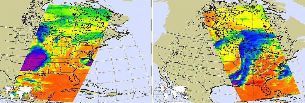
Today’s imagery from NASA’s AIRS instrument on the Aqua satellite indicates more severe weather is in store for the Midwest from Texas to Michigan. There is another extremely strong storm that is stretching from south to north and into Canada, and that system can be seen in this AIRS image from May 11, 2015. The first image (left) was taken at 3:35 am EDT, by the time the second image (right) was taken at 2:41 pm EDT the system had come together and was stretching across the nation vertically across the country.
Current weather forecasting predicts that Monday evening (5/11) will see very strong, severe weather whose activity will be further to the east than the previous storms from the past weekend. Tornado outbreaks are not expected with this system, but cannot be completely ruled out. The weather will still be severe including torrential rain, hail, high winds, and flash flooding. In this AIRS imagery, the very dark purple color is indicative of very cold air masses, a very compelling indication of strong convective storms.
Those persons in the affected areas should be on alert for severe weather and take necessary precautions.
Image credit: NASA JPL, Ed Olson
Lynn Jenner
NASA’s Goddard Space Flight Center