


The six-day-old Camp Fire has already attained the unfortunate title of California’s deadliest fire. The Camp Fire has already led to 42 deaths with a number of residents still unaccounted for. It is also the most destructive in California history as well with over 7,000 structures destroyed by the blaze. The fire began on Nov. 08, 2018 and has grown to a staggering 125,000 acres in just under a week. The cause of this blaze is still under investigation. California state regulators are investigating two utility companies that reported incidents close in time and location to the start of the Camp fire. Over 52,000 people have been evacuated due to the Camp Fire in over 1,300 shelters. To date the blaze is only 30% contained.
Extremely dry fuels from on-going drought conditions in California remain coupled with rugged terrain and these two issues are presenting firefighters with challenging conditions. Dry conditions with high winds contribute to massive and fast fire growth. Presently the high winds have abated and fire growth has slowed. Responders from across the country have joined the effort from Wyoming, Washington, Oregon, New Mexico, Nevada, Arizona, Utah, Colorado, South Dakota and Nebraska.

Last night firefighters continued to hold established containment lines. Firefighters actively fought the fire and worked aggressively providing structure protection. Crews will continue to provide structure protection throughout daytime operations. Firefighters will work to put direct and indirect fire lines in while scouting and putting in contingency lines ahead of the fire. Many risks and hazards along with steep terrain in some areas will impede firefighting efforts.
The forecast calls for continued low relative humidity and the dry fuel combined with steep rugged terrain will continue to impede efforts.
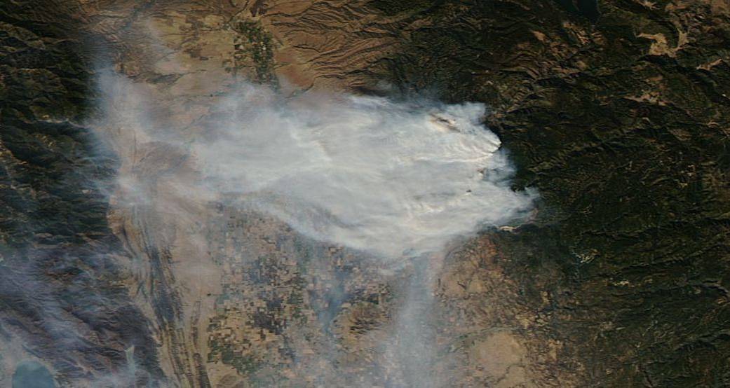
NASA’s Earth Observing System Data and Information System (EOSDIS) Worldview application provides the capability to interactively browse over 700 global, full-resolution satellite imagery layers and then download the underlying data. Many of the available imagery layers are updated within three hours of observation, essentially showing the entire Earth as it looks “right now. This satellite image was collected on November 12, 2018. Actively burning fires, detected by thermal bands, are shown as red points. Image Courtesy: NASA Worldview, Earth Observing System Data and Information System (EOSDIS). Caption: Lynn Jenner with information from Inciweb and CAFire.