


The Blue Cut fire was first reported just after 10:30 a.m. PDT on Aug. 16, 2016, north of San Bernadino, Calif. Smoke and the heat from the fire was detected just three hours later by NASA’s Aqua satellite.
Inciweb, an interagency all-risk incident information management system that coordinates with federal, state and local agencies to manage wildfires reported on August 17 that the fire had covered 18,000 acres.
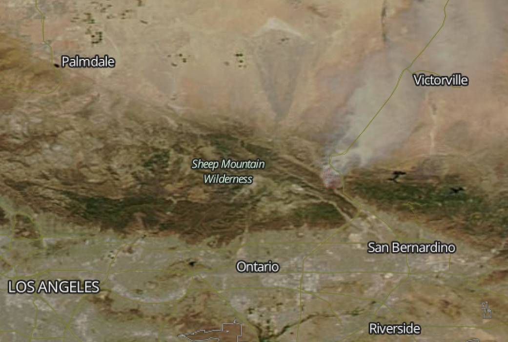
Inciweb reported that the Bluecut Fire started in the Cajon Pass near Kenwood Ave. west of Interstate 15. The Forest Service is in Unified Command with CAL FIRE, San Bernardino County Fire, San Bernardino County Sheriff’s Department, and the California Highway Patrol. More than 80,000 people have been evacuated.
This natural-color satellite image was collected by the Moderate Resolution Imaging Spectroradiometer (MODIS) aboard the Aqua satellite on Aug. 16, 2016 at 1:30 p.m. PDT. Actively burning areas, detected by MODIS’s thermal bands, are outlined in red. At the time of the image a large plume of smoke from the fire was blowing to the northwest, toward Victorville.
For more information on the Blue Cut Fire, call 909-383-5688 or visit http://inciweb.nwcg.gov/incident/4962/. Visit sbcfire.org/ReadySetGo.aspx for fire preparedness and safety information.
NASA image courtesy Jeff Schmaltz, MODIS Rapid Response Team. Caption: NASA/Goddard, Rob Gutro with information from Inciweb.