


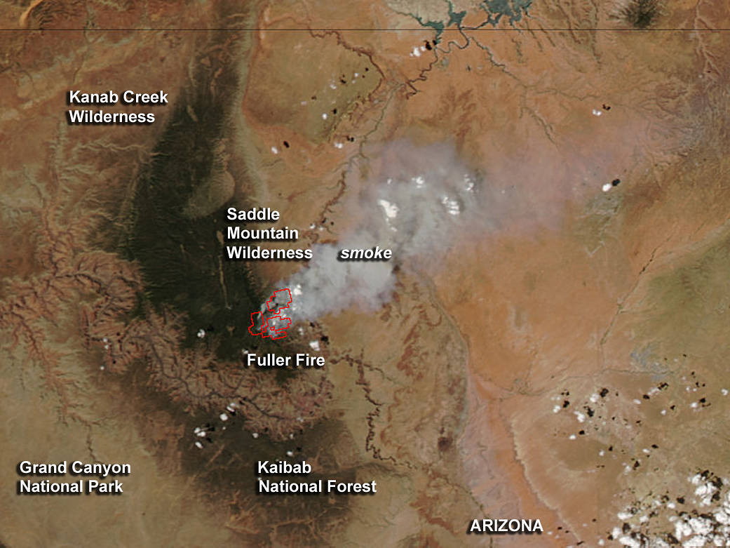
NASA’s Aqua satellite passed over Arizona on July 16 and captured a visible image of smoke from the Fuller Fire.
The Fuller Fire was sparked by lightning on June 29, 2016. It is located on the north rim of the Grand Canyon, near Point Imperial. The fire has covered 13,685 acres and is being managed by the Grand Canyon National Park Service (GCNP) fire managers.
On July 16 at 20:20 UTC (4:20 p.m. EDT) The Moderate Resolution Imaging Spectroradiometer or MODIS instrument that flies aboard NASA’s Aqua satellite captured an image of the smoke from the Fuller Fire. The large red outlines indicate the heat signature from the fire. The smoke, blowing to the northeast, appears as a light brown color.
On July 17, GCNP noted “Firefighters will continue to hold fire to the east of Cape Royal Road using firing operations when needed. To the north, the fire has moved out of the Wilderness into grasses in the South Canyon Point area of the Kaibab National Forest. Crews will use existing roads and natural features wherever possible to limit future fire spread in this area. To the west, low and moderate fire behavior will continue to benefit the spruce-fir ecosystem of the North Rim.”
Light to moderate smoke from today’s fire activity will spread to the northeast reaching into Page, Kayenta, and the northeast areas of the Navajo Nation. For more information on smoke and air quality please visit: http://wildlandfire.az.gov/links.asp#smoke.
For updated fire information from the Grand Canyon National Park Service, call 844-684-541
Image Credit: NASA MODIS Rapid Response, Jeff Schmaltz, Text: NASA Goddard Space Flight Center, Rob Gutro