


Felicia – (East Pacific Ocean)
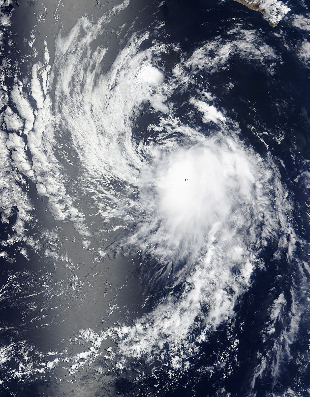
NASA’s Terra satellite passed over the Eastern Pacific Ocean and observed Tropical Depression Felicia almost directly over Socorro Island, as if the storm swallowed the island.
Socorro Island sits in the eastern Pacific Ocean, southwest of the southern tip of Baja California, Mexico. Socorro is a small volcanic island in the Revillagigedo Islands. The island has experienced several tropical cyclones this year already, and Felicia is the most recent and unwelcome visitor.
At 11 a.m. EDT (1500 UTC) on July 24, 2015 the center of Tropical Depression Felicia was located near latitude 21.7 North, longitude 117.9 West. The depression is moving toward the northwest near 10 mph (17 kph) and a turn toward the west-northwest is forecast late on July 24. Maximum sustained winds were near 35 mph (55 kph) and the National Hurricane Center expects Felicia to continue weakening. The estimated minimum central pressure is 1007 millibars.
Felicia is forecast to become a remnant low by Saturday, according to the National Hurricane Center.
Rob Gutro
NASA’s Goddard Space Flight Center, Greenbelt, Md.
July 23, 2015 – Satellite Sees Birth of Tropical Storm Felicia in Eastern Pacific Ocean
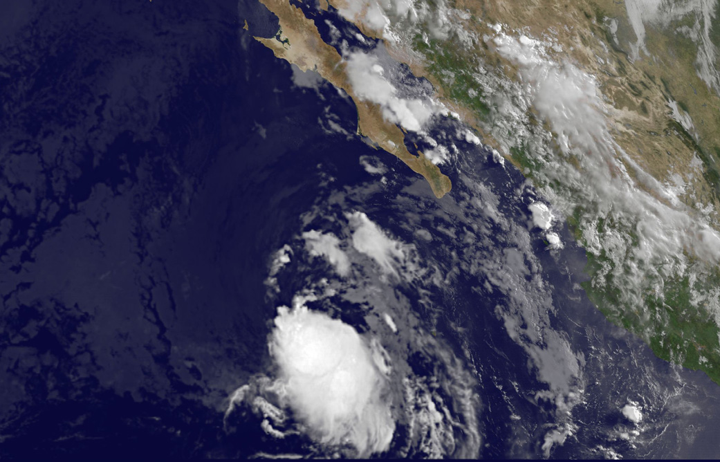
Tropical Storm Felicia was born early on July 23 in the Eastern Pacific Ocean, over 400 miles southwest of Baja California’s southern tip. NOAA’s GOES-West satellite provided an infrared image of the newborn storm.
Previously known as tropical low pressure area “System 99E,” the storm finally developed after days of remaining unorganized. NOAA’s GOES-West satellite captured an image of Tropical Storm Felicia on July 23, 2015 at 15:45 UTC (11:45 a.m. EDT). Satellite imagery shows that a curved band of thunderstorms are wrapping around the southern quadrant of the storm.
The low pressure area became Tropical Depression 7E at 5 a.m. EDT (0900 UTC) on July 23. By 11 a.m. EDT (1500 UTC) the depression strengthened into a tropical storm and was named Felicia. At that time, Felicia was located near latitude 19.1 North, longitude 114.9 West. Felicia was moving toward the northwest near 13 mph (20 kph) and is forecast to turn to the west-northwest is forecast by Friday night, July 24. Maximum sustained winds were near 40 mph (65 kph).
The National Hurricane Center’s forecaster Brennan noted that Tropical Storm Felicia doesn’t seem to have much of a chance to develop much more as it’s heading into cooler waters and moderate northerly vertical wind shear is expected to continue until it gets into those cooler waters. The area it is headed toward are 26 Celsius (78.8 Fahrenheit), and tropical cyclones need sea surface temperatures of at least 26.6 Celsius (80 Fahrenheit) to maintain or increase intensity.
The National Hurricane Center expects Felicia to weaken late on July 24 and become a remnant low pressure area over the weekend of July 25 and 26.
Rob Gutro
NASA’s Goddard Space Flight Center