


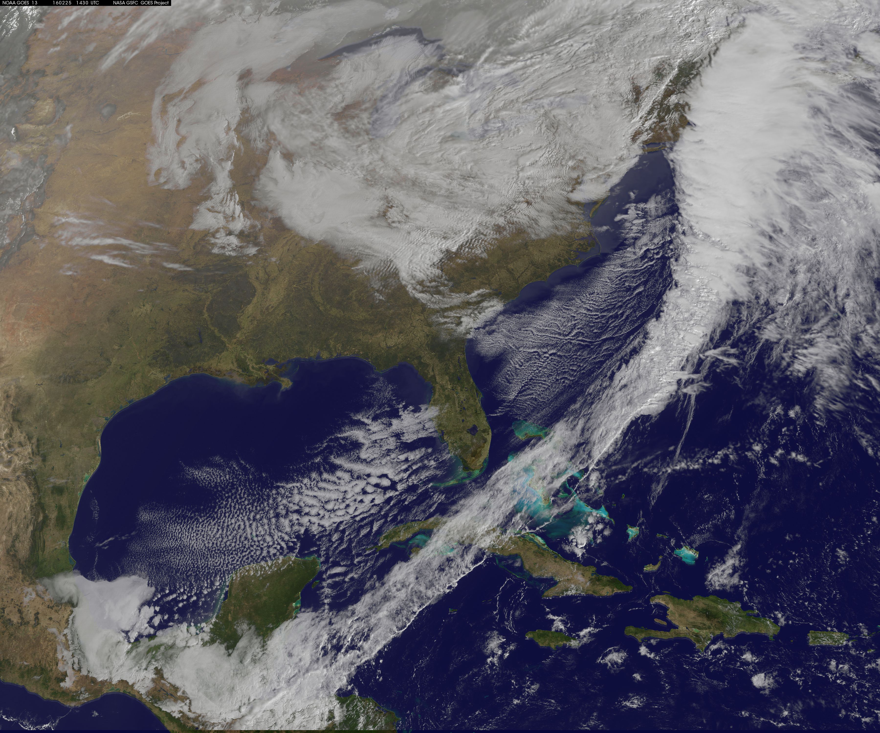
NASA’s RapidScat instrument that flies aboard the International Space Station measured surface winds ahead of a powerful cold front that generated a line of strong to severe storms on Feb. 24. The cold front moved through the southeastern and Mid-Atlantic U.S. and generated many reports of severe weather. Early the next day, NOAA’s GOES-East satellite showed that powerful front had moved off the U.S. East Coast.
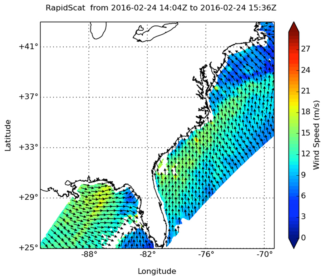
On Feb. 24 in the 10 a.m. hour (EST) RapidScat measured winds ahead of the front, blowing northward off the Atlantic from Florida to New York. RapidScat data showed winds along the southeastern U.S. seaboard were bringing warm, moist air from south to north ahead of the front. RapidScat also showed that winds in the northern Gulf of Mexico were pushing warm, moist air to the east and into the system, helping to create instability in the atmosphere the helped trigger severe weather.
RapidScat measured sustained surface winds as strong as 21 meters per second (46.9 mph/75.6 kph) from Florida’s east coast north to the Mid-Atlantic, as well as along the Gulf coast. The data was made into an image at NASA’s Jet Propulsion Laboratory in Pasadena, California.
NOAA noted 16 reported tornadoes, 281 reports of strong winds, and 27 reports of hail on Feb. 24. For the full report of yesterday’s severe weather, visit NOAA’s Storm Prediction Center report: http://www.spc.noaa.gov/climo/reports/yesterday.html
On Feb. 25, NOAA’s National Weather Service Weather Prediction Center website stated “The strong storm system that brought significant weather to the Gulf Coast through the Mid-Atlantic will continue push northward into Canada today. Snow and gusty winds are expected across portions of the Appalachians, Great Lakes and New England today, where Winter Weather Advisories and a few Winter Storm Warnings are in effect. Blowing snow could result in hazardous travel in these locations.”
A visible image from NOAA’s GOES-East satellite taken on Feb. 25 at 1430 UTC (9:30 a.m. EST) showed the clouds associated with the powerful cold front had moved over the western Atlantic Ocean. The image was created by the NASA/NOAA GOES Project at NASA’s Goddard Space Flight Center in Greenbelt, Maryland.
Rob Gutro
NASA’s Goddard Space Flight Center