


Lee esta historia en español aquí.
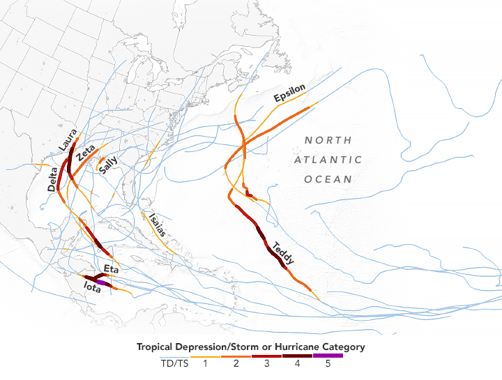
The 2022 Atlantic hurricane season has officially started, and NASA scientists are working with partners at NOAA, FEMA and other organizations to help communities prepare for these storms and respond to their aftermath. To gain a better understanding of how hurricanes are intensifying and becoming stronger in the face of climate change, NASA is developing technology and missions to study our home planet as a complex, dynamic system.
But what’s the recipe for hurricane formation, and how is the behavior of these storms changing as Earth’s long-term warming trend continues? NASA research answers these questions to help you understand how excess heat in Earth’s oceans is changing the way hurricanes form and evolve.
1. What’s the recipe for a hurricane?
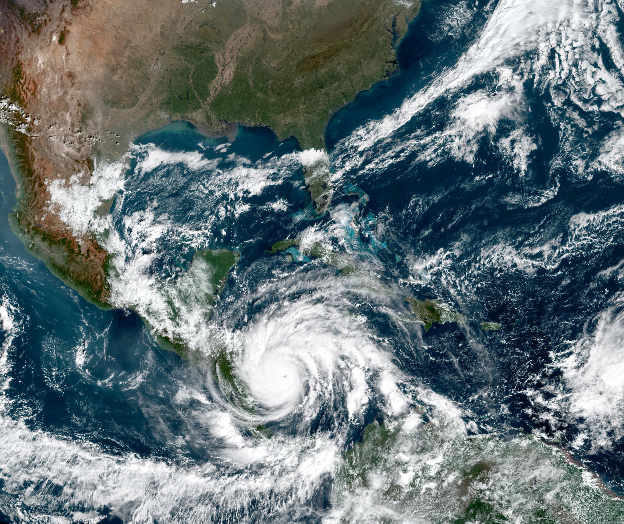
The general name for “hurricanes” is tropical cyclones. Outside the United States, people also call these storms typhoons or simply cyclones. In short, tropical cyclones are storms with winds swirling rapidly around a center of warm air.
Hurricanes depend on four main ingredients to form. First, they need heat or energy stored in the upper layer of the ocean. This ocean heat content powers a storm similar to how fuel powers an engine. Second, they need high humidity in the air, achieved by evaporation of ocean waters above 79°F (26°C). As this humid air rises and interacts with cooler air above, it creates and grows increasingly larger clouds and thunderstorms. Third, hurricanes need favorable winds. At different heights in the atmosphere, these winds need to be weak enough to avoid ripping the storm apart. Fourth, hurricanes need background rotation to organize scattered thunderstorms into one larger storm that spins increasingly faster into a cyclone’s characteristic spiral form. Some of this spin comes from Earth’s own spin as it rotates around its axis.
2. How does climate change interact with a hurricane’s ingredients?
Ocean heat, air humidity, wind — all these ingredients factor into hurricane formation. And all are affected by climate change.
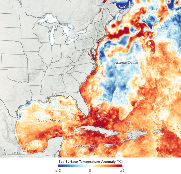
The ocean has absorbed 90% of the warming that has occurred in recent decades due to increasing greenhouse gasses, and the top few meters store as much heat as Earth’s entire atmosphere. But the way winds interact with this heat or energy in the ocean also plays an important role in the fate of a storm, explained Scott Braun, a research meteorologist at NASA’s Goddard Space Flight Center in Greenbelt, Maryland.
“If you get a storm moving over a shallow layer of warm water, the stronger winds can mix up the ocean enough that it pulls up that deeper, colder water, and reduces the energy available for the storm,” Braun said. “However, if the depth of the warm layer is fairly large, the storm can’t really tap into that cooler water, so there’s less chance of that cooler water acting to weaken the storm.”
Changes in wind speed and direction at different heights, called vertical wind shear, can make or break a hurricane. It can impede storm formation by dispersing heat and moisture. If it’s strong, it can also break apart an existing storm by blowing its top away from its bottom.
“Let’s say you’ve got an environment where at low levels, the winds are out of the east at five miles an hour, and at the top, they’re out of the west at five miles an hour,” Braun said. “You’ve got winds trying to move the storm in different directions as a function of height, and that tends to tilt over the storm and potentially rip it apart.”
In future climate projections of hurricane behavior, wind shear is the biggest wildcard, as it may weaken or strengthen storms in different regions. Research suggests some areas of the world might get stronger winds than others as a result of global warming, but it is uncertain how that will play out.
3. Does climate change mean more hurricanes each season?
No. Even though a warm ocean is a key ingredient for hurricane formation, research shows this warming has not significantly influenced the number of Atlantic hurricanes that form each year.
However, because projections suggest that as the ocean warms the atmosphere will also hold more moisture to form clouds and feed storms, scientists are anticipating stronger and wetter hurricanes in coming years. That is, although oceanic warming isn’t yet increasing the frequency of hurricanes, this excess heat appears to be affecting different characteristics of hurricanes that do form.
This is why Dr. Mayra Oyola-Merced, an atmospheric physicist at NASA’s Jet Propulsion Laboratory in Southern California, encourages people living in places constantly exposed to hurricanes to follow guidance from local authorities before a storm hits.
“We know that in terms of a warming climate with increasing sea surface temperatures, we have a higher probability of hurricanes in the extreme portion of the scale,” Oyola-Merced said. “Sometimes even though it’s a Category 1 storm, you can get a lot of damaging rain, winds and storm surges that can put lives and property in danger.”
4. How is climate change affecting hurricane intensity?
Research suggests that with rising temperatures, it will be more likely that storms will undergo rapid intensification, which is defined as an increase in hurricane wind speeds by 35 mph (or about 56 kilometers per hour) within 24 hours. These quick changes can leave local authorities and communities in the path of a hurricane without time to prepare.
Already, rapid intensification appears to be one of the major influences of a warming ocean on hurricane behavior. While rapidly intensifying storms occurred less frequently in past decades, the Atlantic is now producing about one of these storms per season, Oyola-Merced said. And as this phenomenon has happened more often in recent decades, scientists are just beginning to understand how to predict it.
“The reason we don’t know much about that is because until around 2005, this was a very rare thing to happen,” Oyola-Merced said. “This gets tricky because if you have a forecast when something like this happens, and the model is not able to capture this rapid intensification, it means that you have the wrong information, and you’re giving the public the wrong information.”
5. Is climate change slowing down hurricanes?
Yes. In recent decades, hurricanes have been stalling more as they approach coasts, dropping more rainfall over confined locations. Research shows Atlantic hurricanes are experiencing a reduction of roughly 17% in forward motion speeds than in previous decades, which translates into an increase of about 25% in rainfall, Oyola-Merced explained.
“The longer a system spends over the ocean getting warm by now this extremely heated water, you’re also going to increase its rainfall,” Oyola-Merced said. “When you have land that’s already saturated, where it’s constantly raining, and then you come with another storm that’s packed with precipitation, it’s a recipe for disaster.”
With data from more than 20 satellites, NASA plays a foundational role in hurricane science. Before, during, and after a hurricane strikes, NASA satellites are in a prime position to identify impacts and help communities prepare, respond, and recover. With tools like the Disasters Mapping Portal, the agency supports regional governments and disaster management agencies.
When it comes to operational forecasting, NASA’s main role is through its crucial partnership with NOAA. NASA designs, builds, and launches NOAA’s suite of satellites that provide the data that specifically feed numerical weather prediction models.
Banner image: Nighttime view of Hurricane Ida making landfall in Louisiana on August 30, 2021, as seen by the Visible Infrared Imaging Radiometer Suite (VIIRS) on the Suomi NPP satellite. Credits: NASA’s Earth Observatory