


An especially dry period from July to October in Indonesia, a result of the 2015-16 El Niño, contributed to a severe fire season and significant carbon and pollution emissions. The 2015 fire season had significant effects on air quality in the region.
Scientist Robert Field of NASA’s Goddard Institute for Space Studies in New York and colleagues compared the fire season to those of previous years in Indonesia, using NASA satellite data since the 2000s and Indonesian airport visibility beginning in the 1990s.
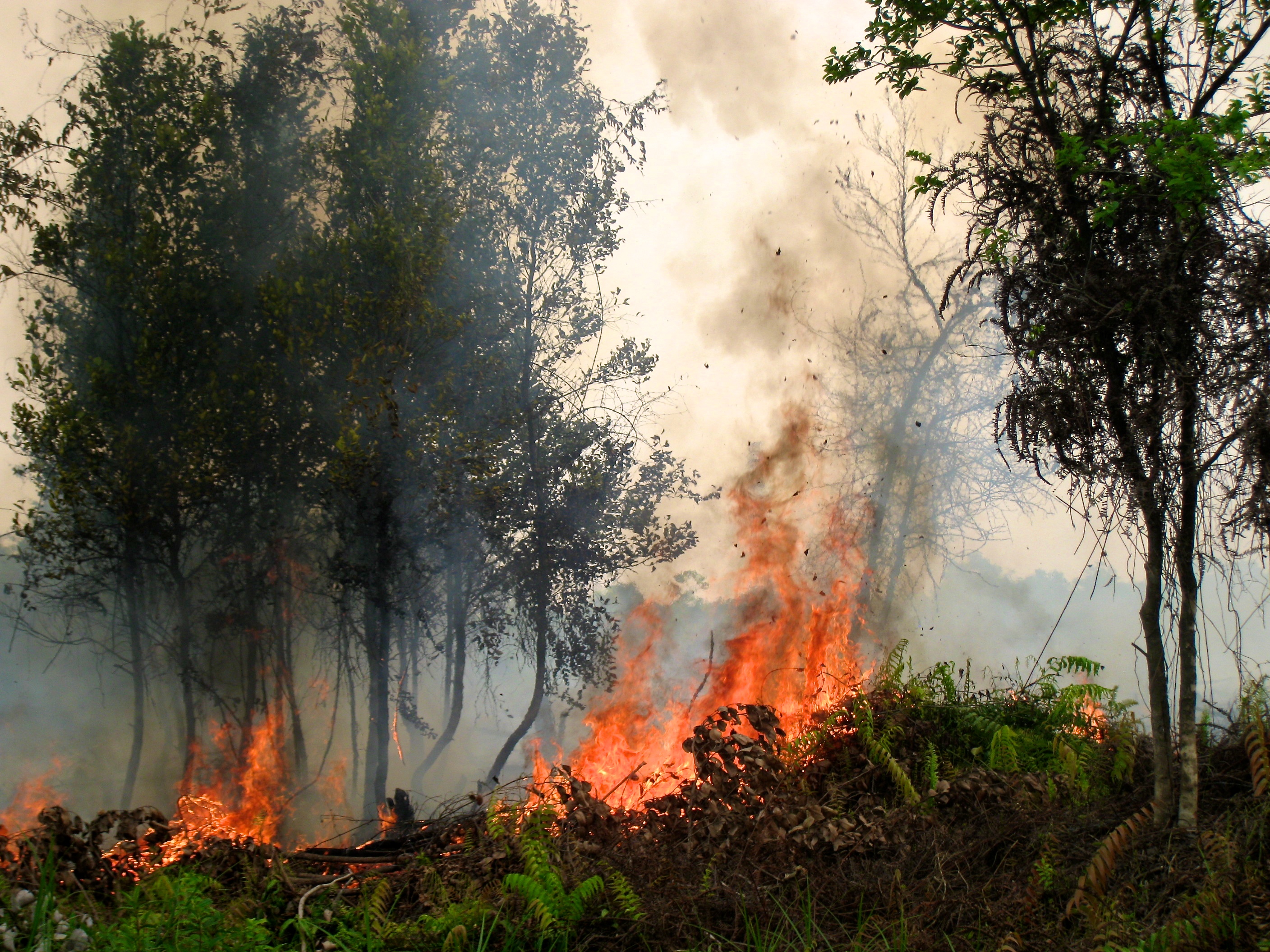
The length and severity of the fire season in Indonesia is strongly influenced by the amount of rainfall during the dry season, Field said. As a result of the recent El Niño, 2015 rainfall was low enough for fires to spread underground into drained, degraded peat swamps, where they burn longer.
Over the two main burning regions of Sumatra and Kalimantan (Indonesian Borneo), fire activity and smoke emissions were the largest recorded over the region by NASA satellite instruments most of which have been collecting data since the early 2000s. Data from five instruments on the NASA Aura, Terra, and Aqua satellites tracked active fires, carbon monoxide, and aerosol optical depth in the atmosphere.
“One of the instruments saw a plume of carbon monoxide from the fires stretching halfway around the world at the equator at about 12km,” Field said.
By looking at airport visibility going back to the 1990s, Field and colleagues were able to compare 2015 to severe events in 1991, 1994 and 1997. In Kalimantan, 2015 visibility reductions ranked lower than 1997 because it was much less dry. Compared to 1991 and 1994, however, the 2015 haze from the smoke created by the fires was more severe but conditions were no drier. This suggests that Kalimantan’s susceptibility to fires has gone up, continuing a trend seen since the 1980s with intensified land use and increased human-induced fires.
Across the multiple data sources, Field and colleagues identified the seasonal rainfall level below which severe is likely – an average of 4mm/day. “Many years, even during the dry season, it’s still too wet for any serious burning to happen,” he said. “Knowing that rainfall threshold, you can look at a seasonal rainfall assessment and have a sense of whether it’s going to be a normal or a bad fire year and plan ahead.”
Eliminating fire from degraded peatlands is a long-term goal that will require changes in land use and land tenure as Indonesia undergoes economic development. In the short term, fire prevention, suppression, and mitigation measures should be tied to early warning triggers.
Related links:
- The Scientific Paper: http://www.pnas.org/cgi/doi/10.1073/pnas.1524888113
- NASA Fires Page: www.nasa.gov/fires
- Policy Forum: www.policyforum.net/indonesias-dangerous-haze/
- GFED emissions: www.globalfiredata.org