


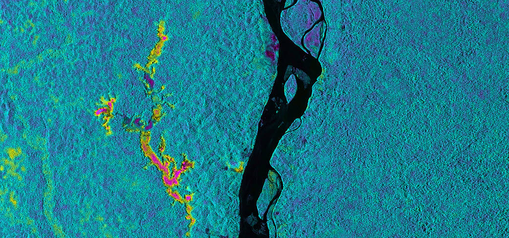
On March 17, 2013, NASA’s Uninhabited Aerial Vehicle Synthetic Aperture Radar (UAVSAR) acquired synthetic aperture radar data over the Napo River in Ecuador and Peru. The image colors indicate the likelihood of inundation (flooding) beneath the forest canopy, which is difficult to determine using traditional optical sensors. Red and yellow shades indicate a high likelihood of standing water with emergent vegetation, blue and green shades are areas less likely to be inundated, and black indicates the open water areas of the Napo River. These data, which have already been transmitted to a field team working along the Napo River, will be used to guide field measurements during a second observation by UAVSAR on March 31, 2013. The image is a 8.7-mile-wide by 5.6-mile-long (14-kilometer-wide by 9-kilometer-long) segment of an image measuring more than 124 miles (200 kilometers) long. North is toward the upper right. The resolution is 20 feet (6 meters). UAVSAR data like these are helping scientists assess the effectiveness of using synthetic aperture radar data to study the inundation dynamics of this and similar rivers around the world.
Credit: NASA/JPL-Caltech