


During an engineering flight test of the Cloud-Aerosol Multi-Angle Lidar (CAMAL) instrument, a view from NASA Armstrong Flight Research Center’s ER-2 aircraft shows smoke plumes, from roughly 65,000 feet, produced by the Thomas Fire in Ventura County, California, around 1 p.m. PST on Dec. 5th, 2017.
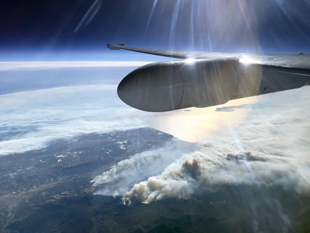
During an engineering flight test of the Cloud-Aerosol Multi-Angle Lidar (CAMAL) instrument, a view from NASA Armstrong Flight Research Center’s ER-2 aircraft shows smoke plumes, from roughly 65,000 feet, produced by the Thomas Fire in Ventura County, California, around 1 p.m. PST on Dec. 5th, 2017. As of Dec. 6, authorities state 65,000 acres have been burned and the fire remains zero percent contained.
Image Credit: NASA/Stu Broce