


NASA’s Terra satellite detected heat signatures and smoke from the Ute Fire, burning in northeastern New Mexico.
The Incident Information System noted on June 4 that the Ute fire was only 23 percent contained and has covered 36,114 acres. The fire began on May 31, 2018, 2:10 p.m. MDT and the cause is under investigation.
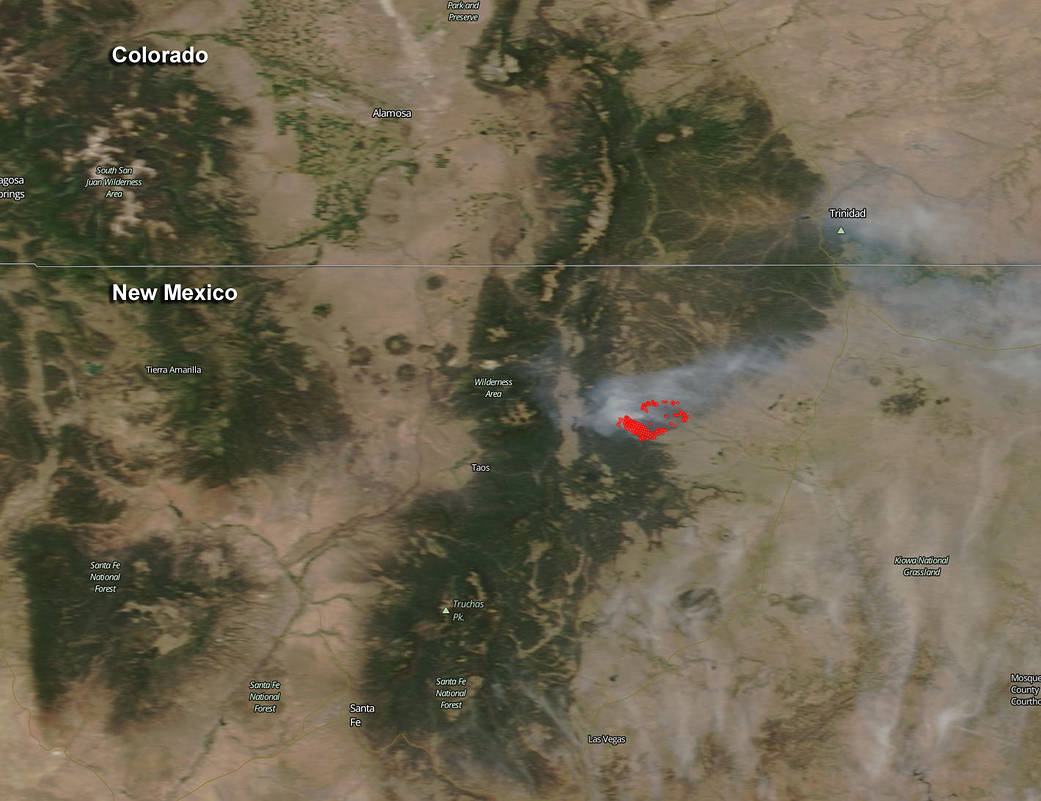
This natural color image from the Moderate Resolution Imaging Spectroradiometer that flies aboard NASA’s Terra satellite was taken on June 2. The red areas indicate hot spots, or fires. Smoke appears as a light brown color. In the image, a large plume of smoke extends from the Ute fire in northeastern New Mexico, northeast over the Colorado border to the town of Trinidad.
The fire is being fueled by grass, Pinyon Juniper and Mixed Conifer. The origin location is near Highway 64 in Ute Park, New Mexico, between Eagle Nest Lake and Cimarron. There are 498 personnel including 13 crews, 8 helicopters, 19 engines, 2 bulldozers, 6 water tenders battling the fire. Cimarron Canyon State Park is closed. Eagle Nest Lake State Park is open, but Eagle Nest Lake is closed to boating as firefighting helicopters are utilizing the lake as a water source. The Carson National Forest has implemented an area closure as a precaution to potential fire spread.
For updates on the Ute fire, visit: https://inciweb.nwcg.gov/incident/5820/ or: https://www.facebook.com/UteParkFireInfo/
Sign Up for Colfax County’s Emergency Alerts at https://bit.ly/2LbNdXh.
NASA image courtesy NASA Worldview/MODIS Rapid Response Team, GSFC. Caption by Rob Gutro