


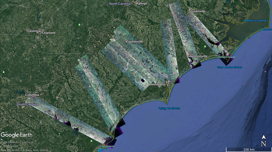
This wide-view map shows areas of North and South Carolina where the UAVSAR team collected data during flights between Sept. 17-23
This wide-view map shows areas of North and South Carolina where the UAVSAR team collected data during flights between Sept. 17-23
September 2018
NASA / Google