Early in the morning on Oct. 25, 2012, the Suomi NPP satellite passed over Hurricane Sandy after it made landfall over Cuba and Jamaica, capturing this highly detailed infrared imagery, showing areas of deep convection around the central eye. Besides the highly detailed infrared imagery, the satellite shows visible-like imagery of the cloud tops.
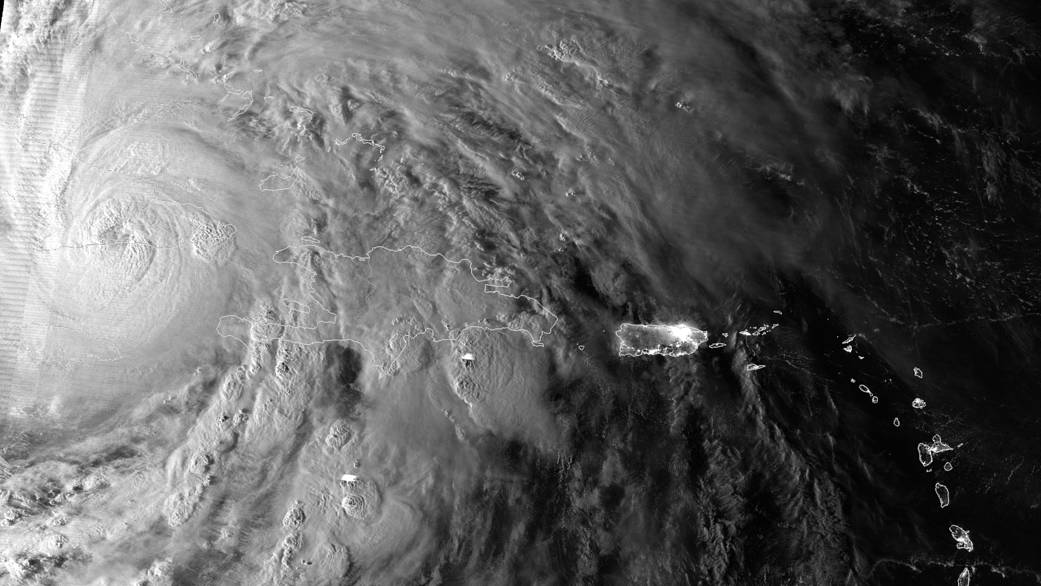
Early in the morning on Oct. 25, 2012, the Suomi NPP satellite passed over Hurricane Sandy after it made landfall over Cuba and Jamaica, capturing this highly detailed infrared imagery, showing areas of deep convection around the central eye. Besides the highly detailed infrared imagery, the satellite shows visible-like imagery of the cloud tops, along with the city lights of Puerto Rico and the Virgin Islands.Image Credit: NOAA/NASA


