As the last snow melts, NASA’s SnowEx teams are packing up the snowshoes, skis, and scientific instruments they’ve used all winter to study snow in mountains and prairies. Now, they’re turning their attention to a different kind of mountain – all of the data they collected.
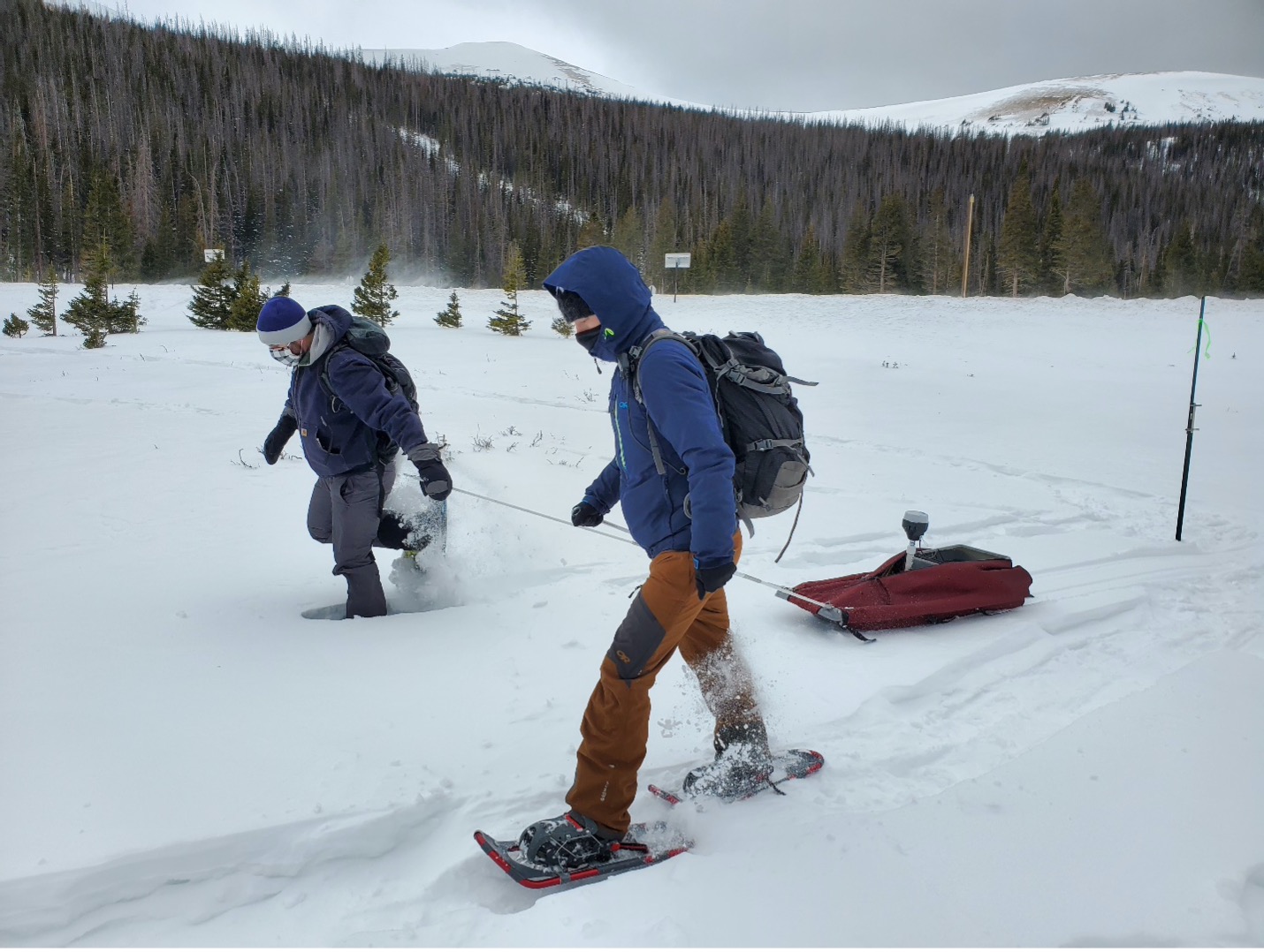
This year, SnowEx teams took snow measurements at six sites across the Western United States, on the ground and with drones and airplanes flying overhead. This information will help scientists determine how much water the winter snowpack holds, which is crucial for managing water resources for drinking, agriculture, hydropower, flood forecasting, drought and wildfire management and more.
In addition to studying snow, SnowEx researchers are also evaluating how accurately various techniques can measure snow in different environments. In the future, NASA hopes to launch a satellite dedicated to studying snow – and the water it stores – from space, in order to understand how changes in the snowpack affect droughts, wildfires, and more. One of the main goals of the multi-year SnowEx campaign is figuring out which instruments may be best suited for the job.
“We’re not going to solve the snow monitoring problem from space with one technology,” said HP Marshall, an associate professor at Boise State University and SnowEx 2021’s co-project scientist. “A big part of SnowEx is figuring out the best way to combine field work, remote sensing, and modeling into one framework.”
In 2020, the SnowEx campaign was cut short due to the COVID-19 pandemic and the team couldn’t finish their airborne experiments. For 2021, the science team had three major goals: conduct a time series of L-band Interferometric Synthetic Aperture Radar (InSAR) observations in diverse snow conditions, measure the reflectivity of the snow surface, and study snow distribution in a prairie landscape.
A Gulf Stream 3 aircraft, carrying the Uninhabited Aerial Vehicle Synthetic Aperture Radar (UAVSAR) instrument from NASA’s Jet Propulsion Laboratory, flew over seven sites in Colorado, Utah, Idaho and Montana from mid-January until the end of March. UAVSAR is an L-band InSAR, a special kind of radar, that SnowEx is using to measure changes in the mass of the snowpack.
The snowpack’s mass can change drastically from one UAVSAR flight to the next. For example, a large snowstorm may dump massive amounts of snow in one area over a short period of time. Some of the snow may melt or sublimate – skipping the liquid phase and going straight from solid to gas. It may also get redistributed by high winds.
The SnowEx team is testing how well the UAVSAR sensor can detect these different changes in the snow’s mass. Summing up the changes in snow mass over the winter season will help the team calculate how much water is stored in the seasonal snowpack, or snow-water equivalent (SWE). “With UAVSAR, what we’re looking at is change in SWE from one flight to the next,” said Carrie Vuyovich, lead snow scientist for NASA’s Terrestrial Hydrology Program, at NASA’s Goddard Space Flight Center in Greenbelt, Maryland.
Scheduled for 2022, NASA and the Indian Space Research Organization (ISRO) plan to launch the NISAR satellite to study changes in Earth’s surface from space. NISAR will carry an L-band radar instrument similar to UAVSAR, and the SnowEx team is testing how they may use NISAR observations to study snow.
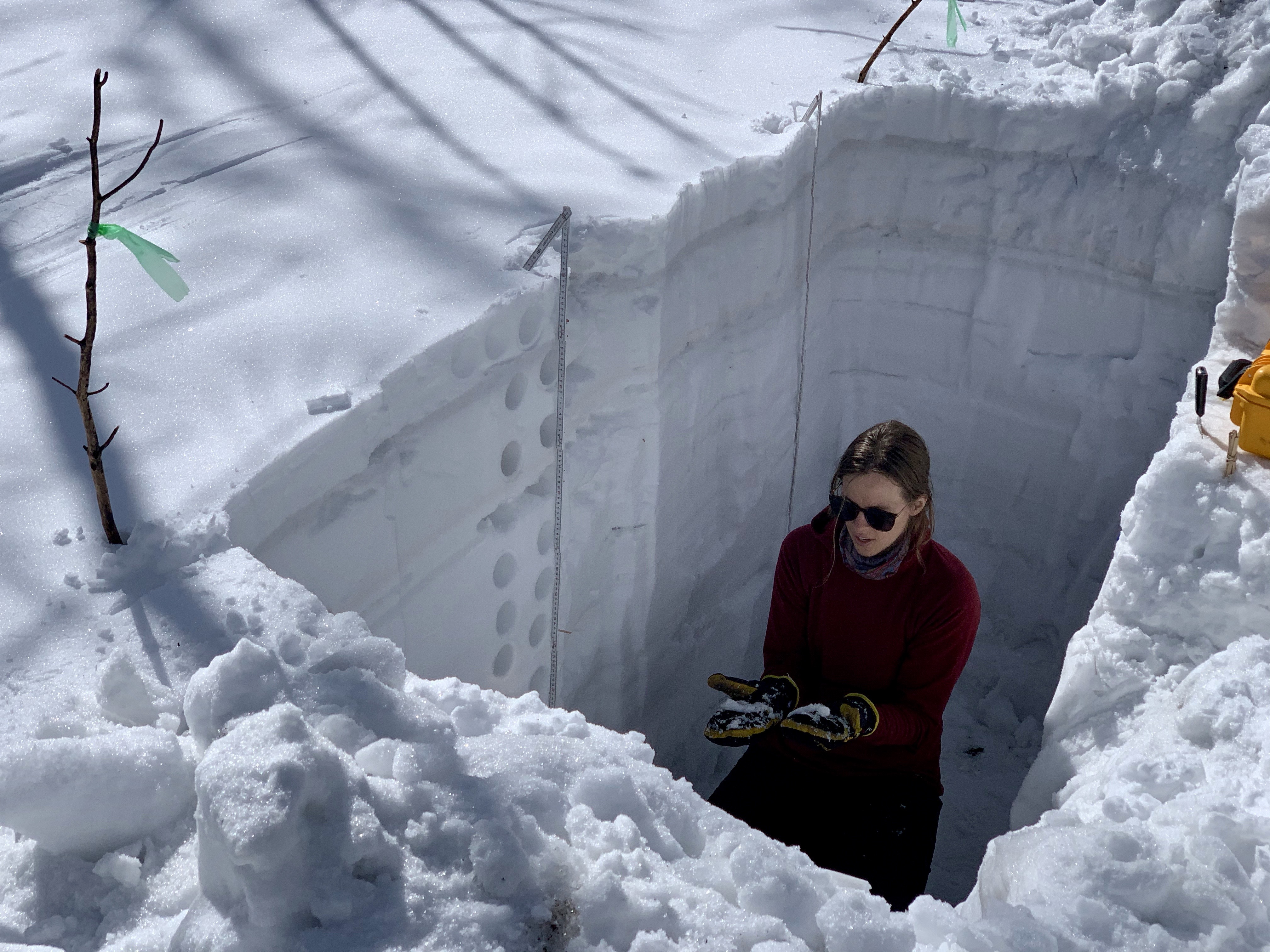
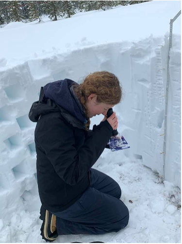
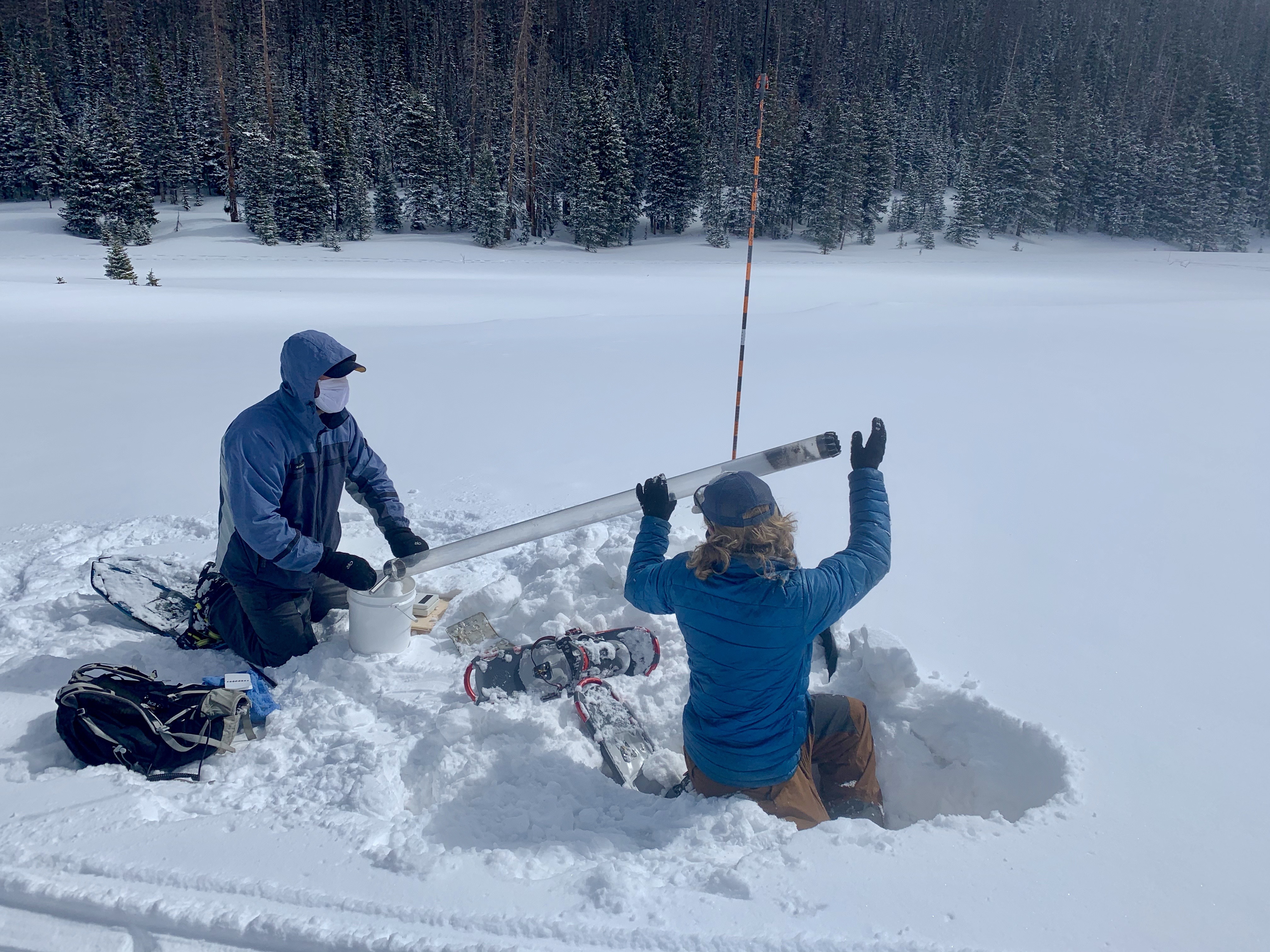
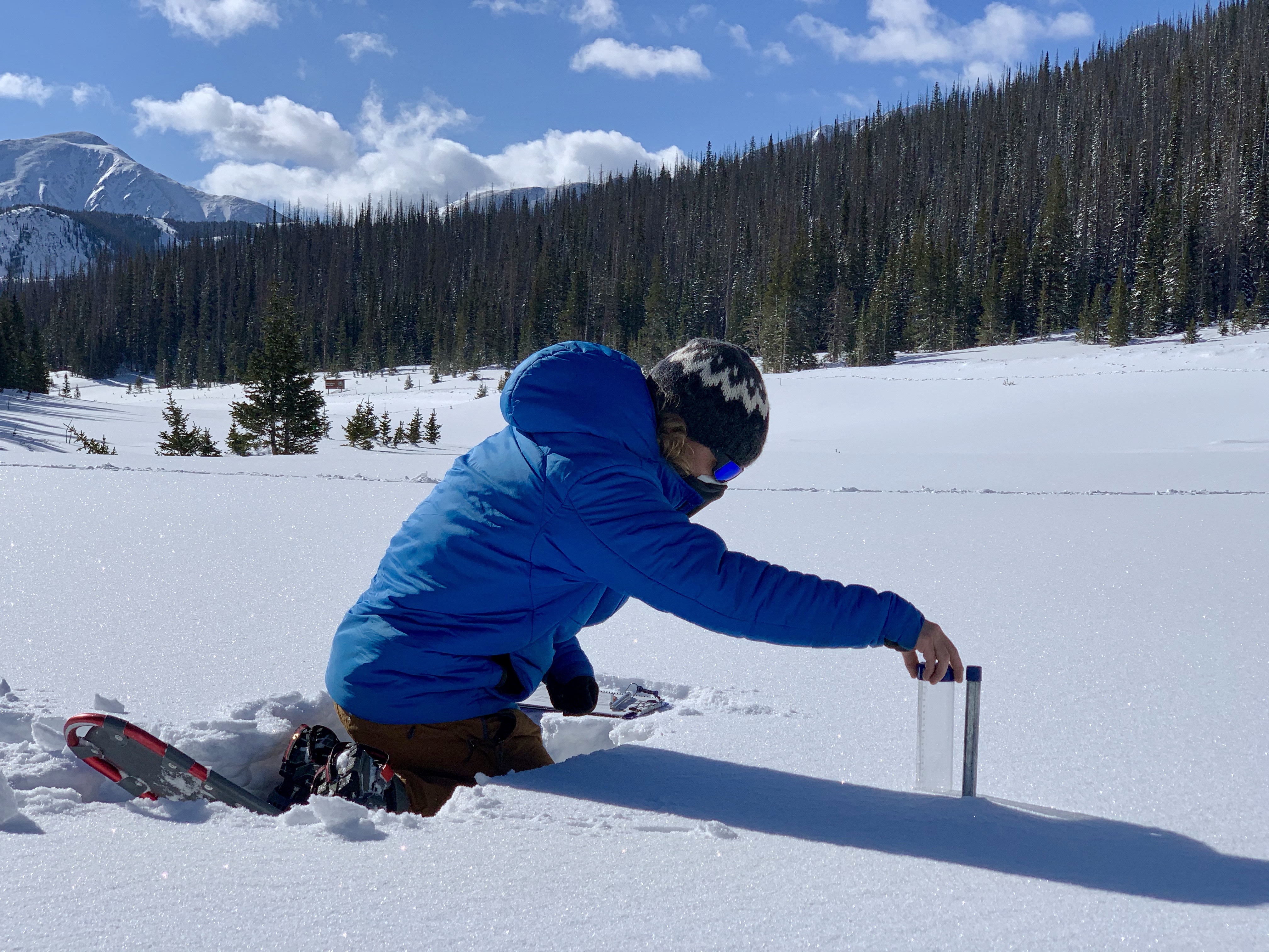
As the planes flew overhead, scientists collected data on the ground below. They measured snow characteristics such as snow depth and density, the size of individual snow grains, temperature, how reflective the snow surface is, and how much of the snowpack is ice, snow or liquid water. The team collected these measurements from snow pits – car-sized holes dug in the snow. From inside the pits, scientists took samples at different depths to see how the characteristics of the snowpack varied from layer to layer.
The SnowEx observers also measured the snowpack using ground-based remote sensing tools similar to those used from the air and space. The data collected during SnowEx is publicly available from the National Snow and Ice Data Center; more datasets are published every month as scientists from across the country complete processing each of the raw datasets and carefully checking them for errors.
Scientists on snowshoes or skis also used handheld spectrometers to measure albedo, or how bright and reflective the snow surface is. Albedo plays a huge role in how fast the snow melts. It depends on a range of factors, such as the size and shape of individual snow crystals, how much of the snow has melted already, and impurities like dust on top of the snow.
From the air, researchers measured albedo using the Airborne Visible / Infrared Imaging Spectrometer (AVIRIS) Next Generation instrument from NASA’s Jet Propulsion Laboratory. Comparing the airborne and ground measurements will help the scientists identify how different factors contribute to the snow albedo.
Credits: NASA’s Goddard Space Flight Center/Scientific Visualization Studio.
This video can be shared and downloaded here.
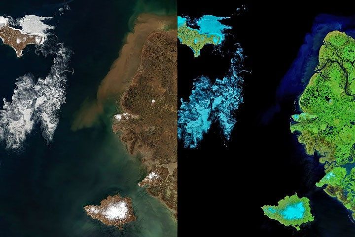
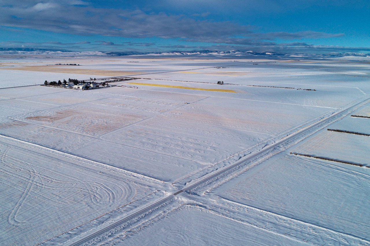
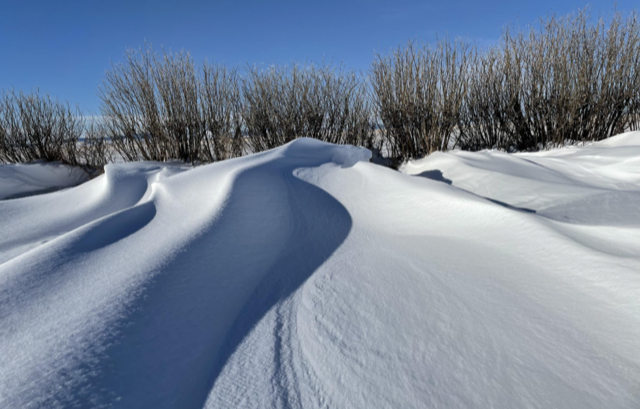
This year, SnowEx added a site in a prairie, which is an important but under-studied landscape when it comes to snow science. While the amount of snow in prairies is much less than what falls in the mountains, “a large percentage of the snow-covered Earth is considered prairie. Snow in those areas is important for agriculture and contributes to flooding,” said Vuyovich.
These exposed landscapes often have high winds that move snow from one area to another, forming deep snowdrifts in some areas and leaving only a light dusting of snow in others. Because of these variations, the SnowEx team wanted to see how well remote sensing can detect these large changes in snow cover over short distances.
All of the experiments went smoothly despite the pandemic, said Marshall. “There are always challenges,” he said, citing risks of hypothermia, avalanches and dangerous roadway conditions. “But COVID was a big additional challenge that we weren’t used to dealing with.” To ensure that everyone was safe, the team implemented routine COVID-19 testing, masks, social distancing protocols, and limited passengers in vehicles.
SnowEx teams also recruited local snow scientists to help collect data in the field. “These teams were completely instrumental in making this campaign a success,” said Vuyovich. “That was the only way we were able to continue SnowEx this winter.”
After a successful winter in the field, the SnowEx team is changing their focus from snowshoes and spectrometers to laptops and high performance computers. In mid-July, 90 members of the community will participate in a week-long hackathon, which will provide tutorials for working with SnowEx data and group projects to build software for analysis of the large datasets. Next winter, the SnowEx team plans to conduct experiments in the Alaskan tundra and boreal forest. Full data analysis involving broader community participation will continue into the future.
By Sofie Bates
NASA’s Earth Science News Team
NASA’s Goddard Space Flight Center