This post was written prior to a reorganization of ESC’s projects and networks in support of the agency’s commercialization efforts. Though accurate at the time of publication, it is no longer being updated and may contain outdated information. For more information about the current projects, click here.
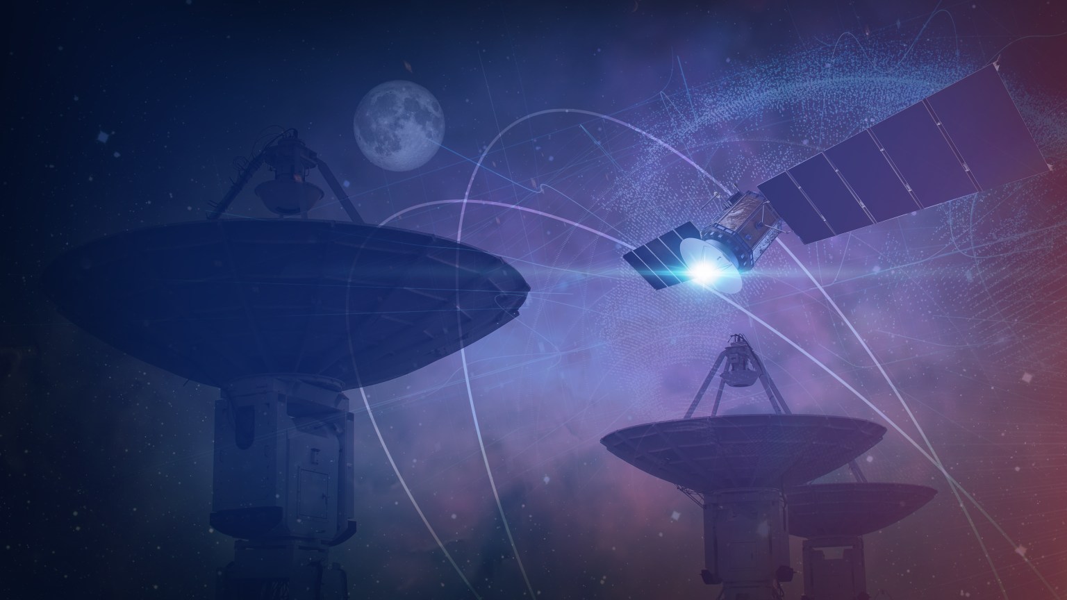
When NASA and its partners establish astronauts and rovers on the Moon, they will need robust navigation data to navigate the rocky surface and make it to their destinations. Additionally, mission control on Earth needs to keep track of our explorers and help them in case of contingencies.
Navigation experts at NASA’s Goddard Space Flight Center in Greenbelt, Maryland, are developing the capability to use Earth-based location system signals for missions at and around the Moon. On Earth, humans rely on systems like the Global Positioning System, or GPS – one of multiple global navigation satellite systems (GNSS) which provide timing and location services to devices like our phones and in-car maps.
In recent years, multiple researchers have studied using the signals from these GPS-like constellations for space navigation in high-altitude Earth orbits and in lunar regime.
By using existing, Earth-based systems for location and timing data on the Moon, the agency and its partners could see significant cost savings for lunar missions.

Munther Hassouneth
NavCube3-mini Project Manager, NASA Goddard Space Flight Center
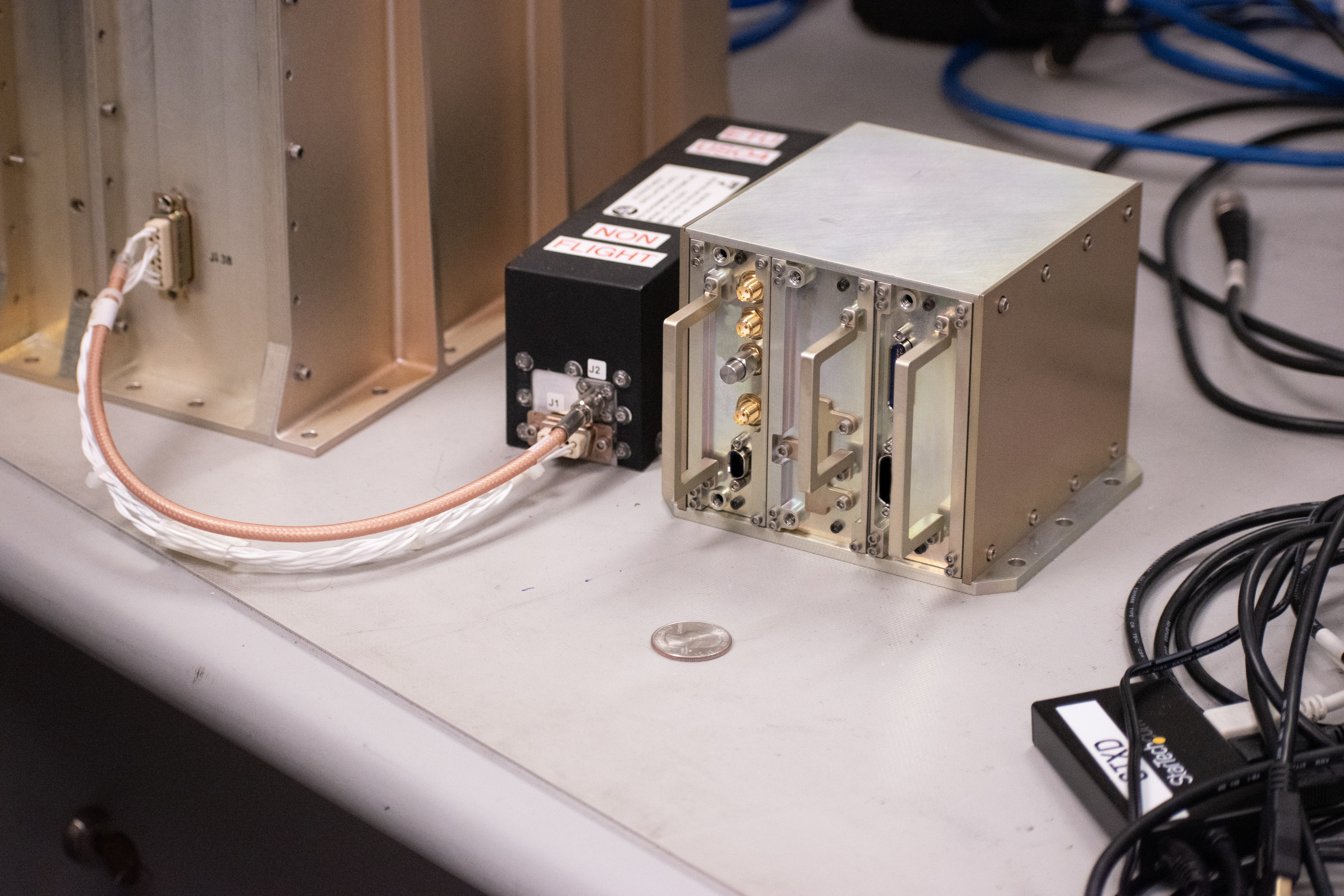
One of these efforts is known as the NavCube3-mini, a revolutionary receiver capable of capturing and processing Earth-based GNSS signals at the Moon. This receiver will empower lunar missions with precise timing and navigation information, while potentially enabling autonomous navigation. Additionally, it only weighs 1.6 kilograms, offering extraordinary potential for missions while saving on size, weight, and power costs.
The NavCube3-mini builds on NASA’s Magnetospheric Multiscale Mission (MMS) Navigator GPS receiver, which set a Guinness World Record for furthest use of GPS signals from Earth. After a few years of miniaturizing and improving the technology, the NavCube3-mini is now smaller, more efficient, can use multiple radio frequency bands, and is capable of receiving signals from both GPS and Galileo – the United States and European Union’s GNSS constellations.
In 2023, the NavCube3-mini team presented their findings about the technology’s potential to the Space Communications and Navigation (SCaN) program office and Goddard technical experts. With technology readiness Level 6 secured, the team is now actively seeking an upcoming mission to adopt the technology and demonstrate it in space.
I am excited to see this technology demonstrated on a lunar mission so we can understand its full potential to our lunar endeavors.
Munther Hassouneth
NavCube3-mini Project Manager, NASA Goddard Space Flight Center
In a separate effort, a team of NASA Goddard navigation experts are working to demonstrate another GNSS receiver on an upcoming Commercial Lunar Payload Services (CLPS) mission. The Firefly Aerospace Blue Ghost lander will be equipped with the Lunar GNSS Experiment Receiver (LuGRE), which will use a different GNSS receiver developed in partnership with the Italian Space Agency. Both efforts are helping NASA advance navigation at the Moon!