


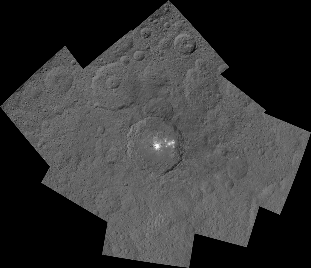
This mosaic shows Ceres’ Occator crater and surrounding terrain from an altitude of 915 miles (1,470 kilometers), as seen by NASA’s Dawn spacecraft. Occator is about 60 miles (90 kilometers) across and 2 miles (4 kilometers) deep.
Occator is home to the brightest area on Ceres, which tends to appear overexposed in most images. This view uses a composite of two images of Occator: one using a short exposure that captures the detail in the bright spots, and one where the background surface is captured at normal exposure.
The images used to make this mosaic have a resolution of 450 feet (140 meters) per pixel, and were taken during the first of six mapping cycles during Dawn’s high-altitude mapping orbit.
Dawn’s mission is managed by NASA’s Jet Propulsion Laboratory for NASA’s Science Mission Directorate in Washington. Dawn is a project of the directorate’s Discovery Program, managed by NASA’s Marshall Space Flight Center in Huntsville, Alabama. UCLA is responsible for overall Dawn mission science. Orbital ATK, Inc., in Dulles, Virginia, designed and built the spacecraft. The German Aerospace Center, the Max Planck Institute for Solar System Research, the Italian Space Agency and the Italian National Astrophysical Institute are international partners on the mission team. For a complete list of acknowledgments, see http://dawn.jpl.nasa.gov/mission.
For more information about the Dawn mission, visit http://dawn.jpl.nasa.gov.
Image Credit: NASA/JPL-Caltech/UCLA/MPS/DLR/IDA