


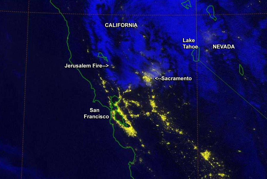
From its orbit around the Earth, the NASA-NOAA Suomi National Polar-orbiting Partnership satellite or Suomi NPP satellite, captured a night-time image of California’s Jerusalem Fire.
InciWeb is an interagency all-risk incident information management system that coordinates with federal, state and local agencies to manage wildfires. According to Inciweb, this fire is burning on lands managed by the U.S. Bureau of Land Management within the Berryessa Snow Mountain National Monument. It is being managed by the Sonoma-Lake-Napa Unit of the California Department of Forestry and Fire Protection (Cal Fire). The fire is located in the Jerusalem Valley area which is northeast of Middletown, California. As of August 10 the fire had covered 12,000 acres.
Current information from Cal Fire is available at: http://cdfdata.fire.ca.gov/incidents/incidents_details_info?incident_id=1193
The Suomi NPP satellite carries an instrument so sensitive to low light levels that it can detect wildfires in the middle of the night. The Day/Night band on Suomi/NPP produces Night-Time visible imagery using illumination from natural (the moon, forest fires) and man-made sources (city lights, gas flares).
This image was taken at 8:10 UTC (4:10 a.m. EDT/1:10 a.m. PDT) on August 10. The large area of city lights to the south of the fire are those from San Francisco, and Sacramento’s city lights are southeast of the fire. Lake Tahoe is visible as almost-circular area located almost due east of the fire.
Image Credit: Naval Research Laboratory/NASA/NOAA
Text Credit: Rob Gutro/Audrey Haar, NASA’s Goddard Space Flight Center