


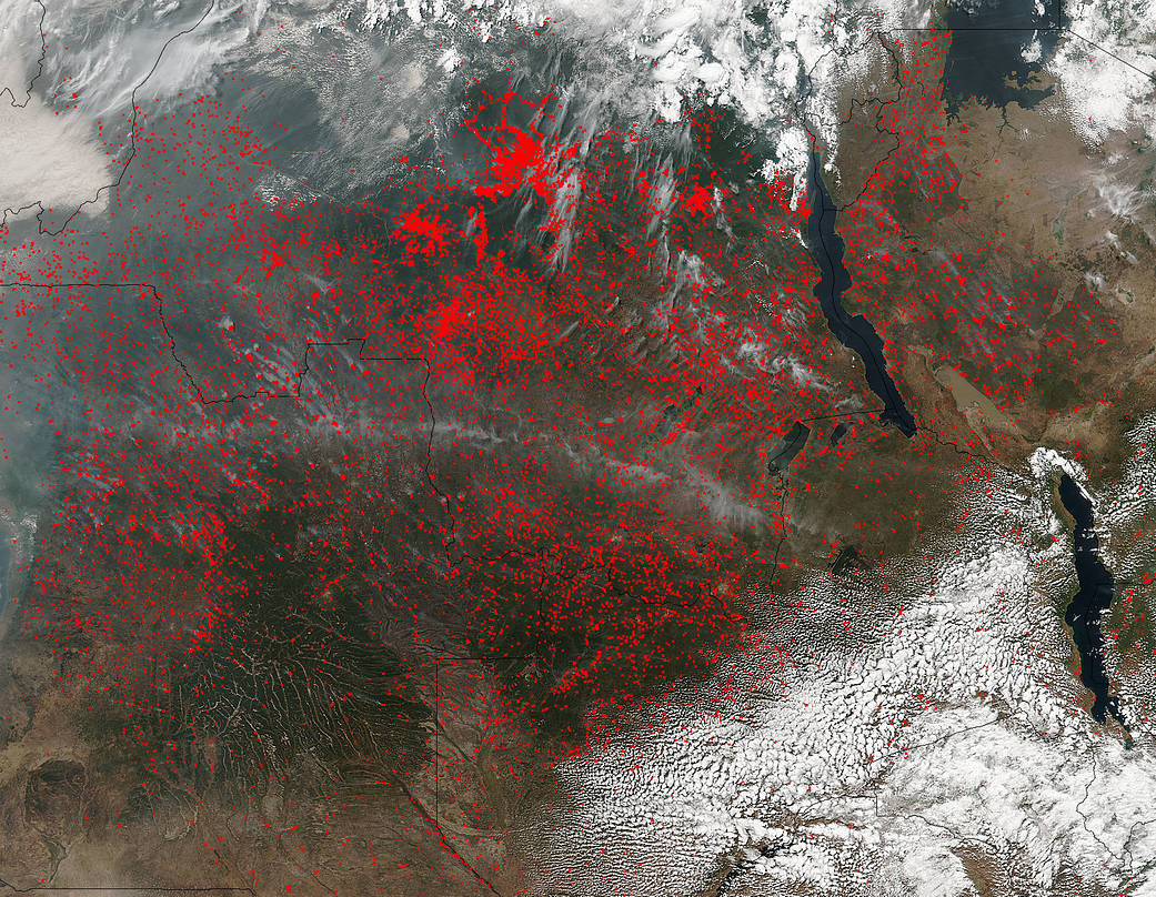
NASA’s Suomi NPP satellite detected thousands of fires burning in central Africa on July 11, 2016. The fires are represented by the multitudes of red dots. Most of the fires burn in grass or cropland. The location, widespread nature, and number of fires suggest that these fires were deliberately set to manage land. Places where traditional plots of open land is not available because the vegetation in the area is dense are the places where “slash and burn” agriculture is practiced most often. These regions include parts of Africa, northern South America, and Southeast Asia, where an abundance of grasslands and rainforests are found.
Although most parts of the world outlaw this type of agriculture due to the fact that the smoke from these (or any) fires is a health hazard, the method of agriculture continues because it is the easiest and lowest cost solution to clearing fields for next year’s crops.
The Suomi NPP satellite is a joint mission between NASA, NOAA and the U.S. Department of Defense.
NASA image courtesy Jeff Schmaltz, MODIS Rapid Response Team. Caption: NASA/Goddard, Lynn Jenner