


The powerful hurricane that struck Galveston, Texas on September 8, 1900, killing an estimated 8,000 people and destroying more than 3,600 buildings, took the coastal city by surprise.
This video looks at advances in hurricane forecasting in the 120 years since, with a focus on the contributions from weather satellites. This satellite technology has allowed us to track hurricanes – their location, movement and intensity.
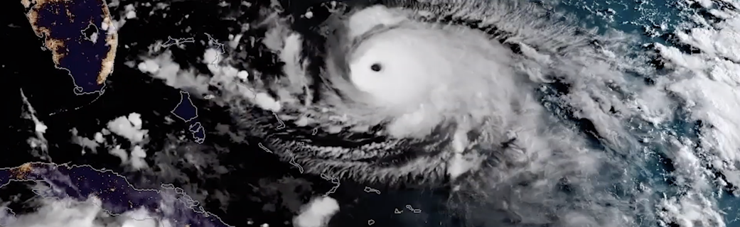
Credits: NASA/ Jefferson Beck
“One of the dramatic impacts is that satellite data keeps an eye on the target,” especially over unpopulated areas such as oceans, said JPSS Director Greg Mandt. “We’re sort of like your eyes in the sky to make sure that Mother Nature can never surprise you.”
A fleet of Earth-observing satellites, including those from the Joint Polar Satellite System (JPSS) and Geostationary Operational Environmental Satellite series (GOES-R), provides remarkable advances in hurricane forecasting. The JPSS polar-orbiting satellites measure the state of the atmosphere by taking precise measurements of sea surface temperatures and atmospheric temperature and moisture, which are critical to securing storm forecasts several days in advance.
Improved sensors also give us a better understanding of the core of hurricanes and allow forecasters to predict where they’re going to hit, without over-warning, Mandt said. “Then you can narrow and shrink that cone of uncertainty and give a better prediction.”
The GOES satellites orbit at the same rate as the Earth spins, which allows them to stare at hurricanes as they evolve. That, combined with advances to the sensors, gives us a view of hurricanes in motion.
“We take a full-disc picture of the entire hemisphere in five minutes,” said GOES-R Series System Program Director Pam Sullivan. “But we can also look at a smaller area and scan it every 30 seconds. You get to see the hurricane eye wall forming. You can see it actually forming in real time. The Earth looks alive. It looks like a living thing.”