


Tropical Depression 1E Dissipates
Tropical Depression 1E or TD1E didn’t get far from the time it was born to the time it weakened to a remnant low pressure area along the southwestern coast of Mexico. NOAA’s GOES-West satellite captured an image of it remnant clouds.
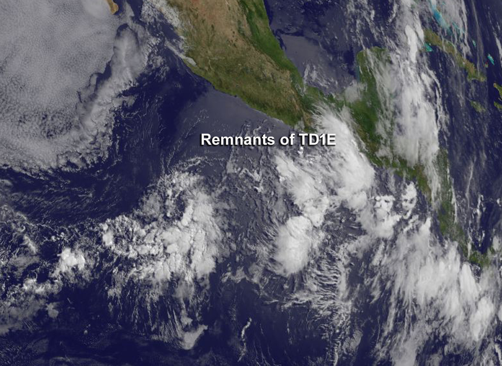
At 1000 AM CDT (1500 UTC), on June 8 the National Hurricane issued their last public advisory on TD1E. The center of the remnants of One-E were located near latitude 16.4 North, longitude 94.8 West. That’s about 30 miles (50 km) east-northeast of Salina Cruz Mexico. The remnants of One-E were moving toward the north near 3 mph (6 km/h). Maximum sustained winds are near 25 mph (35 kph) with higher gusts. The National Hurricane Center said those winds over the Gulf of Tehuantepec will diminish later today. The estimated minimum central pressure is 1008 millibars.
On June 8 at 1500 UTC (11 a.m. EDT), NOAA’s GOES-West satellite showed the remnants of Tropical Depression 1E dissipating on the western coast of Mexico. The image was created by the NASA/NOAA GOES Project at NASA’s Goddard Space Flight Center in Greenbelt, Maryland.
Rob Gutro
NASA’s Goddard Space Flight Center
June 07, 2016 – NASA Sees Slow-moving Tropical Depression 1E over Southern Mexico
Tropical Depression 1E or TD1E continued to hug the coast of southwestern Mexico as NASA’s Aqua satellite passed overhead and caught a look at the extent of the slow moving storm’s clouds.
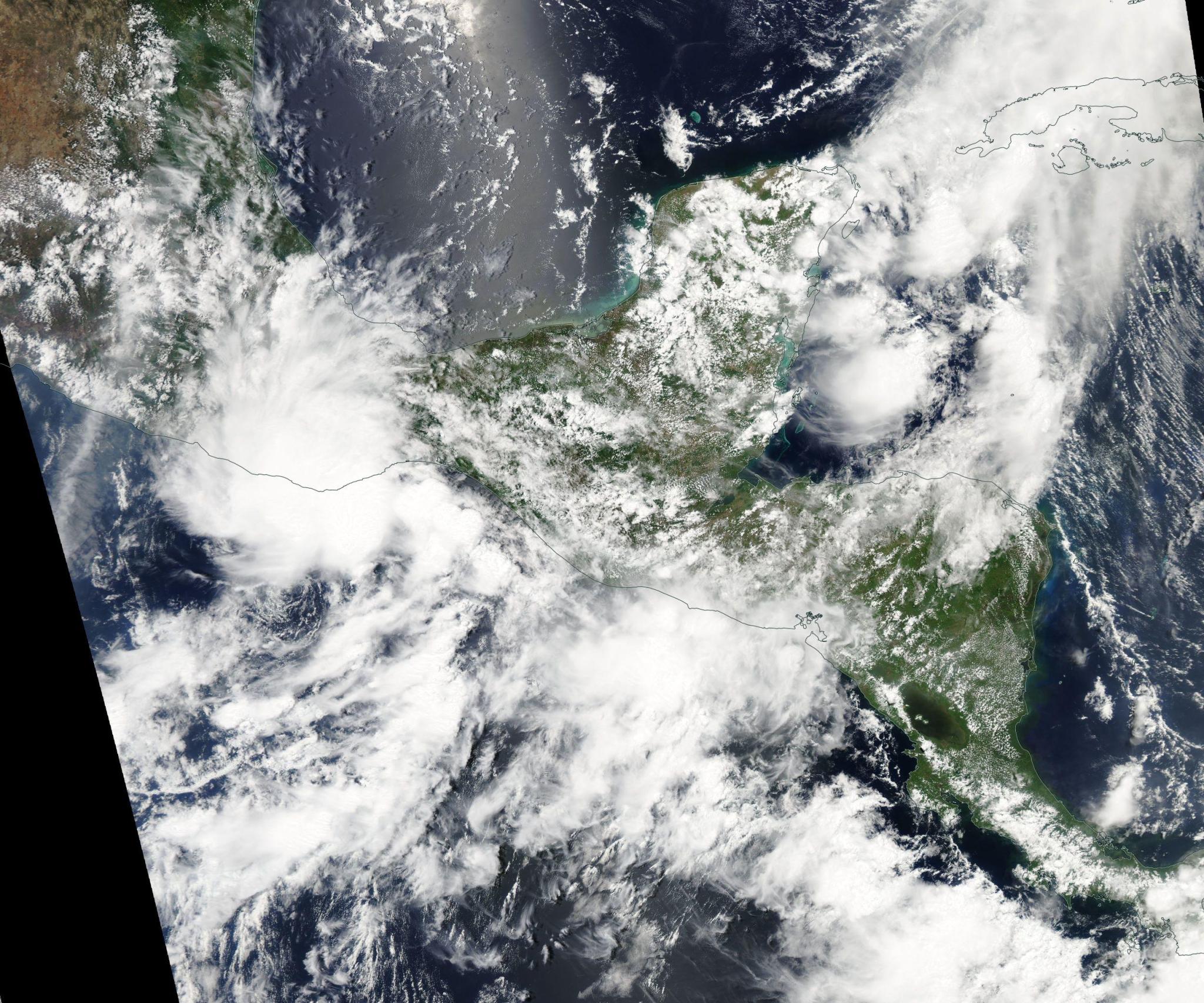
On June 6 NASA’s Aqua satellite captured a visible light image of Tropical Depression 1E over southwestern Mexico and Guatemala. In the image, the center of circulation appeared to be right over the coast. On June 7, the depression appeared disorganized over the Gulf Of Tehuantepec.
Despite being disorganized, TD1E continues to generate heavy rains over the coast of southern Mexico and western Guatemala. A Tropical Storm Watch is in effect for Puerto Escondido to Boca De Pijijiapan.
At 11 a.m. EDT (1500 UTC), the center of Tropical Depression One-E (TD1E) was located near latitude 15.3 North, longitude 95.0 West. That’s about 65 miles (100 km) south-southeast of Salina Cruz, Mexico. The depression is moving toward the east-northeast near 7 mph (11 kph). The system is expected to slow and turn toward the north today. Maximum sustained winds are near 35 mph (55 kph) with higher gusts. The estimated minimum central pressure is 1006 millibars.
The National Hurricane Center expects the tropical cyclone to dissipate either over the Gulf of Tehuantepec or just inland over southern Mexico by Wednesday, June 8. For updated watches, warnings and locations, visit: www.nhc.noaa.gov.