


Moon Mission for Flight-Tested Navigation Doppler Lidar
Enhanced navigational accuracy is giving NASA the flexibility to place landers in the most geologically interesting places on the Moon, Mars, and beyond. To accomplish this, the Navigation Doppler Lidar (NDL), developed at NASA’s Langley Research Center in Hampton, Virginia, uses lasers to determine a spacecraft’s exact velocity and position to land at the desired location.
With support from NASA’s Space Technology Mission Directorate (STMD) and the Flight Opportunities program, researchers flight tested the NDL technology as part of several NASA projects as well as on Astrobotic’s Xodiac rocket-powered lander in Mojave, California. This flight testing helped prepare the technology for two trips to the Moon in early 2024.
New Navigation Concept
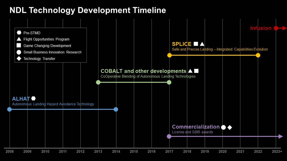
In 2006, Dr. Farzin Amzajerdian of NASA’s Langley Research Center began developing NDL, a concept that used lidar rather than radar for navigation and landing.
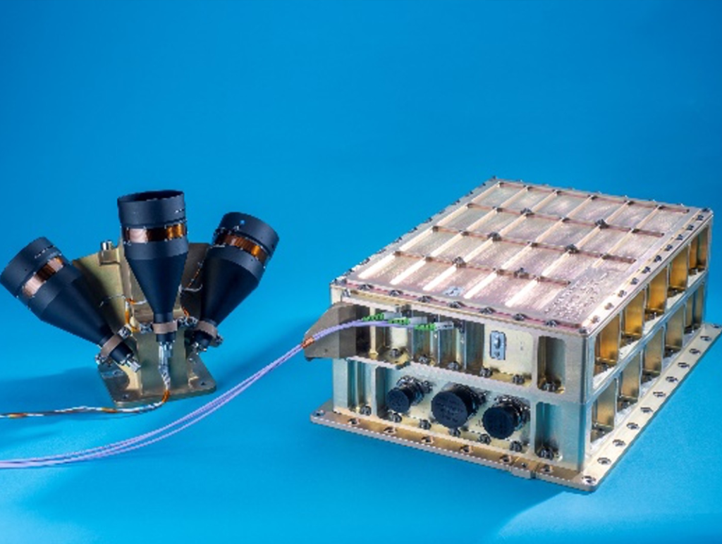
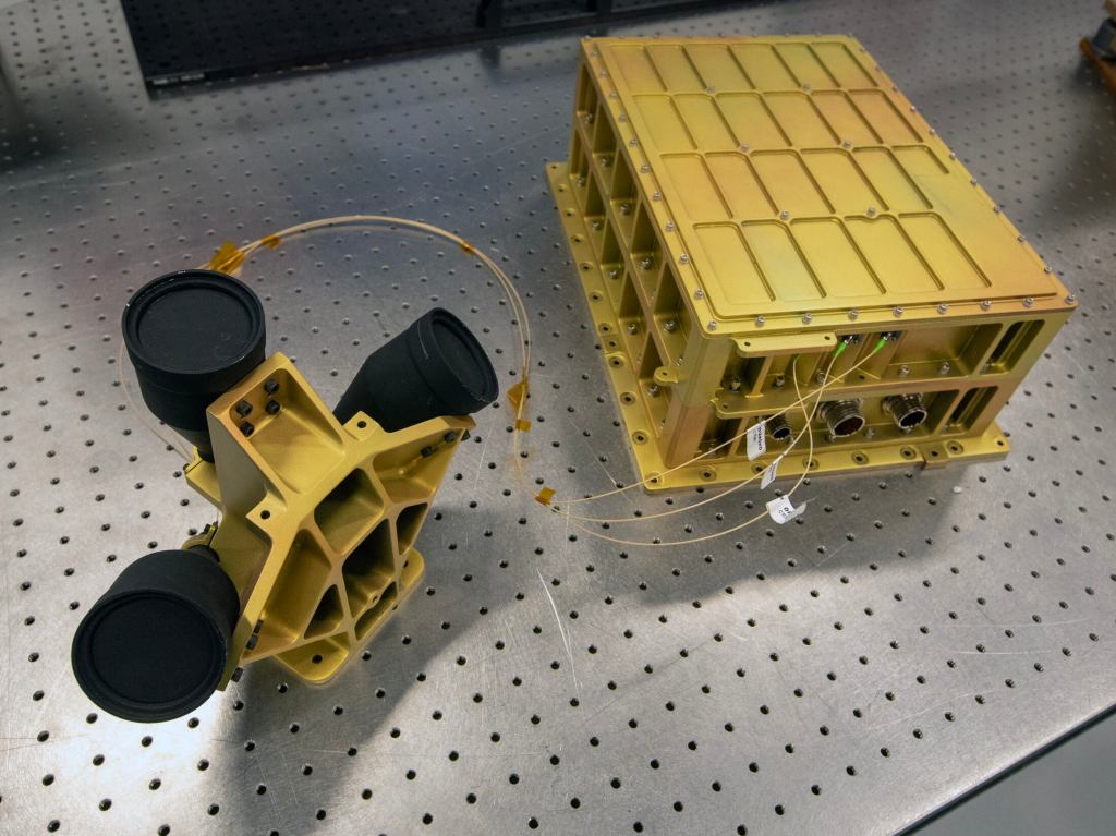
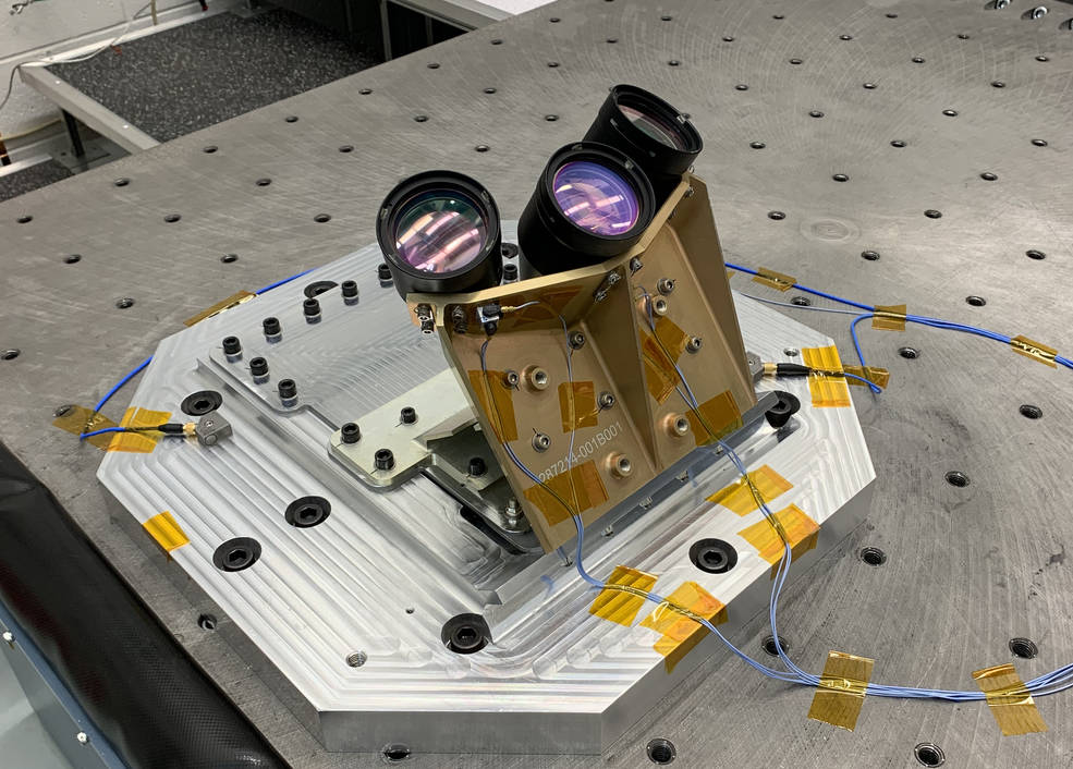
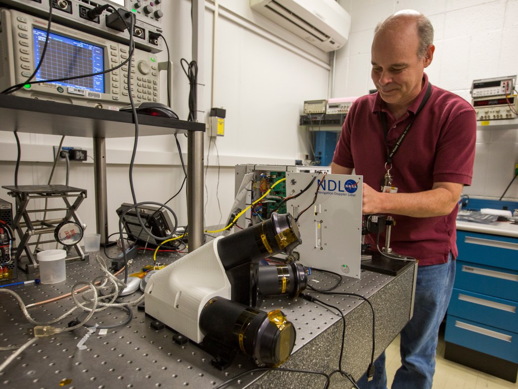
Unlike radar, which uses radio waves to determine position, NDL generates beams of light transmitted by three telescopes connected by fiber optic cables to a small electronics box. When the beams hit the surface of a planetary body and reflect back to the telescope, the system processes that data to determine the direction the spacecraft is moving, its distance to the surface, and the speed at which it is moving towards the surface. These measurements enable precision navigation to the landing location and a tightly controlled safe and soft touchdown on the planetary surface.
Dr. Amzajerdian continued leading NDL development over the next decade with support from several NASA projects and programs. For example, from 2013 through 2017, NDL was part of the Cooperative Blending of Autonomous Landing Technologies (COBALT) project conducted by NASA’s Space Technology Mission Directorate (STMD) and the Human Exploration and Operations Mission Directorate. This project tested and matured technology readiness levels and reduced risk for spaceflight navigation and landing technologies. While part of the COBALT project, a third generation of the NDL technology was developed that was later flight tested aboard Astrobotic’s Xodiac vehicle with support from NASA’s Flight Opportunities program. Learn more in the “Flight Opportunities Testing” tab.
In 2012, under the STMD’s Autonomous Landing Hazard Avoidance Technology (ALHAT) project, the second generation NDL flew aboard the prototype Morpheus lander vehicle at NASA’s Kennedy Space Center in Florida.
Flight Opportunities Testing
Flight Test: Apr. 13, 2017
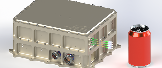
The third-generation NDL model — 60% smaller, three times faster, and with a greater range than its predecessor that flew on the Morpheus vehicle — was demonstrated aboard a Flight Opportunities-supported flight on the Xodiac rocket-powered lander in 2017. The vertical takeoff/vertical landing vehicle rose to 500m before performing a 300m divert trajectory to a landing pad downrange, enabling NDL to demonstrate its capabilities.
This flight testing with Masten Space Systems (now Astrobotic) was instrumental in bridging the gap in technology maturation toward spaceflight. The lessons learned from this testing were critical in design, build, and testing of an NDL Engineering Test Unit that met the criteria of Technology Readiness Level 6 (i.e., a model or prototyping demonstration in a relevant end-to-end environment). The rocket-powered Xodiac vehicle provided a unique environment for examining the effect of landing vehicle dynamics on the NDL operation.
Safe and Precise Landings
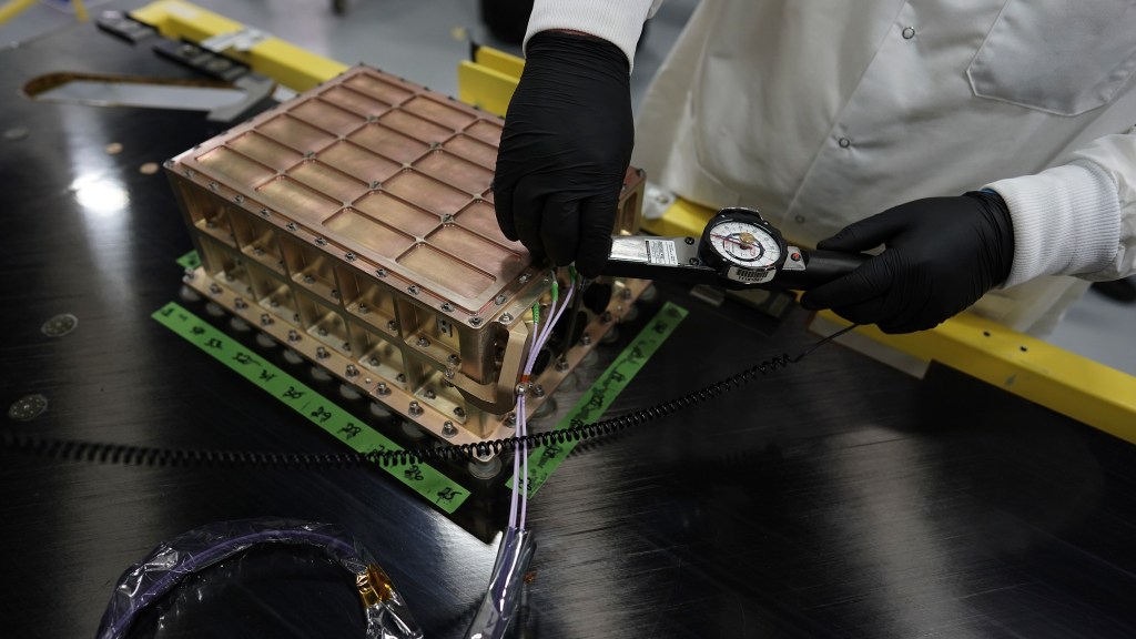
NASA’s Space Technology Mission Directorate (STMD) further matured the NDL technology as part of the Safe and Precise Landing – Integrated Capabilities Evolution (SPLICE) project. This project is a descent and landing system that integrates multiple component technologies (like NDL), including avionics, sensors, and algorithms, to provide safe and precise planetary landings in hard-to-reach and unknown areas that are of high scientific interest.
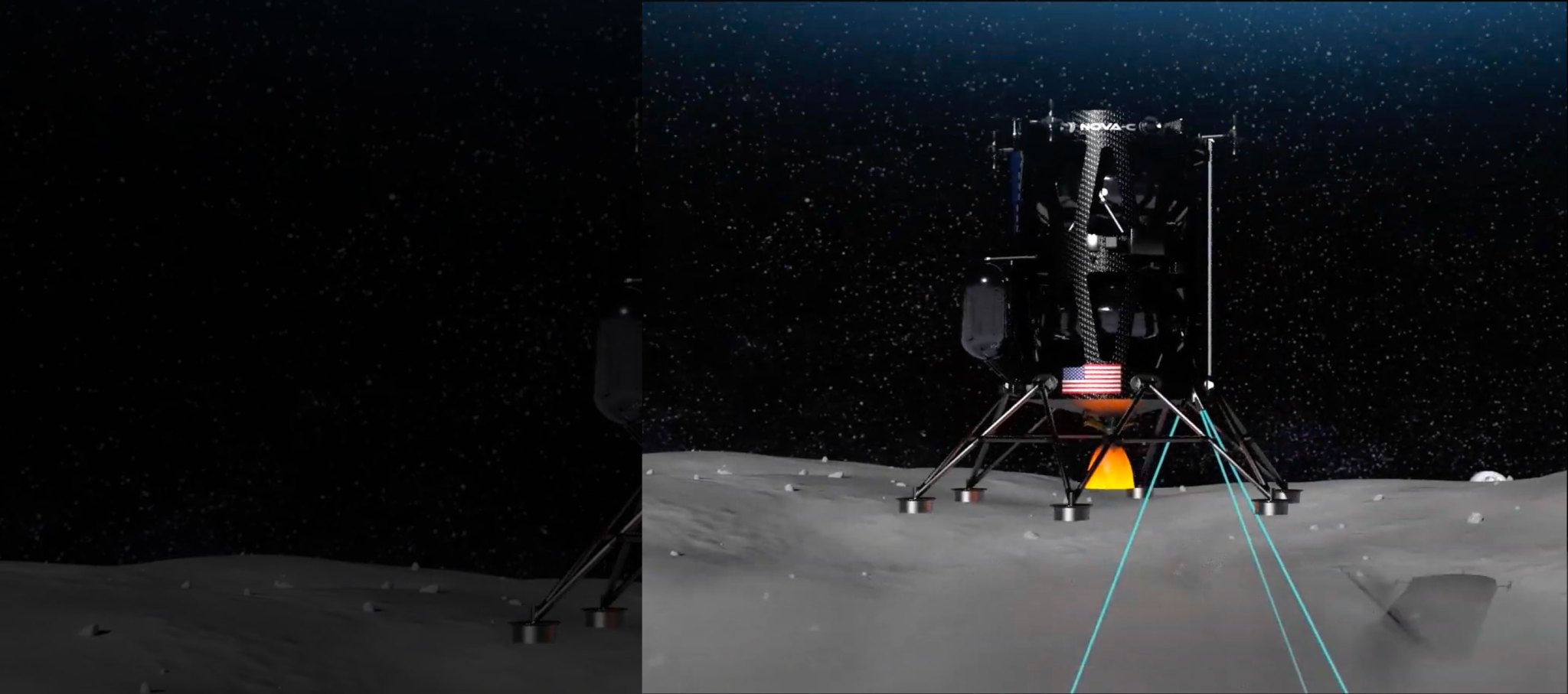
The NDL technology is one of four technologies incorporated into SPLICE playing a role in aiding navigation and landing. It activates when a lander is at ~4 miles (6.4 kilometers) in altitude and transmits laser beams to the Moon’s surface. The reflected beams allow NDL to detect the lander’s velocity and altitude as it approaches the lunar surface, which increases the precision of the navigation and guidance algorithms running on the descent and landing computer.
Commercialization
In 2016, Psionic licensed the NDL technology from NASA and created a commercial version.
The NDL technology was the named NASA’s 2022 Invention of the Year in the commercial category, which recognizes a technology that has been licensed and resulted in commercial sales.
Going to the Moon
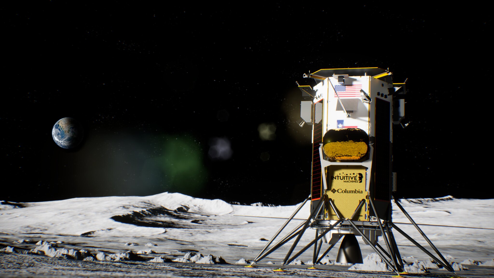
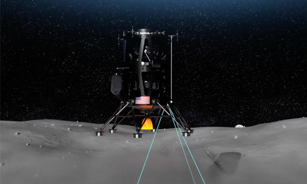
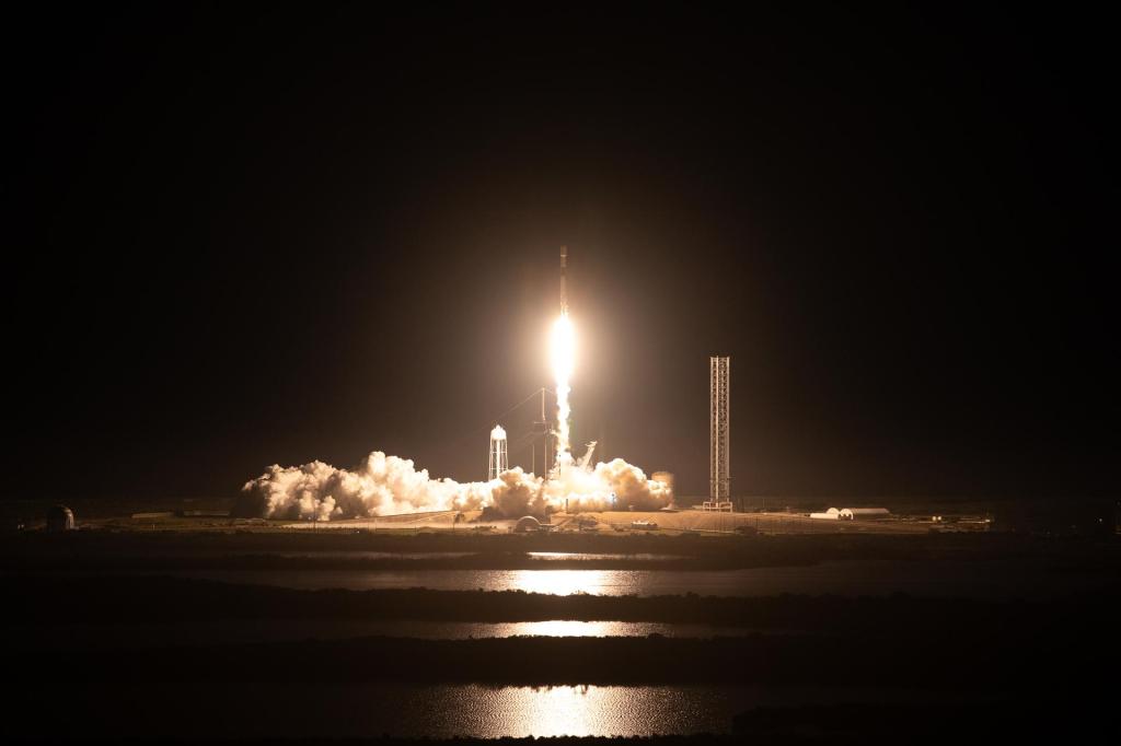
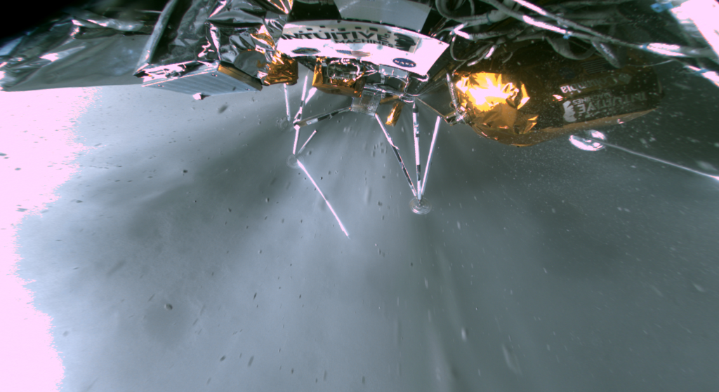
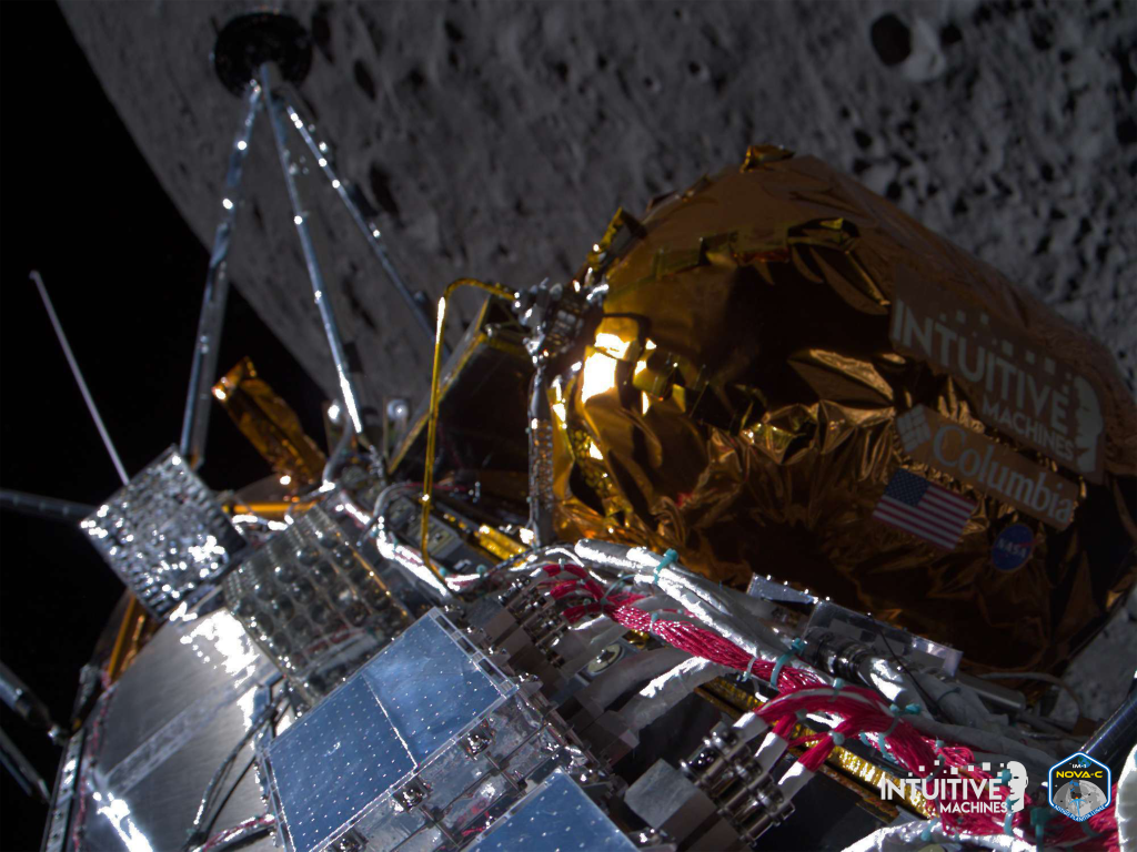
NASA selected the NDL technology as a payload on two lunar missions within the CLPS (Commercial Lunar Payload Services) initiative: the Astrobotic Peregrine Mission 1 that launched in January 2024 and the Intuitive Machines inaugural mission, IM-1, that launched and landed in February 2024. For IM-1, NDL was one of six payloads that landed on the Moon on February 22, 2024, marking the first U.S. landing on the lunar surface in decades.
During the flight on IM’s Odysseus lunar lander, NDL was poised to aid the landing when the vehicle’s navigation system encountered an issue. Gathering data during descent, NDL provided 100% valid measurements from 10 km to the Moon’s surface providing an excellent demonstration of NDL’s potential for future lunar landing missions.
A copy of the NDL engineering test unit (identical to the one flown on both the Astrobotic Peregrine and Intuitive Machines Odysseus CLPS missions) has been assembled and delivered by Psionic to Astrobotic for their upcoming Griffin Mission 1.

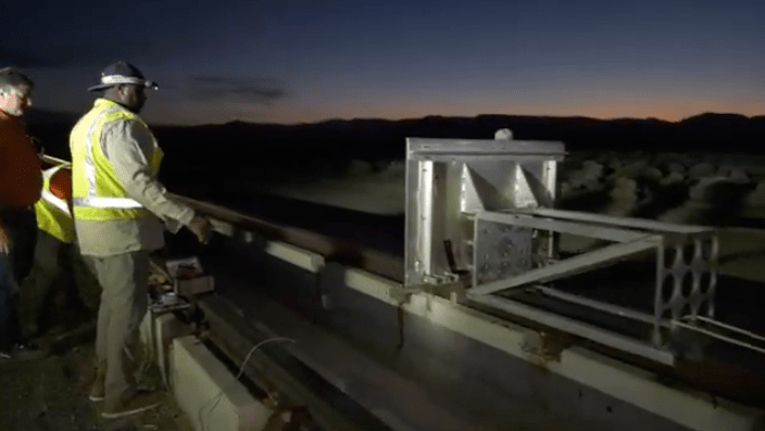
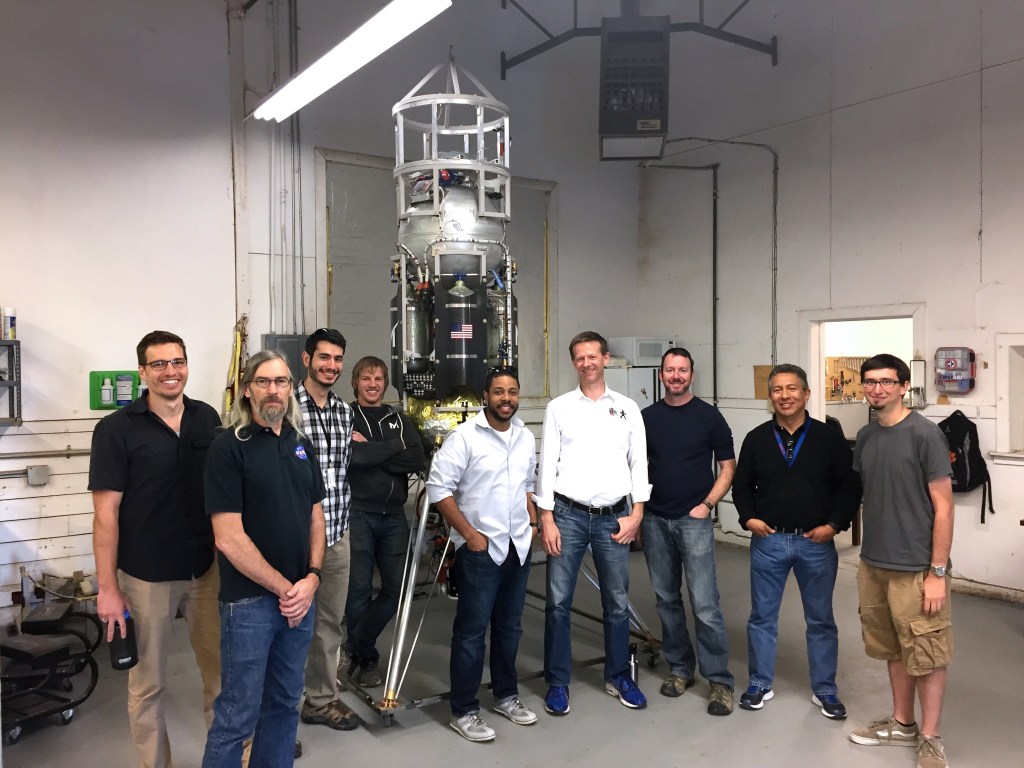
COBALT (Cooperative Blending of Autonomous Landing Technologies) Flight Tests: Mojave Space Port
More on NDL
Journey to the Lunar Surface: From Suborbital Flight Testing to Moon Mission
NASA’s Laser Navigation Tech Enables Commercial Lunar Exploration
Impact Story: Navigation Doppler Lidar
Langley Researchers Are Shaking Up Lunar Landing Technology
Winning NASA Technologies Land Spacecraft, Share Agency Innovations
NASA Collects First Surface Science in Decades via Commercial Moon Mission
Intuitive Machines, NASA Science Progress Toward Moon Landing
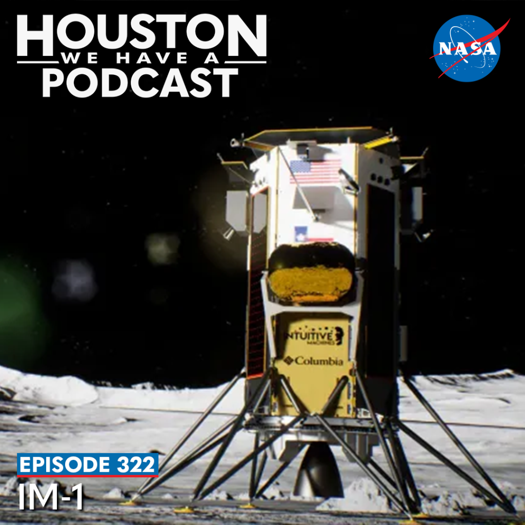
IM-1 Podcast
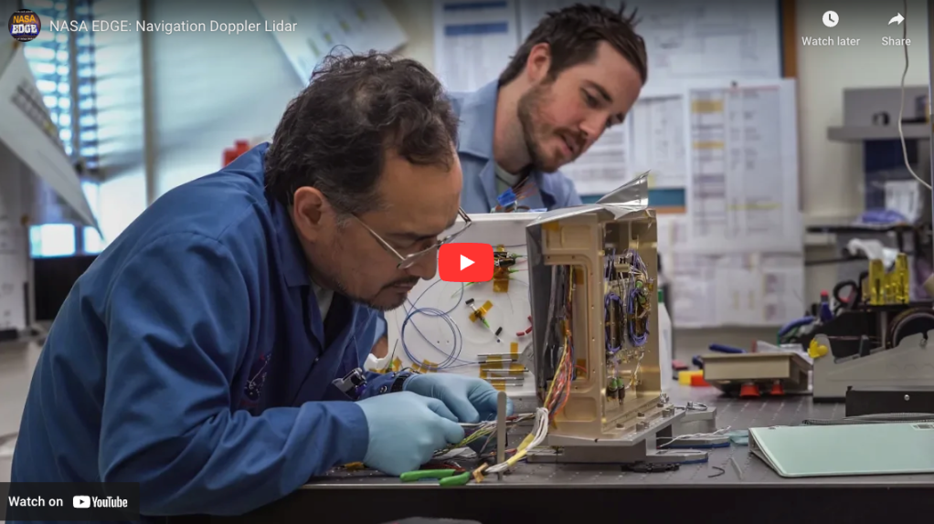
NASA EDGE: Navigation Doppler Lidar

Laser-Based Sensor Tests Moon Landing Technology at Langley Air Force Base