


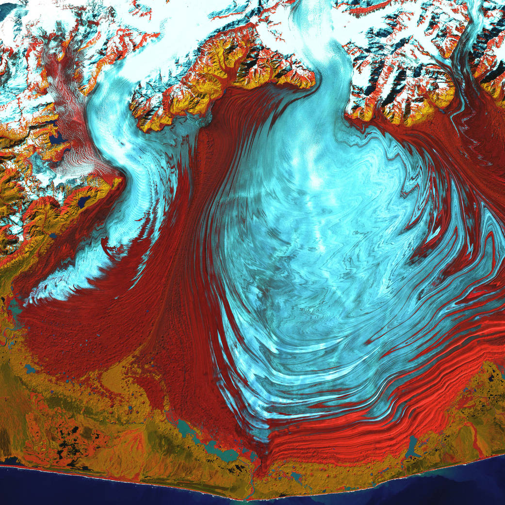
The tongue of the Malaspina Glacier, the largest glacier in Alaska, fills most of this image. The Malaspina lies west of Yakutat Bay and covers 1,500 square miles (3,880 square kilometers). This is a false-color composite image made using infrared, near infrared, and green wavelengths.
The tongue of the Malaspina Glacier, the largest glacier in Alaska, fills most of this image. The Malaspina lies west of Yakutat Bay and covers 1,500 square miles (3,880 square kilometers).
This is a false-color composite image made using infrared, near infrared, and green wavelengths. The image has also been sharpened using the sensor’s panchromatic band. The image was acquired by Landsat 7’s Enhanced Thematic Mapper plus (ETM+) sensor on August 31, 2000.Image Credit: NASA/USGS