


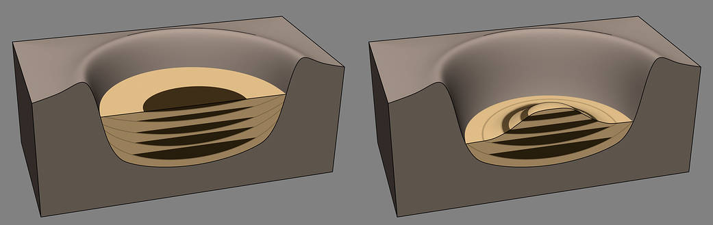
This diagram illustrates how Mount Sharp in Gale Crater, Mars, where NASA’s Curiosity rover is now driving, might have formed billions of years ago. The left side shows Gale Crater filled up with layers of sediment. The yellow units represent sediments derived from the crater rim highlands and transported toward the center of the crater in alluvial fans, deltas, and wind-blown drifts. These mixtures represent both wet and dry periods. Also during wet periods, water pooled in lakes where sediments settled out in the center of crater (brown). Even during dry periods in the crater center, groundwater would have existed beneath the surface. Then, during the next wet period it would resurface to form the next lake. This alternation of lakes, rivers and deserts could have represented a long-lasting habitable environment.
The drawing at right shows what happened later: After the crater had at least partially filled with sediment, erosion of previously deposited sedimentary layers occurred, exposing the ancient sequence of lake, river and desert environments as a series of bands, or layers, along the lower flanks of Mount Sharp. As Curiosity drove uphill and southward from its landing site — toward the middle of the crater — it encountered evidence for the lake deposits (brown) that had been exhumed by erosion. These layers are part of the Murray formation in the lower regions of Mount Sharp.
For more information about the Mars Science Laboratory mission and the mission’s Curiosity rover, visit https://www.nasa.gov/msl and http://mars.jpl.nasa.gov/msl.
Image credit: NASA/JPL-Caltech