


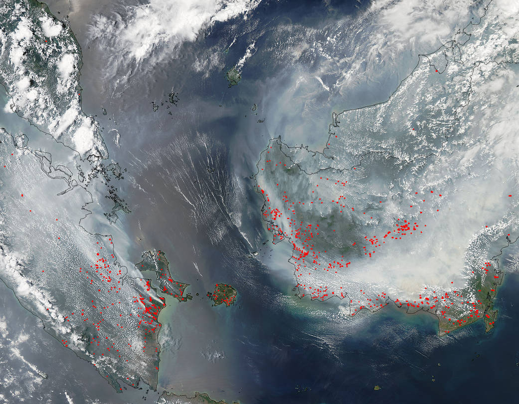
The widespread burning of lowland forests on Borneo as well as southern Sumatra, as seen in this image taken by the MODIS instrument on the Aqua satellite, is an annual, manmade occurrence. People use fires to manage agricultural lands which in this part of the world includes large palm tree plantations. Sometimes these fires burn out of control. In additon, there are other fires that started accidentally during activities like logging and also quickly get out of control. Another method of wildfires comes from lightning strikes in dry, hot areas.
This being an El Nino year Indonesia is experiencing lower than average rainfall which can turn in a severe drought. Forests which are usually swampy dry out leaving behind a rich abundance of fire fuel in the form of peat, both intentional and accidental fires can quickly grow out of control. When peat dries it is quite flammable. Burning peat also generates a huge amount of thick, dark smoke. This thick smoke produced by these fires contributes to the greenhouse gas emissions worldwide.
NASA’s Aqua satellite collected this natural-color image with the Moderate Resolution Imaging Spectroradiometer, MODIS, instrument on September 22, 2015. Actively burning areas, detected by MODIS’s thermal bands, are outlined in red. NASA image courtesy Jeff Schmaltz LANCE/EOSDIS MODIS Rapid Response Team, GSFC. Caption by Lynn Jenner