


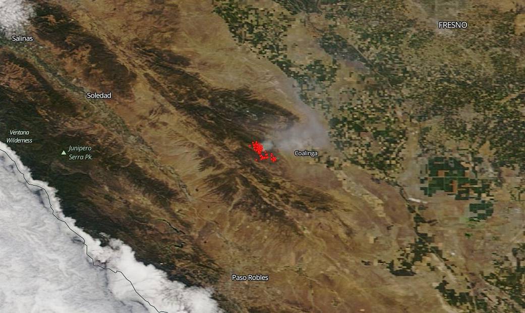
NASA’s Terra satellite captured this image of California’s Mineral fire with the MODIS (Moderate Resolution Imaging Spectroradiometer) instrument on July 14, 2020. This fire began on July 13, 2020 under unknown circumstances that are currently being investigated by officials. It has grown to 11,000 acres amid high winds. Containment is at 5%. The fire is located west of Coalinga in Fresno County.
The Mineral Fire has been exhibiting extreme fire behavior with wind driven uphill runs and short-range spotting and is feeding on Chaparral, tall grass, and timber. Short-range spotting occurs when a piece of burning wood, flaming sparks, or embers are carried by surface winds, starting new fires beyond the area of the main fire. The range of such spotting is usually less than 1/4 mile. The fire is actively burning in steep, inaccessible terrain in an area containing naturally occurring asbestos (occuring naturally as a mineral rather than as a component of commercial products, mining or processing operations) and in the Valley Fever exclusion areas according to Inciweb. There are evacuation order for all residents on Los Gatos Creek Rd. from Indian Springs to Union Carbide Rd. and the community of Bingham Springs.
NASA’s satellite instruments are often the first to detect wildfires burning in remote regions, and the locations of new fires are sent directly to land managers worldwide within hours of the satellite overpass. Together, NASA instruments detect actively burning fires, track the transport of smoke from fires, provide information for fire management, and map the extent of changes to ecosystems, based on the extent and severity of burn scars. NASA has a fleet of Earth-observing instruments, many of which contribute to our understanding of fire in the Earth system. Satellites in orbit around the poles provide observations of the entire planet several times per day, whereas satellites in a geostationary orbit provide coarse-resolution imagery of fires, smoke and clouds every five to 15 minutes. For more information visit: https://www.nasa.gov/mission_pages/fires/main/missions/index.html
NASA’s Earth Observing System Data and Information System (EOSDIS) Worldview application provides the capability to interactively browse over 700 global, full-resolution satellite imagery layers and then download the underlying data. Many of the available imagery layers are updated within three hours of observation, essentially showing the entire Earth as it looks “right now.” Actively burning fires, detected by thermal bands, are shown as red points. Image Courtesy: NASA Worldview, Earth Observing System Data and Information System (EOSDIS). Caption: Lynn Jenner with information from Inciweb and CA Fire.