


![Request for Information – Potential [Placeholder for Prize]](https://assets.science.nasa.gov/dynamicimage/assets/science/psd/solar/2023/09/s/solarsystem_0.jpg?w=1024)


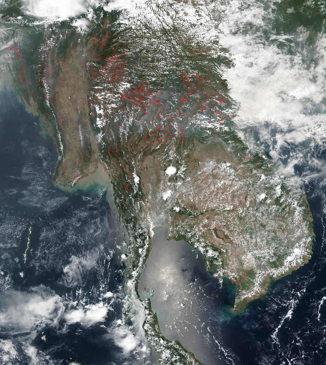
Huge swaths of smoke hang over the entire Indochina peninsula in this NASA/NOAA Suomi NPP image captured on April 16, 2019. During this time of year farmers across the entire region use the “slash and burn” method to remove the remnants of last year’s crops from fields and to enrich the soil for the coming planting season. This type of agriculture has been in use for centuries. It is cost efficient making it a very desirable way to prepare land in areas where more expensive methods are not feasible. In this image the amount of smoke that has been produced is immense with copious amounts blowing across the entire landscape.
While fire helps enhance crops and grasses for pasture, the fires also produce smoke that degrades air quality. Each hot spot, which appears as a red mark in this image, is an area where the thermal detectors on the VIIRS instrument on the Suomi NPP satellite recognized temperatures higher than background. When accompanied by plumes of smoke, as in this image, such hot spots are diagnostic for fire. The smoke released by any type of fire (forest, brush, crop, structure, tires, waste or wood burning) is a mixture of particles and chemicals produced by incomplete burning of carbon-containing materials. All smoke contains carbon monoxide, carbon dioxide and particulate matter or soot. Exposure to high levels of smoke should be avoided and can cause significant health issues.
NASA’s Earth Observing System Data and Information System (EOSDIS) Worldview application provides the capability to interactively browse over 700 global, full-resolution satellite imagery layers and then download the underlying data. Many of the available imagery layers are updated within three hours of observation, essentially showing the entire Earth as it looks “right now.” Image Courtesy: NASA Worldview, Earth Observing System Data and Information System (EOSDIS). Caption: Lynn Jenner