


![Request for Information – Potential [Placeholder for Prize]](https://assets.science.nasa.gov/dynamicimage/assets/science/psd/solar/2023/09/s/solarsystem_0.jpg?w=1024)


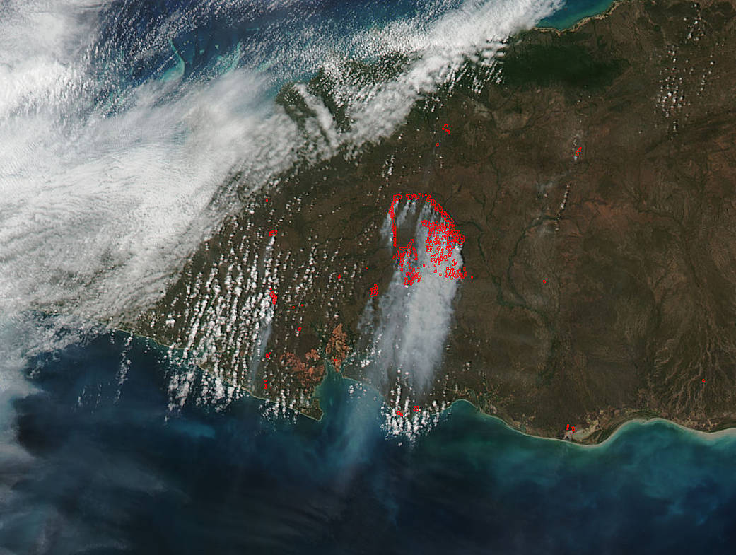
Smoke from a large area of wildfires burning on Australia’s Cape York Peninsula were spotted by NASA-NOAA’s Suomi NPP satellite in space.
This natural-color satellite image taken at 12:00 a.m. EDT (0400 UTC) on July 17, 2017, was collected by the Visible Infrared Imaging Radiometer Suite (VIIRS) instrument that flies aboard NASA-NOAA’s Suomi NPP satellite. The VIIRS instrument can detect the heat signatures from the fires, and actively burning areas are outlined in red in the image.
In the image, a large area of smoke blowing to the northwest appears as a light brown color from fires burning north of the Mungkan Kandhju National Park.
North is to the left in this image.
NASA image courtesy NASA MODIS Rapid Response Team. Caption: NASA/Goddard, Rob Gutro