


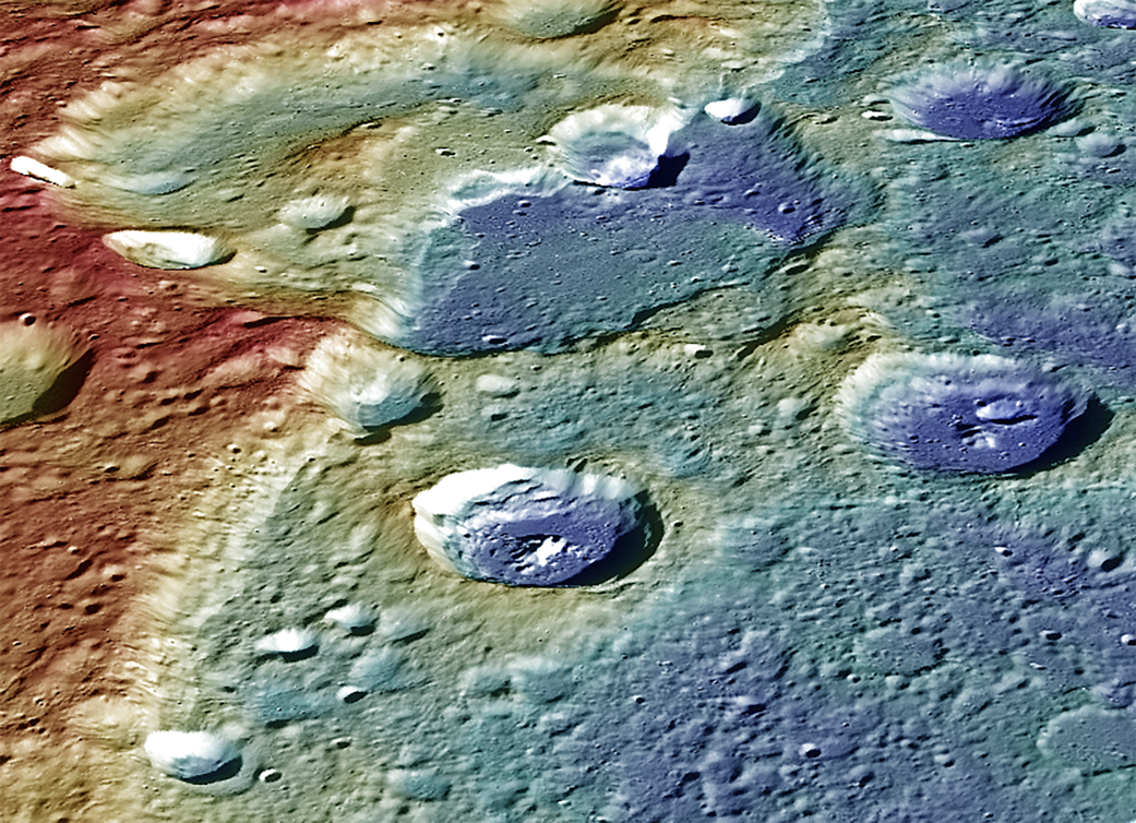
Instruments: Mercury Dual Imaging System (MDIS) and Mercury Laser Altimeter (MLA)Latitude: 57.1°Longitude: 304.0° EScale: Duccio crater has a diameter of roughly 105 kilometers (65 miles)Height: Portions of Carnegie Rupes are nearly 2 kilometers (1.2 miles) in heightOrientation: North is roughly to the left of the imageOf Interest: This image provides a perspective view of the center portion of Carnegie Rupes, a large tectonic landform, which cuts through Duccio crater. The image shows the terrain (variations in topography) as measured by the MLA instrument and surface mapped by the MDIS instrument. The image was color-coded to highlight the variations in topography (red = high standing terrain, blue = low lying terrain). Tectonic landforms such as Carnegie Rupes form on Mercury as a response to interior planetary cooling, resulting in the overall shrinking of the planet. To make this graphic, 48 individual MDIS images were used as part of the mosaic. The MESSENGER spacecraft is the first ever to orbit the planet Mercury, and the spacecraft’s seven scientific instruments and radio science investigation are unraveling the history and evolution of the Solar System’s innermost planet. In the mission’s more than four years of orbital operations, MESSENGER has acquired over 250,000 images and extensive other data sets. MESSENGER’s highly successful orbital mission is about to come to an end, as the spacecraft runs out of propellant and the force of solar gravity causes it to impact the surface of Mercury in April 2015.Credit: NASA/Johns Hopkins University Applied Physics Laboratory/Carnegie Institution of Washington