


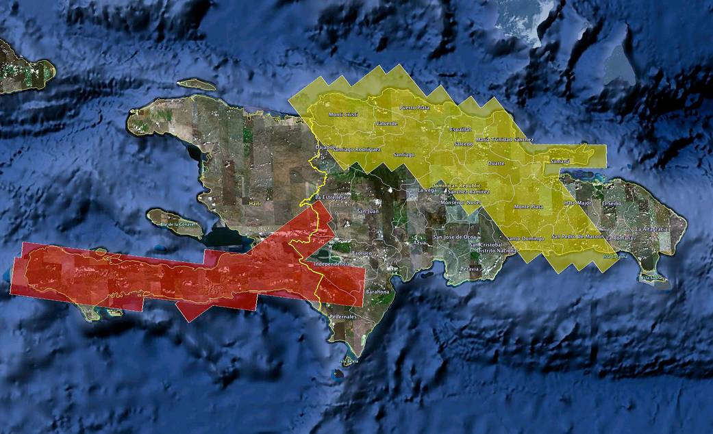
NASA UAVSAR Airborne Radar Image Over Haiti
NASA's UAVSAR airborne radar will create 3-D maps of earthquake faults over wide swaths of Haiti (red shaded area) and the Dominican Republic (yellow shaded area).
- X
https://www.nasa.gov/image-detail/nasa-uavsar-airborne-radar-image-over-haiti/
Size1041x634px