


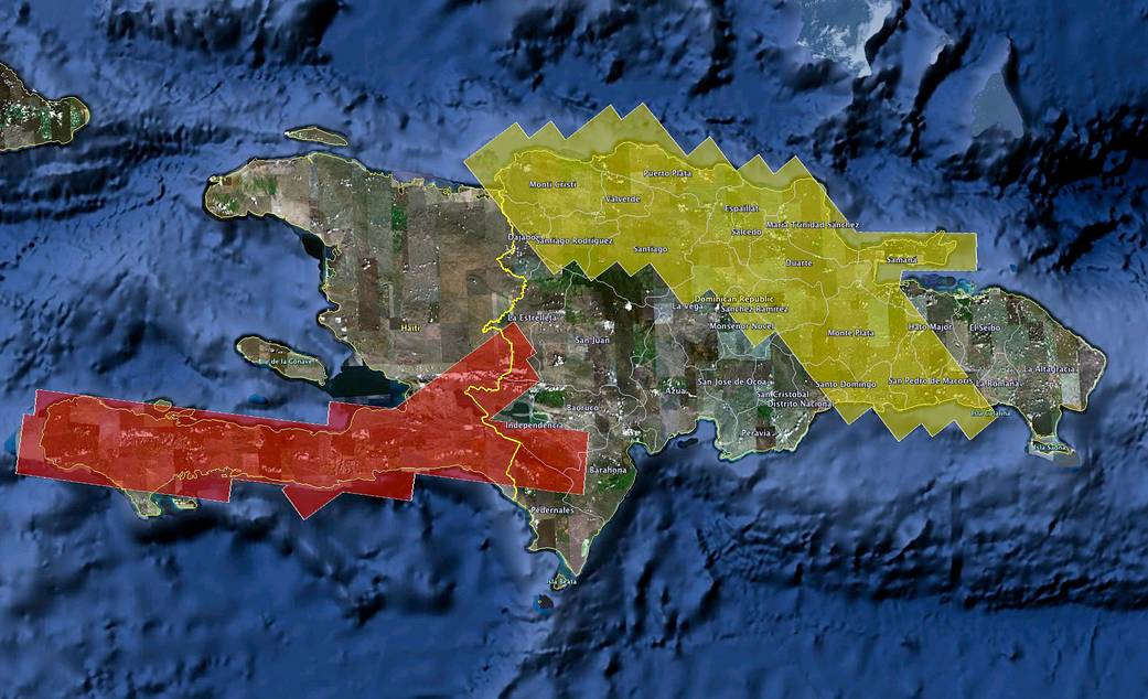
NASA's UAVSAR airborne radar will create 3-D maps of earthquake faults over wide swaths of Haiti (red shaded area) and the Dominican Republic (yellow shaded area).
haiti20100126
Photo Description
NASA’s UAVSAR airborne radar created 3-D maps of earthquake faults over wide swaths of Haiti (red shaded area) and the Dominican Republic (yellow shaded area).Project Description
In response to the disaster in Haiti on Jan. 12, 2010, NASA added a series of science overflights of earthquake faults in Haiti and the Dominican Republic on the island of Hispaniola to a previously scheduled three-week airborne radar campaign to Central America.
NASA’s Uninhabited Aerial Vehicle Synthetic Aperture Radar, or UAVSAR, left NASA’s Dryden Flight Research Center in Edwards, CA, on Jan. 25 aboard a modified NASA Gulfstream III aircraft.Jan 26, 2010
Image credit: NASA