


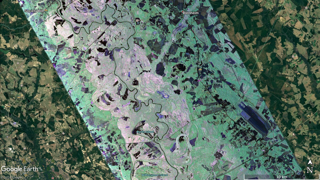
UAVSAR color composite image of Pee Dee River in South Carolina during a Sept. 17, 2018 science flight.
UAVSAR color composite image of Pee Dee River in South Carolina during a Sept. 17, 2018 science flight. The image show extensive water inundation, which is visible as various shades of pink pixels, along the present day river and old river bed across a broad area of 8 to 10 km.
Sept. 17, 2018
NASA / Google