


Hyperspectral Imaging
NASA’s hyperspectral imaging aids the monitoring of Lake Erie and nearby harmful algal blooms (HAB), improving bloom tracking, early detection, and response.
Overview
NASA Glenn’s Role in Monitoring Harmful Algal Blooms in Lake Erie
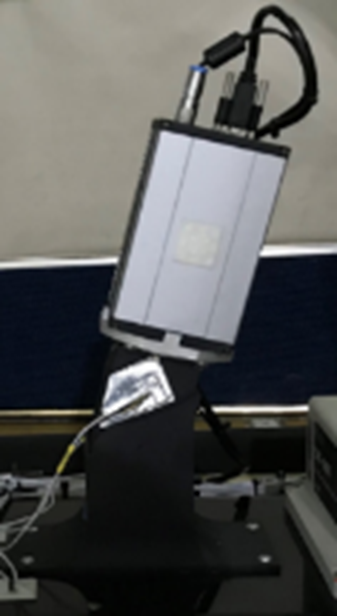
Harmful algal blooms (HABs) in Lake Erie have been a growing concern in recent years. In 2014, a severe bloom led Ohio to declare a state of emergency. In response, NASA’s Glenn Research Center in Cleveland was called upon to assist in monitoring the blooms. Glenn conducted aerial surveys twice a week during August and September using its hyperspectral imaging sensor aboard the S3 Viking aircraft.
The gathered data was promptly assembled and distributed to shoreline water resource managers, with support from NASA Headquarters’ Earth Science Division.

Since then, the state of Ohio, the National Oceanic and Atmospheric Administration (NOAA), and the U.S. Environmental Protection Agency (EPA) have increased funding and efforts to observe, monitor, and address the root causes of HABs. Additionally, local communities and stakeholders have continued to request Glenn’s involvement in HAB observation. Ohio and NOAA have funded extensive field campaigns and sample analyses, providing NASA an opportunity to efficiently advance its airborne hyperspectral remote sensing technology.
Advancing Hyperspectral Remote Sensing for HAB Monitoring
Building on these efforts, Glenn launched the Airborne Hyperspectral Observation of Harmful Algal Blooms Campaign in 2015. This initiative was twice as large as the 2014 campaign, focusing primarily on Lake Erie but also including small inland lakes and the Ohio River. Conducted in collaboration with multiple marine science and remote sensing partners, this campaign demonstrated the potential of airborne hyperspectral imaging to:
- Distinguish HABs from non-harmful blooms
- Determine HAB concentrations
- Track bloom movement with enhanced spatial and temporal resolution
- Provide cloud-independent monitoring, complementing satellite observations
Collaborating with institutions in Ohio, Michigan, South Dakota, and Alabama, Glenn was able to generate next-day georeferenced estimates of cyanobacteria and scum concentrations. Rapid processing of hyperspectral imagery was crucial for timely responses. For example, in one instance, flight data indicated a potential bloom near the Cincinnati water intake before visual confirmation was available. Based on this data, water sampling detected microcystins in the source water, prompting state and municipal authorities to act before visible scums formed.
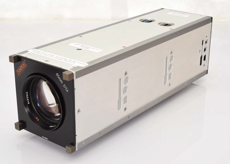
Technological Advancements in Hyperspectral Imaging
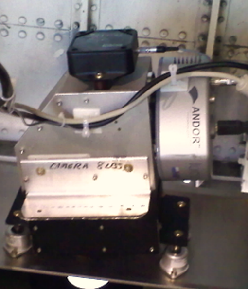
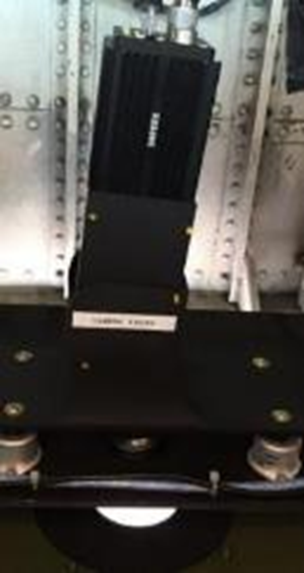
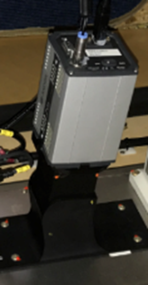
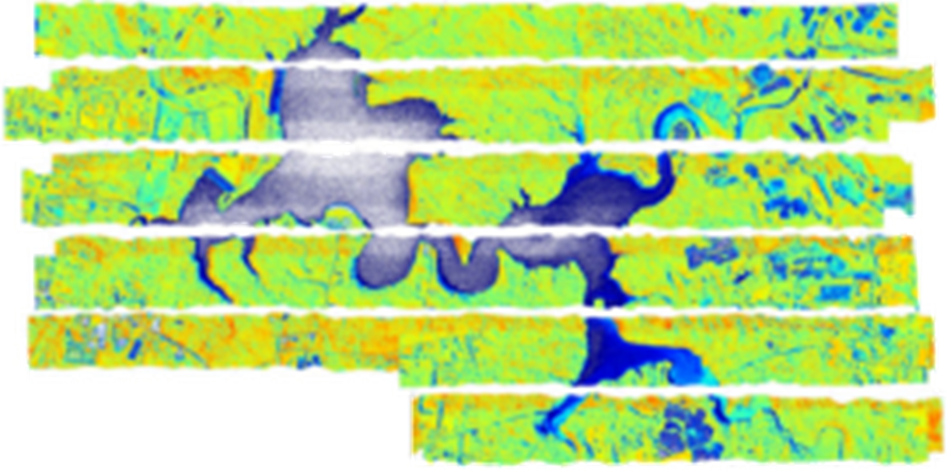
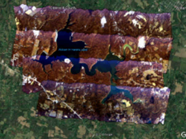
Over the years, multiple hyperspectral imaging (HSI) sensors have been designed, built, and tested to improve resolution, frame rate, and overall instrument robustness.
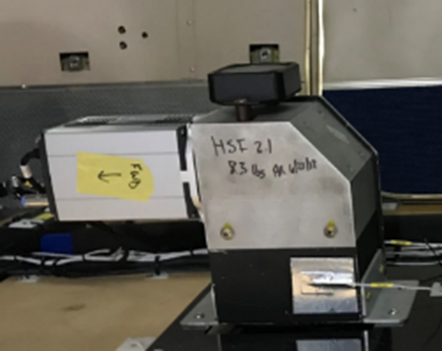
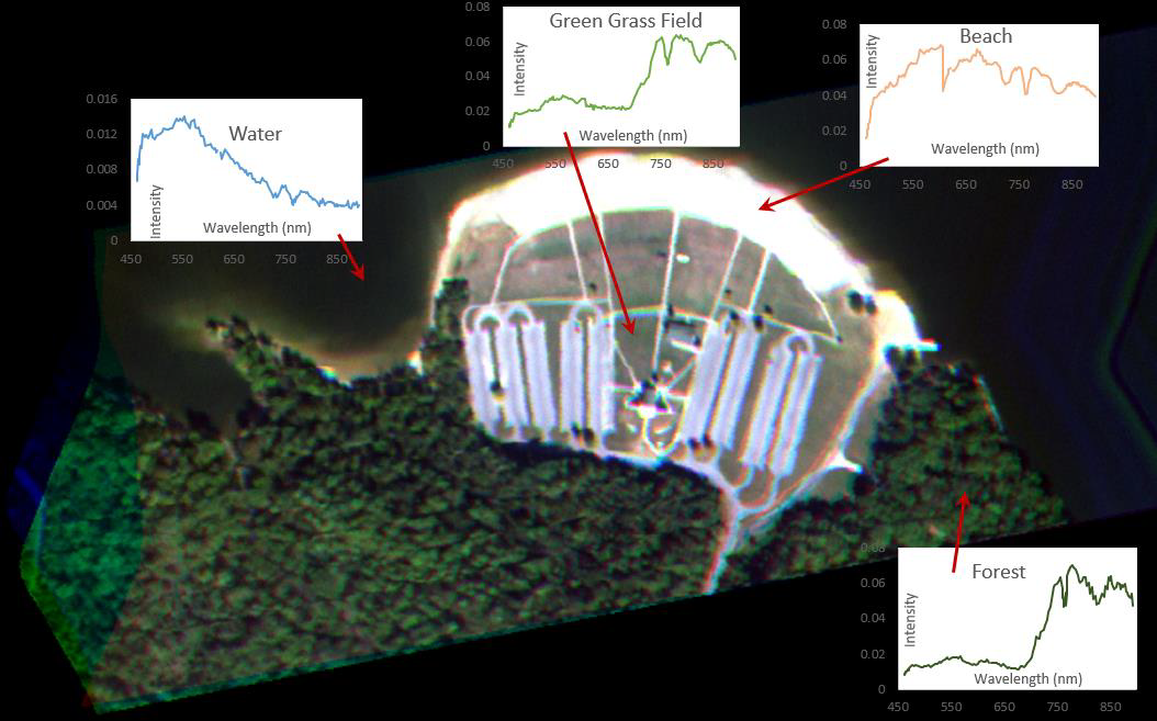
These advancements have resulted in increased swath width and image detail, as demonstrated in comparative maps.
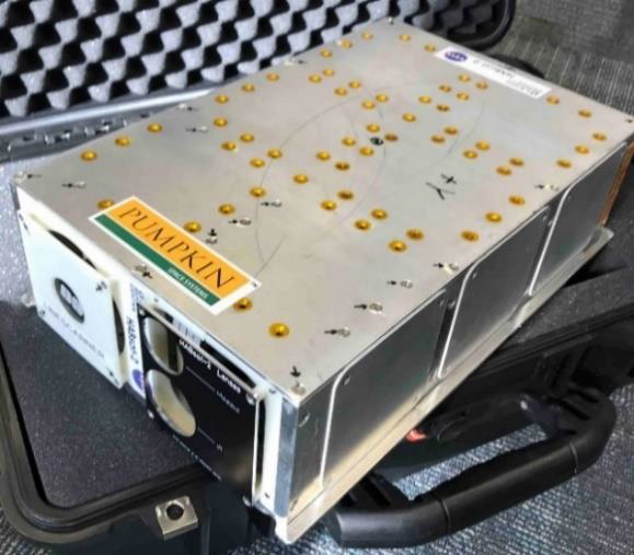
Breakthroughs in drone and HSI technology led to the development of a compact, low Size, Weight, and Power (SWaP) payload known as Hyperspectral HAB Detection via Remote UAV Sensing (HyDRUS).

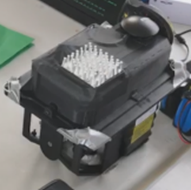
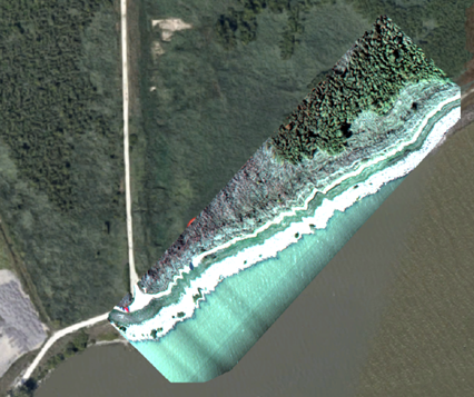
In collaboration with Rocket University – an internal Glenn young career development group – HyDRUS was designed, built, and tested on an Altavian NOVA F6500 fixed-wing drone. The system successfully collected HSI data along Lake Erie’s heavily affected shoreline.
Expanding Remote Sensing to CubeSats and Satellites
Recent efforts have focused on miniaturizing hyperspectral sensors for CubeSat deployment. This technology aims to bridge the gap in remote sensing of freshwater systems by providing high spatial, spectral, and temporal resolution.

Through the National Oceanographic Partnership Program (NOPP), the Satellite Hosting Atmospheric and Littoral Ocean Water Sensors (SHALLOWS) initiative developed a prototype instrument called Harmful Algal Bloom Satellite-2 (HABSat-2).
In 2019, HABSat-2 was installed on NASA’s Twin Otter aircraft alongside legacy hyperspectral imagers and navigation equipment.
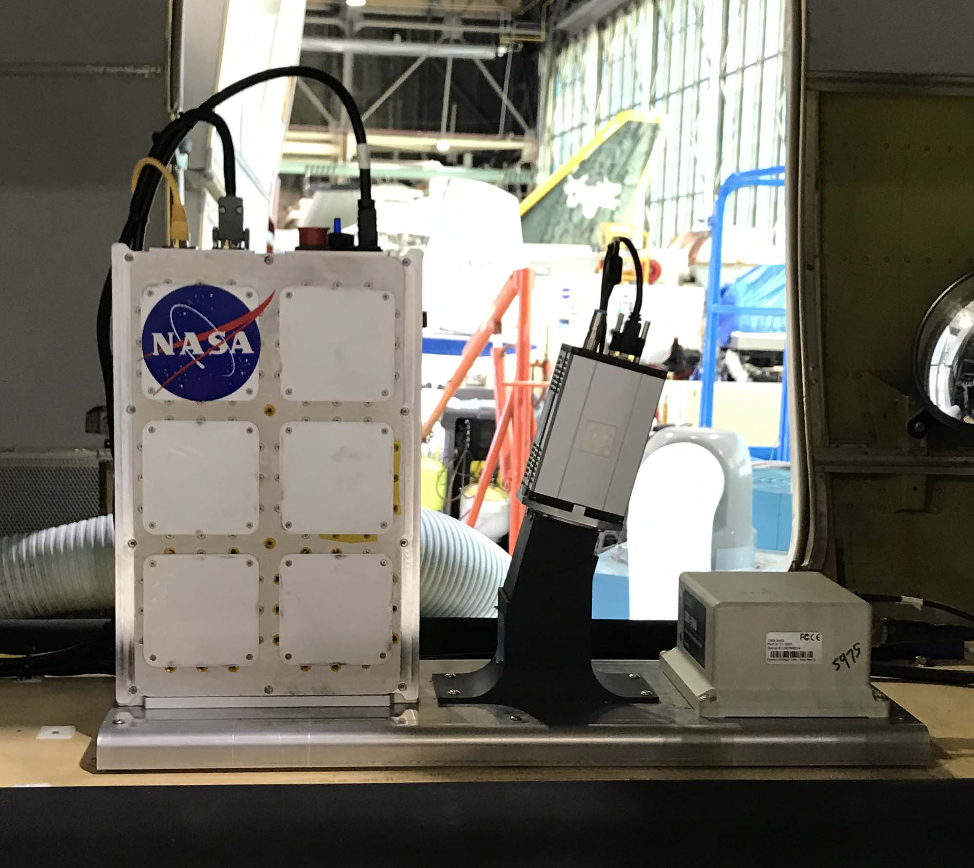
Recently, the third-generation HABSat-3 was completed and delivered to NASA Glenn for testing in 2024.
NASA Glenn continues to play a critical role in advancing airborne and spaceborne monitoring of harmful algal blooms, providing essential data to protect water quality and public health.
Contact
| Area of Expertise | Researcher Name | |
|---|---|---|
| Optics Engineering | John Lekki | john.d.lekki@nasa.gov |
| Optics Engineering | Roger Tokars | roger.p.tokars@nasa.gov |
Video
Remote Sensing Harmful Algal Bloom Video Journal
Projects supported by this research:
NASA Ocean Color
NASA’s Ocean Biology Processing Group (OBPG) supports the collection, processing, calibration, and validation of ocean-related products from a number of NASA, NOAA and international missions. These functions are supported within the framework and facilities of the NASA Ocean Data Processing System (ODPS), which has been successfully supporting operational, satellite-based remote-sensing missions since 1996.
Learn More about NASA Ocean Color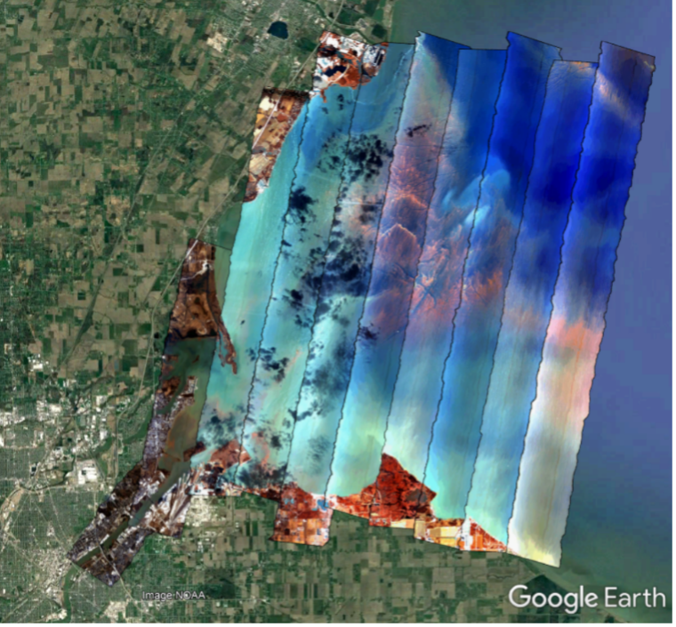
NASA Glenn facilities where this research is conducted:
Flight Research Building
Built in the 1940s, the Flight Research Building (Hangar) is a 65-by-250-foot heated facility that is large enough to hold numerous aircraft of various sizes. It has been home to many unique and innovative aircraft over the years.
Learn More about Flight Research Building
Key Publications
| Publication Title | Author(s) | Source | Type | Year |
|---|---|---|---|---|
| A blind convolutional deep autoencoder for spectral unmixing of hyperspectral images over waterbodies | Mejia E., Manian V., Ortiz J., Tokars R. | Frontiers in Earth Science, section Environmental Informatics and Remote Sensing | Journal Article | 2023 |
| GRC Remote Sensing Campaign of Harmful Algal Blooms 2017-2019 | Tokars R. | GRC HAB Algorithm Meeting; Cleveland, OH; United States | Presentation | 2019 |
| Airborne Hyperspectral Sensing of Monitoring Harmful Algal Blooms in the Great Lakes Region: System Calibration and Validation | Lekki J., et al. | Glenn Research Center | Technical Report | 2017 |
Discover More Topics From NASA
Optical diagnostics research at NASA's Glenn Research Center
Flow Field Diagnostics
NASA is advancing Flow Field Diagnostics by developing and applying cutting-edge measurement techniques to study aerodynamic and propulsion systems.
Phosphor Thermometry and Health Monitoring
NASA is developing luminescence-based diagnostics for non-contact monitoring of turbine coatings, ensuring performance, durability, and safety at high temperatures.