


Tropical Depression 1E Dissipates
On Sunday, May 13, 2018, the National Hurricane Center issue in its final advisory on tropical depression 1E in the Eastern Pacific Ocean.
Visible imagery from NASA and NOAA satellites reveal that the storm had dissipated, making it a very short-lived storm.
By Rob Gutro
NASA’s Goddard Space Flight Center, Greenbelt, Md.
May 11, 2018 – Eastern Pacific – First Depression of the Season Forms
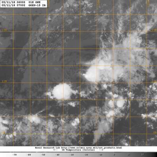
The GOES west satellite captured a look at the Eastern Pacific Ocean’s first tropical cyclone of the season.
At 11 p.m. EDT (0300 UTC) on May 10 the center of Tropical Depression 1-E was located near 12.7 degrees north latitude, 127.4 degrees west longitude. The depression is moving toward the west-northwest near 9 mph (15 kph).
A turn toward the northwest and a gradual decrease in forward speed are expected during the next couple of days. Maximum sustained winds are near 35 mph (55 kph) with higher gusts.
On May 11 at 2 a.m. EDT (0600 UTC) NOAA’s GOES west satellite found Tropical Depression 1-E continues to maintain a cluster of strong convection to the northeast of the center even though it is encountering moderate to strong west-southwesterly vertical wind shear.
The depression is moving through an area of unfavorable upper-level winds, and it is forecast to degenerate to a remnant low pressure area Friday or Friday night.
By Rob Gutro
NASA’s Goddard Space Flight Center, Greenbelt, Md.