


![Request for Information – Potential [Placeholder for Prize]](https://assets.science.nasa.gov/dynamicimage/assets/science/psd/solar/2023/09/s/solarsystem_0.jpg?w=1024)


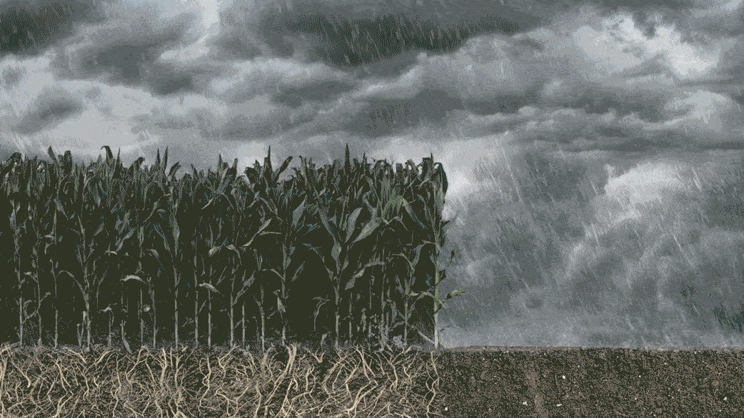
As soil and other surfaces dry, water is transferred into the air as water vapor. That is evaporation. Plants actively release water, moving it out of their leaves and stems and into the drier air. That is transpiration.
Combine the two and that’s evapotranspiration – the process through which water leaves plants, soils and other surfaces.
It’s a measurement that farmers can use to estimate the amount of water being taken up or used by their fields and crops. Knowing how much water is transferred to the air allows farmers to better calculate crop water requirements, helping them use water more efficiently and better plan irrigation. This makes evapotranspiration a crucial measurement for farmers and other water resource managers, especially in the western United States where most of the water goes to irrigate crops.
As evapotranspiration happens it consumes energy. It’s like how after we run through a sprinkler on a hot summer day, the water evaporates and cools our skin. In the same way, evapotranspiration cools the land surface, and areas with high rates of evapotranspiration are relatively cooler than surrounding areas with lower rates of evapotranspiration.
These differences in land surface temperature can be measured with thermal infrared sensors that work on the same principle as the touchless infrared thermometers that doctors use to check for fever.
Where NASA’s Missions Come In
NASA has a variety of missions that monitor and measure plant health and evapotranspiration, for example, there is the ECOsystem Spaceborne Thermal Radiometer Experiment on Space Station (ECOSTRESS) as well as instruments aboard NASA satellite missions, Terra and Aqua.
One of the longest-running datasets of worldwide surface temperatures is from the nearly 50 year-long Landsat program, a joint project between NASA and the U.S. Geological Survey. The Landsat 7 and 8 satellites currently orbit Earth, and every eight days one of these two Landsat satellites flies overhead. Each one carries a thermal sensor that can measure the temperature of the land, crops, cities — everything they pass over. The swath, or width, of the images is 115 miles (185 kilometers) and the data in these images are provided at a resolution of about a quarter of an acre, or roughly about the size of a baseball infield.
By combining these satellite measurements of how hot or cool a field is with other satellite and weather data, scientists can calculate how much evapotranspiration is taking place. This provides a view from the vantage point of space of how much water is being used across the landscape, and allows information to be provided for individual fields and farms just about once a week.
Landsat data is the cornerstone of OpenET, a NASA supported web-based platform that uses publicly available data and open source models to provide evapotranspiration data. Evapotranspiration is the “ET” in OpenET and it is a new tool that puts this NASA Earth science data into the hands of farmers, ranchers, water managers and others. The information it provides is in areas as small as a quarter of an acre and at daily, monthly, and yearly intervals for 17 western U.S. states. This is an area which continues to see prolonged drought and thus getting this information into the hands of farmers, water managers and conservation groups can transform water management in the American west.