![Request for Information – Potential [Placeholder for Prize]](https://assets.science.nasa.gov/dynamicimage/assets/science/psd/solar/2023/09/s/solarsystem_0.jpg?w=1024)


The use of NASA satellite data by environmental managers tracking harmful algal bloom outbreaks along lakefronts and coasts can result in earlier detections that yield significant savings on healthcare, lost work hours and other economic costs.
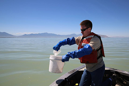
A NASA-funded case study published last month in the journal GeoHealth reviewed a 2017 algal bloom in Utah Lake near Provo, Utah. It showed that satellite data help lead to earlier warnings of hazardous algae than other detection approaches, and in this case, the earlier notice resulted in approximately $370,000 in savings.
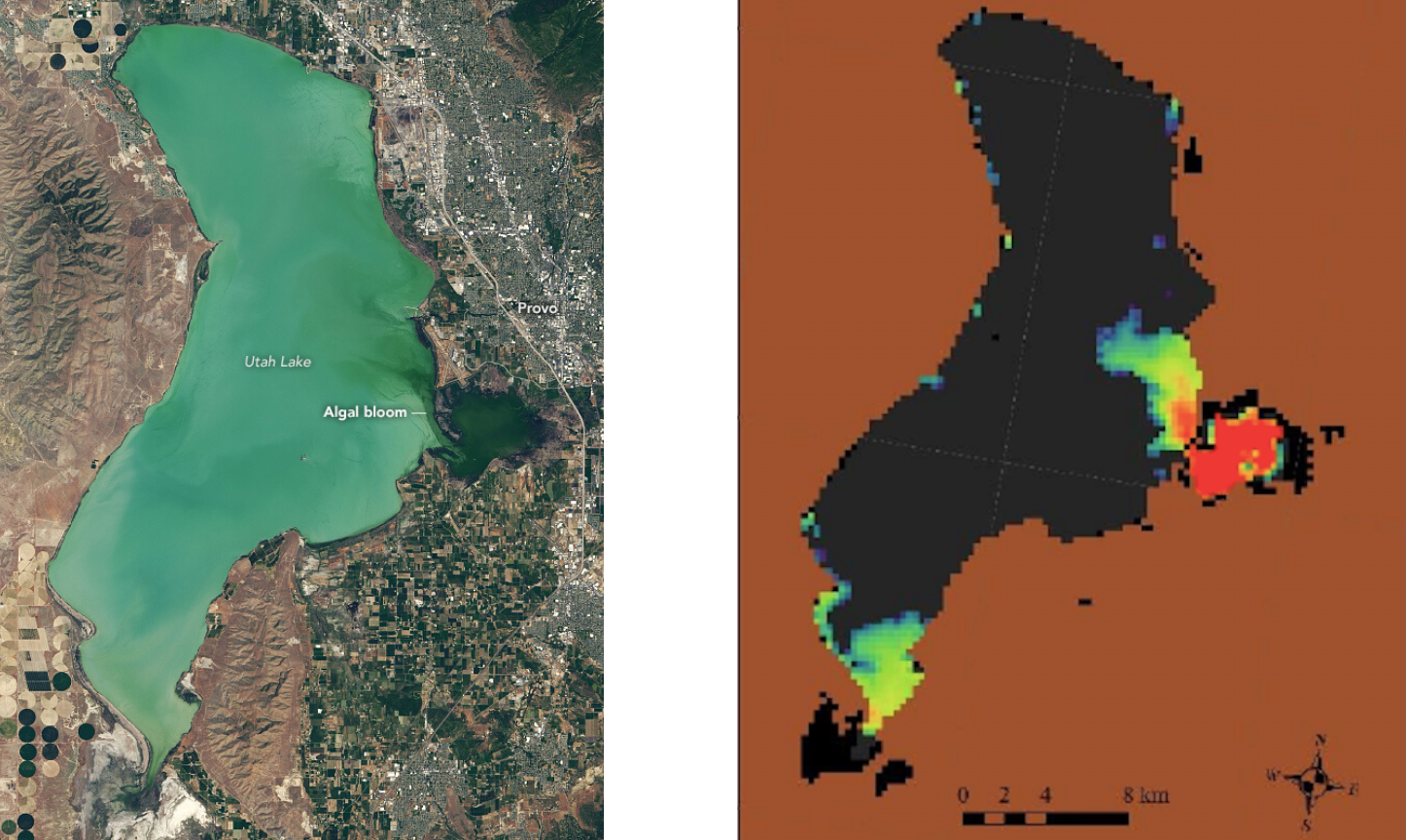
“Using satellite data to detect this harmful algal bloom potentially saved hundreds of thousands of dollars in social costs by preventing hundreds of cases of cyanobacteria-induced illness,” said study coauthor Molly Robertson, a research assistant at the non-profit research group Resources for the Future (RFF). The analysis is the work of the VALUABLES Consortium, a collaboration of RFF and NASA.
Some toxin-producing algae can be harmful to human health when the algae are present in high numbers. Algal blooms often change the color of bodies of water, making a bloom detectable by Earth-observing satellites.
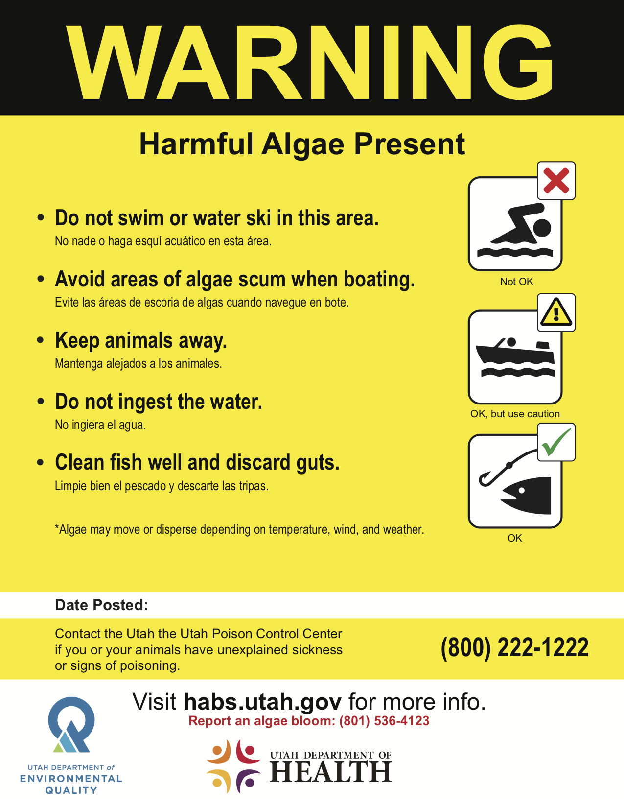
For their analysis, the study authors compared two possible scenarios in reviewing data from the June 2017 harmful algal bloom in Utah Lake. They concluded that Earth-observing satellite data of the lake showed color changes, and thus the presence of algae, and that this information prompted the Utah Department of Environmental Quality to test the bloom for toxicity earlier than observations on the ground alone would have enabled. This information allowed Utah public health and environmental officials to post warnings to boaters, swimmers and fishers on June 29.
The researchers then ran a second scenario for this Utah Lake bloom, but without including the satellite-enabled detection and concluded that public health warnings would not been posted until July 6. They estimated the seven-day delay would be due to the time it takes on average for a bloom to be reported, on-site testing to occur, analysis of testing results, the decision to post warnings and finally the time it takes to post a warning. The delay would have allowed humans and other animals in the water with the harmful algae. The authors then referenced health economics literature and estimated the costs of that exposure to the local community.
Robertson said the case study was part of a larger effort to develop a framework to measure the economic benefits of detecting harmful algal blooms.
“Incorporating satellite data into the harmful algal blooms detection strategy for other large US lakes could yield similar benefits,” said Robertson.
For their analysis, the authors used data from the European Space Agency’s Sentinel-3 satellite as provided by the Cyanobacteria Assessment Network (CyAN). CyAN is a multi-agency project led by the Environmental Protection Agency (EPA) and including NASA, the National Oceanic and Atmospheric Administration (NOAA), and the United States Geological Survey (USGS). CyAN is developing an early warning indicator system to detect algal blooms in U.S. freshwater systems. Also incorporated into CyAN is data from the Landsat series of satellites, the Earth-observing satellites developed in a partnership between NASA and the USGS.
The Consortium for the Valuation of Applications Benefits Linked to Earth Science (VALUABLES) is a collaboration between NASA and RFF. It focuses on advancing innovative uses of existing techniques and developing new techniques for valuing the information provided by Earth-observing satellites.